File:Granice Podhala (według różnych kryteriów).png
Jump to navigation
Jump to search

Size of this preview: 800 × 566 pixels. Other resolutions: 320 × 226 pixels | 640 × 452 pixels | 1,024 × 724 pixels | 1,280 × 905 pixels | 2,560 × 1,810 pixels | 5,495 × 3,885 pixels.
Original file (5,495 × 3,885 pixels, file size: 13.07 MB, MIME type: image/png)
Captions
Captions
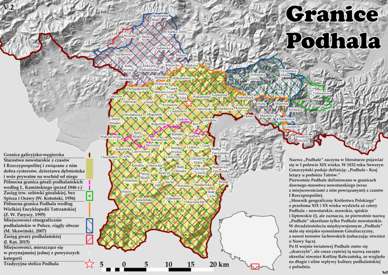
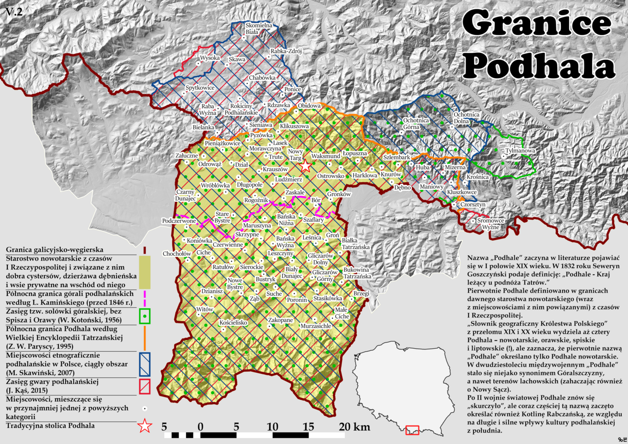
Borders of Podhale region (Polish)
Summary
[edit].png&action=edit§ion=1)
| Description |
English: Map of region of Podhale - a view on its borders from different perspectives and from different years. In Polish. |
| Date | |
| Source | Own work |
| Author | Gwiezdny Baca |
Licensing
[edit].png&action=edit§ion=2)
I, the copyright holder of this work, hereby publish it under the following license:
This file is licensed under the Creative Commons Attribution-Share Alike 4.0 International license.
- You are free:
- to share – to copy, distribute and transmit the work
- to remix – to adapt the work
- Under the following conditions:
- attribution – You must give appropriate credit, provide a link to the license, and indicate if changes were made. You may do so in any reasonable manner, but not in any way that suggests the licensor endorses you or your use.
- share alike – If you remix, transform, or build upon the material, you must distribute your contributions under the same or compatible license as the original.
File history
Click on a date/time to view the file as it appeared at that time.
| Date/Time | Thumbnail | Dimensions | User | Comment | |
|---|---|---|---|---|---|
| current | 17:16, 3 June 2023 | | 5,495 × 3,885 (13.07 MB) | Gwiezdny Baca (talk | contribs) | Changes to area by M. Skawiński |
| 15:28, 2 June 2023 |  | 5,495 × 3,885 (13.06 MB) | Gwiezdny Baca (talk | contribs) | Minor changes | |
| 14:42, 2 June 2023 |  | 5,495 × 3,885 (13.06 MB) | Gwiezdny Baca (talk | contribs) | Uploaded own work with UploadWizard |
You cannot overwrite this file.
File usage on Commons
There are no pages that use this file.
File usage on other wikis
The following other wikis use this file:
.png&oldid=770718597)