File:Gray alaska.svg
Jump to navigation
Jump to search

Size of this PNG preview of this SVG file: 800 × 427 pixels. Other resolutions: 320 × 171 pixels | 640 × 342 pixels | 1,024 × 547 pixels | 1,280 × 684 pixels | 2,560 × 1,367 pixels | 2,878 × 1,537 pixels.
Original file (SVG file, nominally 2,878 × 1,537 pixels, file size: 159 KB)
Captions
Captions
Add a one-line explanation of what this file represents
Summary[edit]
| Description |
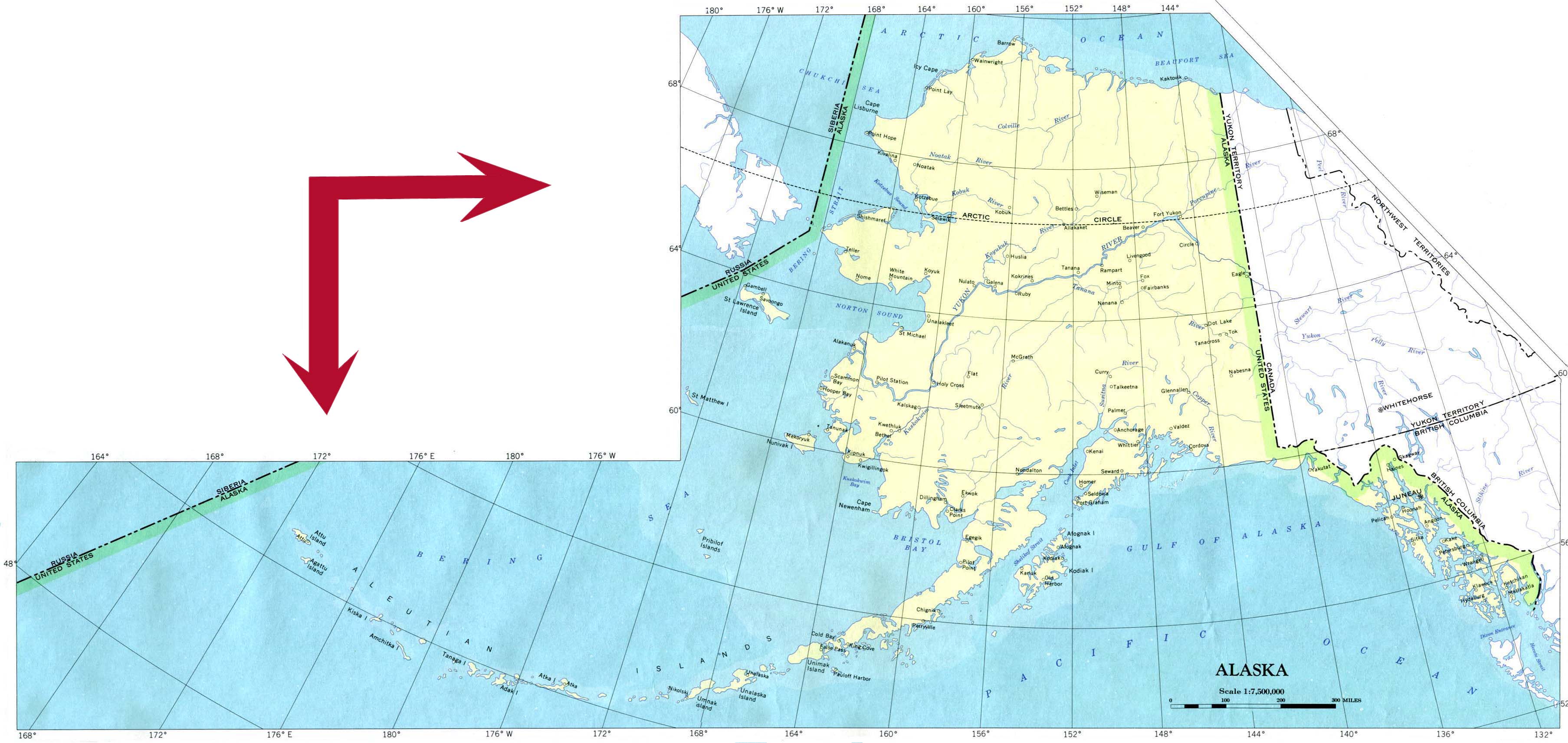
English: Map of Alaska
Geographic limits of the map:
|
| Date | |
| Source | Vector tracing of Image:Gray alaska.png, in turn a trace of PD image from University of Texas (http://www.lib.utexas.edu/maps/united_states/alaska_90.jpg) |
| Author | Vectorized by Skew-t. Originally traced by Calliopejen. |
| Other versions | Image:Gray alaska.png |
Licensing[edit]
| I, the copyright holder of this work, release this work into the public domain. This applies worldwide. In some countries this may not be legally possible; if so: I grant anyone the right to use this work for any purpose, without any conditions, unless such conditions are required by law. |
File history
Click on a date/time to view the file as it appeared at that time.
| Date/Time | Thumbnail | Dimensions | User | Comment | |
|---|---|---|---|---|---|
| current | 11:18, 10 December 2008 | | 2,878 × 1,537 (159 KB) | Skew-t (talk | contribs) | {{Information |Description={{en|1=Map of Alaska}} |Source=Vector tracing of Image:Gray alaska.png, in turn a trace of PD image from University of Texas (http://www.lib.utexas.edu/maps/united_states/alaska_90.jpg) |Author=Vectorized by [[User:Skew-t|S |
You cannot overwrite this file.
File usage on Commons
The following 3 pages use this file:
File usage on other wikis
The following other wikis use this file:
- Usage on en.wikipedia.org
- Usage on hu.wikipedia.org
- Usage on ru.wikipedia.org