File:Greater Fatra - location map in Žilina Region.svg
Jump to navigation
Jump to search

Size of this PNG preview of this SVG file: 778 × 600 pixels. Other resolutions: 312 × 240 pixels | 623 × 480 pixels | 997 × 768 pixels | 1,280 × 987 pixels | 2,560 × 1,973 pixels | 1,527 × 1,177 pixels.
Original file (SVG file, nominally 1,527 × 1,177 pixels, file size: 142 KB)
Captions
Captions
Add a one-line explanation of what this file represents
Summary
[edit]
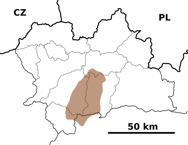
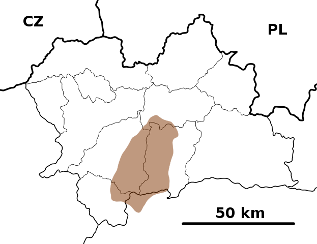
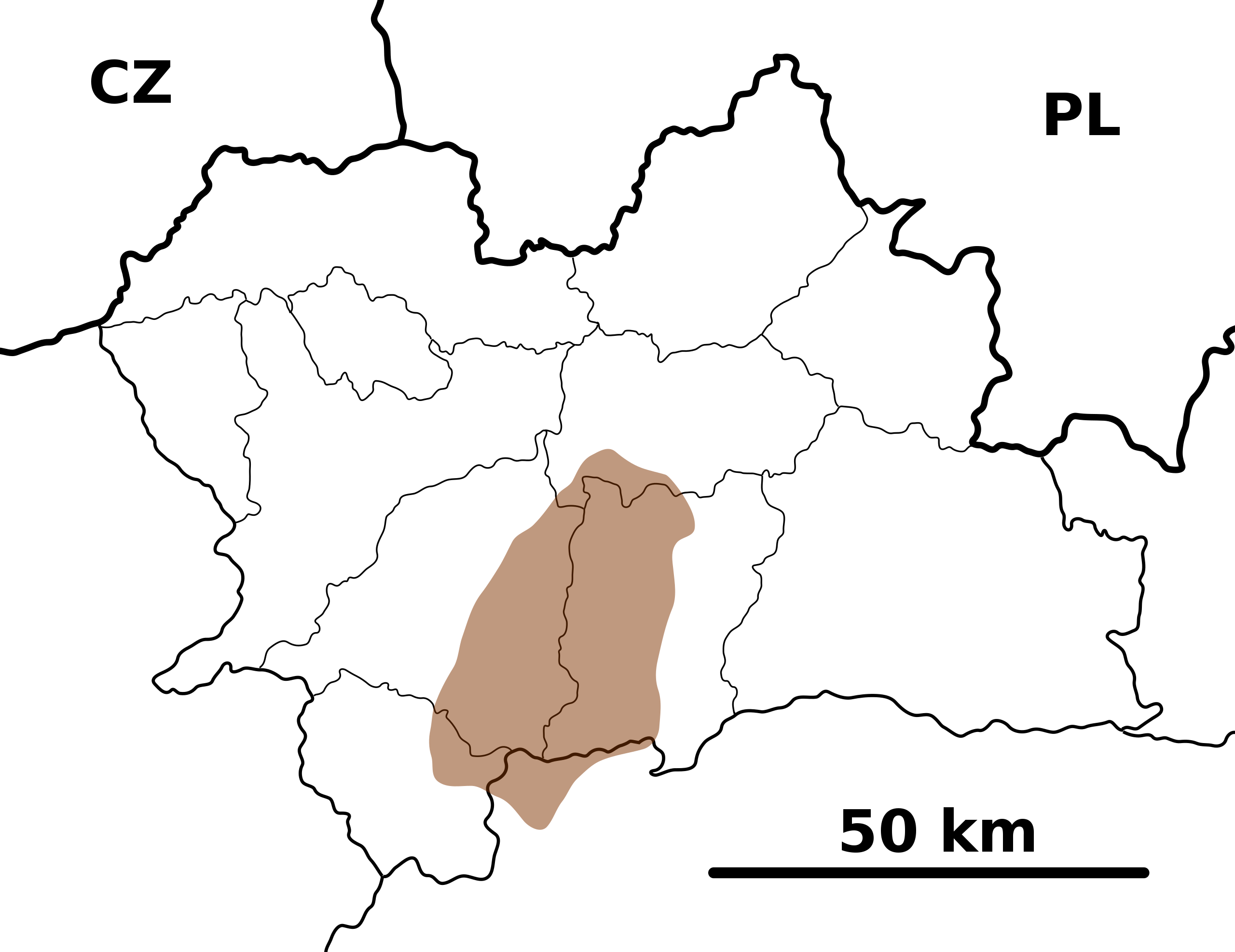
| Description | Outline map of the Greater Fatra Range in the Žilina Region, Slovakia, calibrated for en:Template:Geoboxes at en:Template:Geobox locator Žilina Region |
| Date | |
| Source | Own work |
| Author | Caroig |
Licensing
[edit]
I, the copyright holder of this work, hereby publish it under the following licenses:

|
Permission is granted to copy, distribute and/or modify this document under the terms of the GNU Free Documentation License, Version 1.2 or any later version published by the Free Software Foundation; with no Invariant Sections, no Front-Cover Texts, and no Back-Cover Texts. A copy of the license is included in the section entitled GNU Free Documentation License. |
This file is licensed under the Creative Commons Attribution-Share Alike 3.0 Unported, 2.5 Generic, 2.0 Generic and 1.0 Generic license.
- You are free:
- to share – to copy, distribute and transmit the work
- to remix – to adapt the work
- Under the following conditions:
- attribution – You must give appropriate credit, provide a link to the license, and indicate if changes were made. You may do so in any reasonable manner, but not in any way that suggests the licensor endorses you or your use.
- share alike – If you remix, transform, or build upon the material, you must distribute your contributions under the same or compatible license as the original.
You may select the license of your choice.
File history
Click on a date/time to view the file as it appeared at that time.
| Date/Time | Thumbnail | Dimensions | User | Comment | |
|---|---|---|---|---|---|
| current | 20:39, 4 September 2007 | | 1,527 × 1,177 (142 KB) | Caroig (talk | contribs) | == Summary == {{Information |Description=Outline map of the Greater Fatra National Park in the Žilina Region, Slovakia, calibrated for en:Template:Geoboxes at en:Template:Geobox locator Žilina Region |Source=Own work |Date=2007-09-04 |Author=[ |
You cannot overwrite this file.
File usage on Commons
There are no pages that use this file.
File usage on other wikis
The following other wikis use this file:
- Usage on en.wikipedia.org
- Usage on eo.wikipedia.org
- Usage on fr.wikipedia.org
- Usage on hu.wikipedia.org
- Usage on simple.wikipedia.org
- Usage on si.wikipedia.org
- Usage on sk.wikipedia.org
- Usage on th.wikipedia.org
- Usage on uz.wikipedia.org