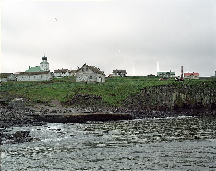
File:Groundwater Monitoring Wells--St. George - DPLA - 213513b5a8dd65289dd2d38e53b94887.jpg

Original file (10,956 × 8,688 pixels, file size: 14.24 MB, MIME type: image/jpeg)
Captions
Captions
Summary[edit]
| Groundwater Monitoring Wells--St. George
( |
||||||||||||||||||||
|---|---|---|---|---|---|---|---|---|---|---|---|---|---|---|---|---|---|---|---|---|
| Creator InfoField | Department of Commerce. National Oceanic and Atmospheric Administration. National Ocean Service. Office of Response and Restoration. Pribilof Islands Restoration Project Office. 1996-9/2008 | |||||||||||||||||||
| Title |
Groundwater Monitoring Wells--St. George |
|||||||||||||||||||
| Description |
Groundwater monitoring well installation. Location: St. George Island, Alaska Photographer: John Lindsay Photographer Affiliation: NOAA NARA Accessioned Digital Format: JPG |
|||||||||||||||||||
| Collection |
institution QS:P195,Q59661040 |
|||||||||||||||||||
| Source/Photographer |
|
|||||||||||||||||||
| Permission (Reusing this file) |
|
|||||||||||||||||||
| Standardized rights statement InfoField |
|
|||||||||||||||||||
File history
Click on a date/time to view the file as it appeared at that time.
| Date/Time | Thumbnail | Dimensions | User | Comment | |
|---|---|---|---|---|---|
| current | 02:01, 25 November 2020 |  | 10,956 × 8,688 (14.24 MB) | DPLA bot (talk | contribs) | Uploading DPLA ID 213513b5a8dd65289dd2d38e53b94887 |
You cannot overwrite this file.
File usage on Commons
The following page uses this file:
Metadata
This file contains additional information such as Exif metadata which may have been added by the digital camera, scanner, or software program used to create or digitize it. If the file has been modified from its original state, some details such as the timestamp may not fully reflect those of the original file. The timestamp is only as accurate as the clock in the camera, and it may be completely wrong.
| Orientation | Normal |
|---|---|
| Horizontal resolution | 4,000 dpi |
| Vertical resolution | 4,000 dpi |
| Software used | Adobe Photoshop CS Windows |
| File change date and time | 08:51, 27 February 2006 |
| Color space | sRGB |
| Image width | 10,956 px |
| Image height | 8,688 px |
| Date and time of digitizing | 00:51, 27 February 2006 |
| Date metadata was last modified | 00:51, 27 February 2006 |
Structured data
Items portrayed in this file
depicts
some value
Reference
Groundwater Monitoring Wells--St. George (English)
Reference
Reference
Reference
Groundwater monitoring well installation. Location: St. George Island, Alaska Photographer: John Lindsay Photographer Affiliation: NOAA NARA Accessioned Digital Format: JPG (English)
image/jpeg
- Media contributed by the Digital Public Library of America
- Media contributed by the National Archives and Records Administration
- Media contributed by National Archives at College Park - Still Pictures
- PD US NOAA
- Artworks without Wikidata item
- US National Archives series: Central Photographic Files Relating to Environmental Problems and Remediation Activities, Social and Economic Life on the Pribilof Islands, Alaska, 1996 - 2007
- Files with no machine-readable author


