File:Grube Einigkeit, Kunstgraben.png
Jump to navigation
Jump to search
Size of this preview: 488 × 599 pixels. Other resolutions: 195 × 240 pixels | 391 × 480 pixels | 704 × 864 pixels.
Original file (704 × 864 pixels, file size: 1.2 MB, MIME type: image/png)
Captions
Captions
Add a one-line explanation of what this file represents
Summary[edit]
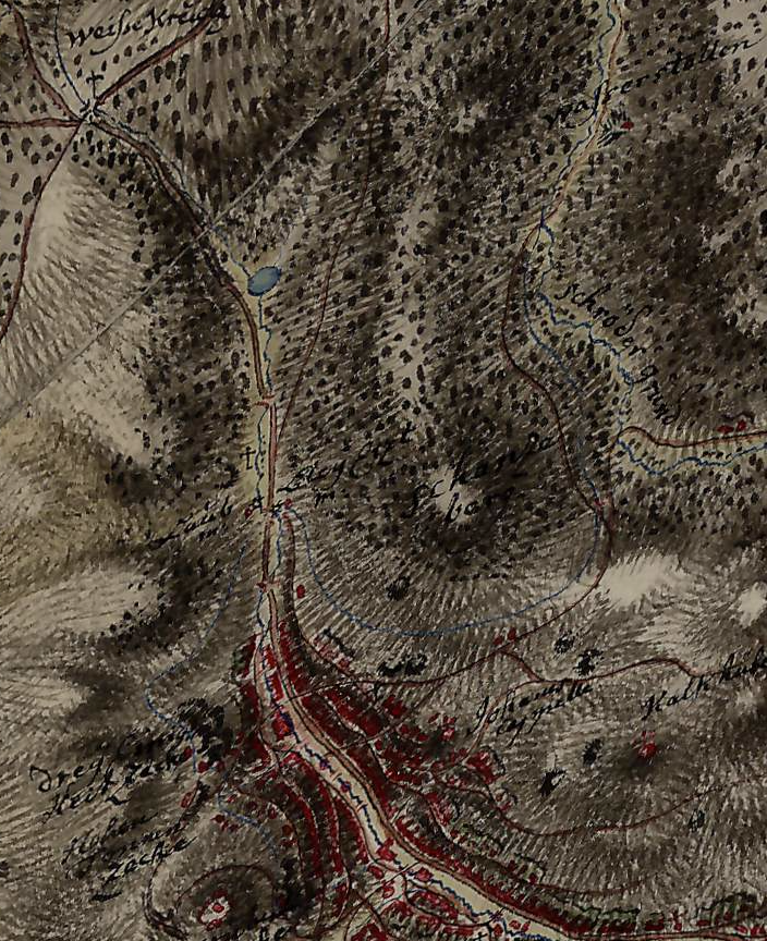
| Description | Kartenausschnitt aus der Josephinischen Landesaufnahme mit Verlauf des Kunstgrabens zur Grube Einigkeit in Sankt Joachimsthal (heute Jáchymov) im Erzgebirge. |
| Date | 1764–1768 |
| Source | https://maps.arcanum.com/de/map/firstsurvey-bohemia/?layers=141 |
| Author |
© 2nd Military Survey, Section No. W_10_IV, Austrian State Archive/Military Archive, Vienna © Laboratoř geoinformatiky Univerzita J.E. Purkyně – http://www.geolab.cz © Ministerstvo životního prostředí ČR – http://www.env.cz |
Licensing[edit]
|
This work is in the public domain in its country of origin and other countries and areas where the copyright term is the author's life plus 100 years or fewer. This work is in the public domain in the United States because it was published (or registered with the U.S. Copyright Office) before January 1, 1929. | |
| This file has been identified as being free of known restrictions under copyright law, including all related and neighboring rights. | |
File history
Click on a date/time to view the file as it appeared at that time.
| Date/Time | Thumbnail | Dimensions | User | Comment | |
|---|---|---|---|---|---|
| current | 17:28, 24 June 2022 | | 704 × 864 (1.2 MB) | Ch vik (talk | contribs) | {{Information |Description=Kartenausschnitt aus der ''Josephinischen Landesaufnahme'' mit Verlauf des Kunstgrabens zur Grube Einigkeit in Sankt Joachimsthal (heute Jáchymov) im Erzgebirge. |Source=https://maps.arcanum.com/de/map/firstsurvey-bohemia/?layers=141 |Date=1764–1768 |Author=© 2nd Military Survey, Section No. W_10_IV, Austrian State Archive/Military Archive, Vienna © Laboratoř geoinformatiky Univerzita J.E. Purkyně – http://www.geolab.cz © Ministerstvo životního prostředí ČR – http:... |
You cannot overwrite this file.
File usage on Commons
There are no pages that use this file.
File usage on other wikis
The following other wikis use this file:
- Usage on de.wikipedia.org