File:Grudziądz location map.png
Jump to navigation
Jump to search

Size of this preview: 639 × 600 pixels. Other resolutions: 256 × 240 pixels | 512 × 480 pixels | 892 × 837 pixels.
Original file (892 × 837 pixels, file size: 785 KB, MIME type: image/png)
Captions
Captions
Add a one-line explanation of what this file represents
| Description |
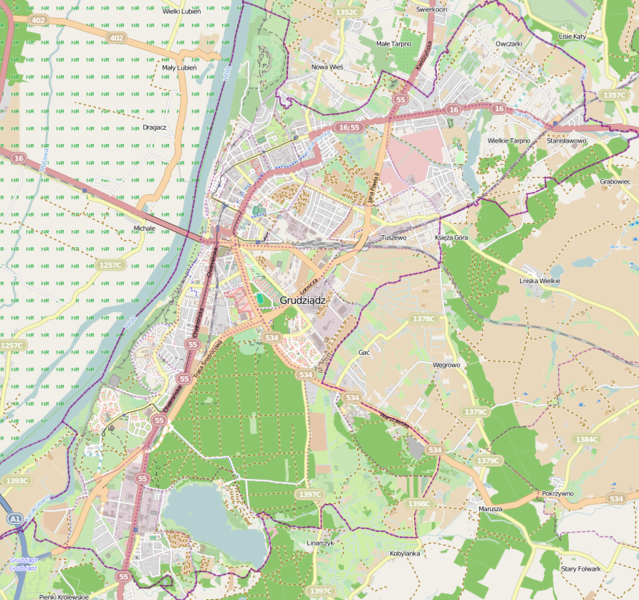
Location map of Grudziądz, Poland This map of Grudziądz was created from OpenStreetMap project data, collected by the community. This map may be incomplete, and may contain errors. Don't rely solely on it for navigation. |
|||||||||
| Date | ||||||||||
| Source | You may find a page on the OpenStreetMap wiki page for Grudziądz | |||||||||
| Creator |
OpenStreetMap contributors OpenStreetMap contributors |
|||||||||
| Permission (Reusing this file) |
OpenStreetMap data is available under the Open Database License (details). Map tiles are licensed under the Creative Commons Attribution-ShareAlike 2.0 license (CC-BY-SA 2.0).
This file is licensed under the Creative Commons Attribution-Share Alike 2.0 Generic license.
|
|||||||||
| Geotemporal data | ||||||||||
| Bounding box |
|
|||||||||
| Georeferencing | If inappropriate please set warp_status = skip to hide. | |||||||||
File history
Click on a date/time to view the file as it appeared at that time.
| Date/Time | Thumbnail | Dimensions | User | Comment | |
|---|---|---|---|---|---|
| current | 14:46, 10 November 2013 | | 892 × 837 (785 KB) | Powerek38 (talk | contribs) | VicuñaUploader 1.18 |
You cannot overwrite this file.
File usage on Commons
The following page uses this file:
File usage on other wikis
The following other wikis use this file:
- Usage on fr.wikipedia.org
- Usage on pl.wikipedia.org
- Strzemięcin (Grudziądz)
- Grudziądz (stacja kolejowa)
- Most im. Bronisława Malinowskiego w Grudziądzu
- Rządz (Grudziądz)
- Mniszek (Grudziądz)
- Tarpno (Grudziądz)
- Wikipedysta:AlexKazakhov/Lotnisko (Grudziądz)
- Barokowy zespół pojezuicki w Grudziądzu
- Kanał Trynka
- Twierdza Grudziądz
- Jezioro Rudnickie Wielkie
- Tarpno (jezioro)
- Kościół św. Jana w Grudziądzu
- Parafia Ewangelicko-Augsburska w Grudziądzu
- Kościół i klasztor Reformatów w Grudziądzu
- Kościół i klasztor benedyktynek w Grudziądzu
- Gmach Wyższej Szkoły Realnej w Grudziądzu
- Kaplica św. Jerzego w Grudziądzu
- Kościół Niepokalanego Serca Najświętszej Maryi Panny w Grudziądzu
- Kościół Świętego Krzyża w Grudziądzu
- Pomnik Żołnierza Polskiego w Grudziądzu
- Muzeum im. ks. dr. Władysława Łęgi w Grudziądzu
- Zespół Szkół Mechanicznych w Grudziądzu
- Zamek krzyżacki w Grudziądzu
- Bazylika św. Mikołaja w Grudziądzu
- Browary Grudziądz
- Osiedle Mikołaja Kopernika (Grudziądz)
- Osiedle Kawalerii Polskiej
- Stare Miasto (Grudziądz)
- I Liceum Ogólnokształcące im. Bolesława Chrobrego w Grudziądzu
- Cmentarz przy ul. Cmentarnej w Grudziądzu
- Planetarium i Obserwatorium Astronomiczne w Grudziądzu
- Grudziądz Przedmieście
- Rynek w Grudziądzu
- Grudziądz Owczarki
- Grudziądz Mniszek
- Rządz (jezioro)
- Mały Kuntersztyn
- Wielki Kuntersztyn
- Tuszewo (Grudziądz)
- Ogród Botaniczny w Grudziądzu
- Park Miejski w Grudziądzu
- Ratusz w Grudziądzu
- Parafia Imienia Jezus w Grudziądzu
- Pomnik ułana z dziewczyną w Grudziądzu
- Kaplica św. Mikołaja w Grudziądzu
- Stadion Miejski w Grudziądzu
- Parafia Wniebowzięcia Najświętszej Maryi Panny w Grudziądzu
- Parafia św. Mikołaja w Grudziądzu
View more global usage of this file.