File:Gullane Village - geograph.org.uk - 1431505.jpg
Salta a la navegació
Salta a la cerca
No hi ha cap versió amb una resolució més gran.
Gullane_Village_-_geograph.org.uk_-_1431505.jpg (640 × 468 píxels, mida del fitxer: 81 Ko, tipus MIME: image/jpeg)
Llegendes
Llegendes
Afegeix una explicació d'una línia del que representa aquest fitxer
Resum[modifica]
| Descripció |
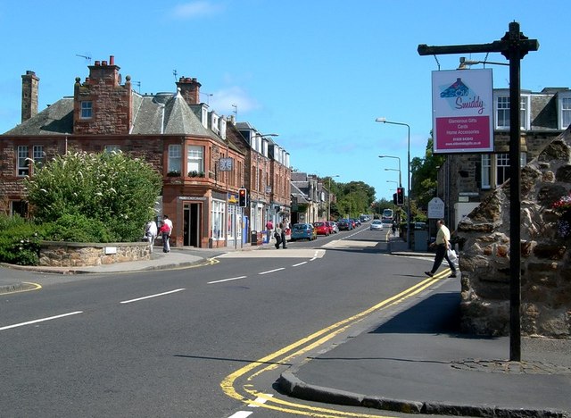
English: Gullane Village Looking along the A198 through the attractive East Lothian village of Gullane. |
| Data | |
| Font | From geograph.org.uk |
| Autor | Mary and Angus Hogg |
| Reconeixement (required by the license) | Mary and Angus Hogg / Gullane Village / |
| Posició de la càmera | | Aquesta i altres imatges properes a: OpenStreetMap |
|---|
_heading:45.00&language=ca)
| Posició de l'objecte | | Aquesta i altres imatges properes a: OpenStreetMap |
|---|
_heading:45.00&language=ca)
Llicència[modifica]

|
Aquesta imatge prové de la col·lecció del projecte Geograph British Isles. Vegeu la pàgina d'aquesta fotografia al lloc web Geograph per a més informació del fotògraf. El titular dels drets d'autor d'aquesta imatge és Mary and Angus Hogg i autoritza utilitzar-la sota la llicència Reconeixement-CompartirIgual 2.0 de Creative Commons.
|
Aquest fitxer està publicat sota la llicència de Creative Commons Reconeixement i Compartir Igual 2.0 Genèrica.
Reconeixement: Mary and Angus Hogg
- Sou lliure de:
- compartir – copiar, distribuir i comunicar públicament l'obra
- adaptar – fer-ne obres derivades
- Amb les condicions següents:
- reconeixement – Heu de donar la informació adequada sobre l'autor, proporcionar un enllaç a la llicència i indicar si s'han realitzat canvis. Podeu fer-ho amb qualsevol mitjà raonable, però de cap manera no suggereixi que l'autor us dóna suport o aprova l'ús que en feu.
- compartir igual – Si modifiqueu, transformeu, o generareu amb el material, haureu de distribuir les vostres contribucions sota una llicència similar o una de compatible com l'original
- Remove redundant categories and try to put this image in the most specific category/categories
- Remove this template
- The location categories are based on information from this geonames tool and this OpenStreetMap tool combined with a database. You can also have a look at this tool from mysociety.
- The topic category from Geograph was Village (find similar images at Geograph)
Historial del fitxer
Cliqueu una data/hora per veure el fitxer tal com era aleshores.
| Data/hora | Miniatura | Dimensions | Usuari/a | Comentari | |
|---|---|---|---|---|---|
| actual | 22:50, 1 març 2011 | | 640 × 468 (81 Ko) | GeographBot (discussió | contribucions) | == {{int:filedesc}} == {{Information |description={{en|1=Gullane Village Looking along the A198 through the attractive East Lothian village of Gullane.}} |date=2009-08-02 |source=From [http://www.geograph.org.uk/photo/1431505 geograph.org.uk] |author=[htt |
No podeu sobreescriure aquest fitxer.
Ús del fitxer
La pàgina següent utilitza aquest fitxer:
Ús global del fitxer
Utilització d'aquest fitxer en altres wikis:
- Utilització a ar.wikipedia.org
- Utilització a cy.wikipedia.org
- Utilització a en.wikipedia.org
- Utilització a en.wikivoyage.org
- Utilització a eu.wikipedia.org
- Utilització a fa.wikipedia.org
- Utilització a fr.wikipedia.org
- Utilització a ga.wikipedia.org
- Utilització a no.wikipedia.org
- Utilització a sco.wikipedia.org
- Utilització a www.wikidata.org