File:H1N1 Argentina Map.svg
Jump to navigation
Jump to search

Size of this PNG preview of this SVG file: 259 × 600 pixels. Other resolutions: 103 × 240 pixels | 207 × 480 pixels | 331 × 768 pixels | 442 × 1,024 pixels | 884 × 2,048 pixels | 354 × 820 pixels.
Original file (SVG file, nominally 354 × 820 pixels, file size: 558 KB)
Captions
Captions
Add a one-line explanation of what this file represents
Summary[edit]
| Description |
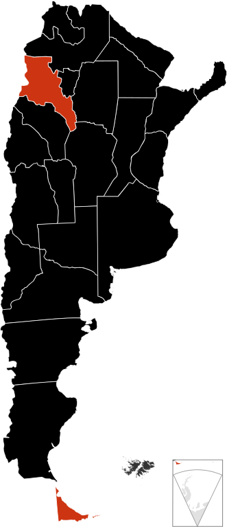
English: A map about the 2009 A (H1N1) flu outbreak in Argentina
death confirmed
confirmed cases Español: Un mapa sobre el brote de gripe A (H1N1) en Argentina de 2009
muertes confirmadas
casos confirmados |
| Date | |
| Source | Own work |
| Author | Vrysxy |
| Other versions |
Derivative works of this file: H1N1 Argentina (mortalidad 0907) Map.png
|


_Map.png)
Licensing[edit]
I, the copyright holder of this work, hereby publish it under the following licenses:
This file is licensed under the Creative Commons Attribution-Share Alike 3.0 Unported license.
- You are free:
- to share – to copy, distribute and transmit the work
- to remix – to adapt the work
- Under the following conditions:
- attribution – You must give appropriate credit, provide a link to the license, and indicate if changes were made. You may do so in any reasonable manner, but not in any way that suggests the licensor endorses you or your use.
- share alike – If you remix, transform, or build upon the material, you must distribute your contributions under the same or compatible license as the original.

|
Permission is granted to copy, distribute and/or modify this document under the terms of the GNU Free Documentation License, Version 1.2 or any later version published by the Free Software Foundation; with no Invariant Sections, no Front-Cover Texts, and no Back-Cover Texts. A copy of the license is included in the section entitled GNU Free Documentation License. |
You may select the license of your choice.
File history
Click on a date/time to view the file as it appeared at that time.
| Date/Time | Thumbnail | Dimensions | User | Comment | |
|---|---|---|---|---|---|
| current | 08:42, 2 January 2010 | | 354 × 820 (558 KB) | Dexxter (talk | contribs) | +La Rioja (http://www.msal.gov.ar/archivos/Informe%20SE%2049-%20FINAL%20PDF.pdf) |
| 01:08, 4 November 2009 |  | 354 × 820 (558 KB) | Fonadier (talk | contribs) | Fixing frontiers | |
| 02:05, 20 August 2009 |  | 354 × 820 (558 KB) | Dexxter (talk | contribs) | cambio color | |
| 22:58, 14 August 2009 |  | 354 × 820 (558 KB) | Dexxter (talk | contribs) | +chaco | |
| 03:08, 9 August 2009 |  | 354 × 820 (559 KB) | CaninePitDog (talk | contribs) | First deaths: Jujuy, Salta, and Tucumán. | |
| 03:19, 25 July 2009 |  | 354 × 820 (558 KB) | Dexxter (talk | contribs) | la muerte en Salta era un hoax del propio Gobierno provincial, aún no se confirmaron muertes en la provincia. | |
| 23:33, 24 July 2009 |  | 354 × 820 (558 KB) | Dexxter (talk | contribs) | actualizo | |
| 05:36, 18 July 2009 |  | 354 × 820 (558 KB) | Dexxter (talk | contribs) | actualizo | |
| 04:24, 10 July 2009 |  | 354 × 820 (558 KB) | Dexxter (talk | contribs) | actualizo correctamente | |
| 02:51, 9 July 2009 |  | 354 × 820 (559 KB) | Dexxter (talk | contribs) | color change did not work, part of the map has just disappeared |
You cannot overwrite this file.
File usage on Commons
The following 4 pages use this file:
File usage on other wikis
The following other wikis use this file:
- Usage on en.wikipedia.org
- Talk:2009 swine flu pandemic in the United Kingdom/Archive 1
- Talk:2009 swine flu pandemic by country/Archive 1
- 2009 swine flu pandemic in Argentina
- Talk:2009 swine flu pandemic in Argentina
- 2009 swine flu pandemic in South America
- Talk:2009 swine flu pandemic in South America
- Talk:2009 swine flu pandemic in Oceania
- Talk:2009 swine flu pandemic by country/Archive 2
- Talk:2009 swine flu pandemic/Archive 7
- Wikipedia:Graphics Lab/Image workshop/Archive/Jul 2009
- Wikipedia talk:WikiProject South America/Falkland Islands work group/Archive 2
- Wikipedia talk:WikiProject Antarctica/Archive 1
- Usage on es.wikipedia.org
- Usage on fr.wikipedia.org
- Usage on pl.wikipedia.org