File:Hartmann Schedel, Templum Salomonis (FL6880176 2368176).jpg
Jump to navigation
Jump to search
Size of this preview: 392 × 598 pixels. Other resolutions: 157 × 240 pixels | 314 × 480 pixels | 503 × 768 pixels | 671 × 1,024 pixels | 2,020 × 3,084 pixels.
Original file (2,020 × 3,084 pixels, file size: 2.71 MB, MIME type: image/jpeg)
Captions
Captions
Add a one-line explanation of what this file represents
Summary[edit]
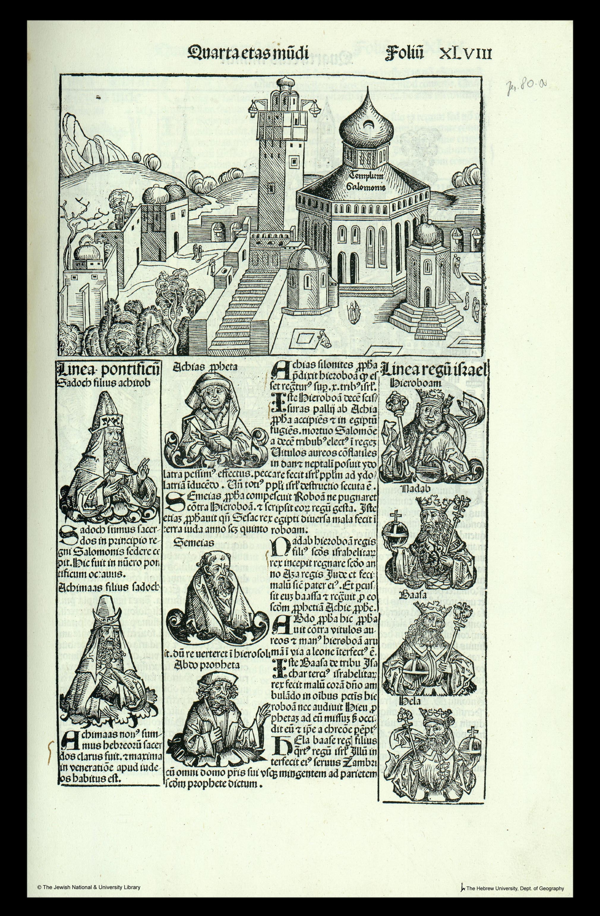
| Hartmann Schedel: Templum Salomonis
( |
||||||||||||||||||||||||
|---|---|---|---|---|---|---|---|---|---|---|---|---|---|---|---|---|---|---|---|---|---|---|---|---|
| Artist |
| |||||||||||||||||||||||
| Contributors | Wolgemut, Michael, 1434-1519 Koberger, Anton, approximately 1440-1513 | |||||||||||||||||||||||
| Title |
Templum Salomonis |
|||||||||||||||||||||||
| Publisher |
Anton Koberger |
|||||||||||||||||||||||
| Description |
Templum Salomonis. |
|||||||||||||||||||||||
| Language | Latin | |||||||||||||||||||||||
| Publication date | 1493 | |||||||||||||||||||||||
| Dimensions | height: 223 mm (8.77 in); width: 140 mm (5.51 in) | |||||||||||||||||||||||
| Collection |
|
|||||||||||||||||||||||
| Current location |
|
|||||||||||||||||||||||
| Place of publication | Nuremberg | |||||||||||||||||||||||
| search Merhav catalog | Nuremberg | |||||||||||||||||||||||
| Notes | Woodcut; An approximate representation of the Dome of the Rock with the inscription Templum Salomois next to an imaginary minaret and part of Jerusalem; From: Schedel, Hartmann. Liber chronicarum. Nuernberg. Anton Koberger, 1493. Fol.XLVIII. The illustrations and the maps are cut in wood by Michael Wohlgemut | |||||||||||||||||||||||
| IE PID | IE6880170 | |||||||||||||||||||||||
| Rosetta filename | FL6880176 | |||||||||||||||||||||||
| NNL item ID (P3959) | 990023681760205171 | |||||||||||||||||||||||
| search Merhav catalog | Latin, Hartmann Schedel | |||||||||||||||||||||||
| search Merhav catalog | Anton Koberger | |||||||||||||||||||||||
| Source/Photographer |
|
|||||||||||||||||||||||
| Other versions | ||||||||||||||||||||||||
| Jpg / Tif version |
|
|||||||||||||||||||||||

.jpg)

.jpg&action=edit§ion=1)
Licensing[edit]
.jpg&action=edit§ion=2)
The copyright situation of this work is theoretically uncertain, because in the country of origin copyright lasts 70 years after the death of the author, and the date of the author's death is unknown. However, the date of creation of the work was over 120 years ago, and it is thus a reasonable assumption that the copyright has expired (see here for the community discussion). Do not use this template if the date of death of the author is known.
| |
| This file has been identified as being free of known restrictions under copyright law, including all related and neighboring rights. | |
File history
Click on a date/time to view the file as it appeared at that time.
| Date/Time | Thumbnail | Dimensions | User | Comment | |
|---|---|---|---|---|---|
| current | 00:32, 28 July 2023 | | 2,020 × 3,084 (2.71 MB) | Geagea (talk | contribs) | pattypan 22.03 |
You cannot overwrite this file.
File usage on Commons
The following page uses this file:
.jpg&oldid=787445350)