File:Hasuike area 1980-1200.png
Jump to navigation
Jump to search
Size of this preview: 800 × 557 pixels. Other resolutions: 320 × 223 pixels | 640 × 445 pixels | 1,024 × 713 pixels | 1,200 × 835 pixels.
Original file (1,200 × 835 pixels, file size: 1.84 MB, MIME type: image/png)
Captions
Captions
Add a one-line explanation of what this file represents
Summary[edit]
| Description |
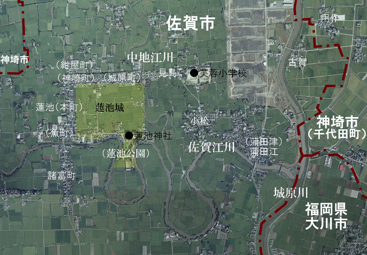
日本語: 蓮池町周辺航空写真(1981年) |
| Date | |
| Source | 国土地理院・地図空中写真閲覧サービス(1981年10月4日に撮影されたもの・整理番号CKU813・コース番号C16B・写真番号22、23、24およびコース番号C15C・写真番号9、10、11)より作成 |
| Author | ja:User:㭍月例祭 |
Licensing[edit]

|
The copyright holder of this file, the Ministry of Land, Infrastructure, Transport and Tourism of Japan, allows anyone to use it for any purpose, provided that the copyright holder is properly attributed. Redistribution, derivative work, commercial use, and all other use is permitted. |
Attribution:
Copyright © National Land Image Information (Color Aerial Photographs), Ministry of Land, Infrastructure, Transport and Tourism
|
 |
This image is copyrighted by the Ministry of Land, Infrastructure, Transport and Tourism of Japan. For terms of use, see the stipulation to use of National Land Information (in Japanese) and message from MLIT (in Japanese and English). When you display this image on an article, include the following phrase in the description: "Made based on National Land Image Information (Color Aerial Photographs), Ministry of Land, Infrastructure, Transport and Tourism".
|
File history
Click on a date/time to view the file as it appeared at that time.
| Date/Time | Thumbnail | Dimensions | User | Comment | |
|---|---|---|---|---|---|
| current | 17:06, 7 May 2017 | | 1,200 × 835 (1.84 MB) | 㭍月例祭 (talk | contribs) | {{Information |Description=蓮池町周辺航空写真(1981年) |Source=国土地理院・地図空中写真閲覧サービス(1981年10月4日に撮影されたもの・整理番号CKU813・コース番号C16B・写真番号22、23、24お... |
You cannot overwrite this file.
File usage on Commons
There are no pages that use this file.
File usage on other wikis
The following other wikis use this file:
- Usage on ja.wikipedia.org