File:Hauptstraße 107 Chaussee-Abschnitt 2.jpg
From Wikimedia Commons, the free media repository
Jump to navigation
Jump to search
![File:Hauptstraße 107 Chaussee-Abschnitt 2.jpg](https://upload.wikimedia.org/wikipedia/commons/thumb/f/f5/Hauptstra%C3%9Fe_107_Chaussee-Abschnitt_2.jpg/800px-Hauptstra%C3%9Fe_107_Chaussee-Abschnitt_2.jpg?20231120223731)
Size of this preview: 800 × 389 pixels. Other resolutions: 320 × 156 pixels | 640 × 312 pixels | 1,024 × 498 pixels | 1,280 × 623 pixels | 4,000 × 1,947 pixels.
Original file (4,000 × 1,947 pixels, file size: 2.79 MB, MIME type: image/jpeg)
File information
Structured data
Captions
Captions
Add a one-line explanation of what this file represents
Summary
[edit]DescriptionHauptstraße 107 Chaussee-Abschnitt 2.jpg |
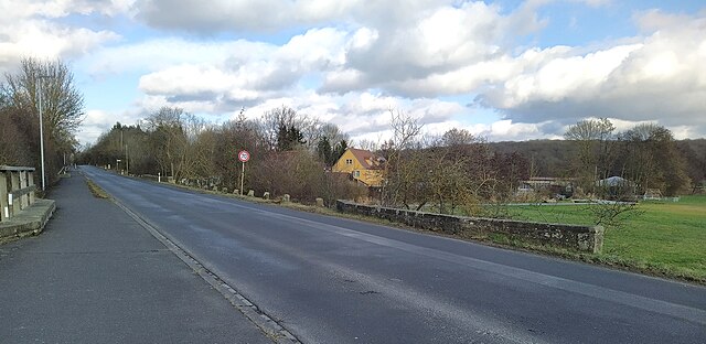
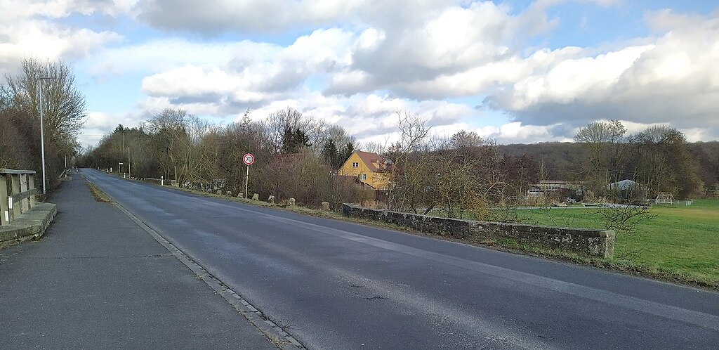
Deutsch: Chaussee-Abschnitt Hauptstraße 107; zwischen Poppenhausen und Kronungen |
Date | |
Source | Own work |
Author | Michael Bemmerl |
Camera location | 50° 05′ 17.7″ N, 10° 08′ 29.54″ E ![]() | View this and other nearby images on: OpenStreetMap | ![]() |
---|
![]() |
This is a picture of the Bavarian Baudenkmal (cultural heritage monument) with the ID D-6-78-168-99 (Wikidata)
|
Licensing
[edit]Michael Bemmerl, the copyright holder of this work, hereby publishes it under the following license:
![w:en:Creative Commons](https://upload.wikimedia.org/wikipedia/commons/thumb/7/79/CC_some_rights_reserved.svg/90px-CC_some_rights_reserved.svg.png)
![attribution](https://upload.wikimedia.org/wikipedia/commons/thumb/1/11/Cc-by_new_white.svg/24px-Cc-by_new_white.svg.png)
This file is licensed under the Creative Commons Attribution 3.0 Germany license.
Attribution: Michael Bemmerl
- You are free:
- to share – to copy, distribute and transmit the work
- to remix – to adapt the work
- Under the following conditions:
- attribution – You must give appropriate credit, provide a link to the license, and indicate if changes were made. You may do so in any reasonable manner, but not in any way that suggests the licensor endorses you or your use.
![](https://upload.wikimedia.org/wikipedia/commons/thumb/b/ba/Flag_of_Germany.svg/90px-Flag_of_Germany.svg.png)
Annotations InfoField | This image is annotated: View the annotations at Commons |
303
925
703
131
4000
1947
Deutsch: Wasserdurchlass
3
891
3456
616
4000
1947
Deutsch: Wasserdurchlass Leuselbach
984
991
928
241
4000
1947
Deutsch: Begrenzungspoller aus Sandstein
716
969
109
59
4000
1947
Deutsch: Begrenzungspoller aus Sandstein
653
956
84
50
4000
1947
Deutsch: Wasserdurchlass
1084
794
2806
381
4000
1947
Deutsch: Weidenmühle
![]() |
This is a picture of the Bavarian Baudenkmal (cultural heritage monument) with the ID D-6-78-168-98 (Wikidata)
|
File history
Click on a date/time to view the file as it appeared at that time.
Date/Time | Thumbnail | Dimensions | User | Comment | |
---|---|---|---|---|---|
current | 22:37, 20 November 2023 | ![]() | 4,000 × 1,947 (2.79 MB) | WikiMichi (talk | contribs) | == {{int:filedesc}} == {{Information |description= {{de|Chaussee-Abschnitt Hauptstraße 107; zwischen Poppenhausen und Kronungen}} |source={{own}} |author=Michael Bemmerl |date=2022-02-05 |permission= |other_versions= }} {{Location dec|50.08825|10.14154}} {{Baudenkmal Bayern|D-6-78-168-99}} == {{int:license-header}} == {{self|cc-by-3.0-de|author=Michael Bemmerl}} Category:Hauptstraße 107 (Poppenhausen) |
You cannot overwrite this file.
File usage on Commons
There are no pages that use this file.
File usage on other wikis
The following other wikis use this file:
- Usage on de.wikipedia.org
Metadata
This file contains additional information such as Exif metadata which may have been added by the digital camera, scanner, or software program used to create or digitize it. If the file has been modified from its original state, some details such as the timestamp may not fully reflect those of the original file. The timestamp is only as accurate as the clock in the camera, and it may be completely wrong.
Camera manufacturer | HMD Global |
---|---|
Camera model | Nokia 7.2 |
Copyright holder | License: CC-BY 3.0 de (http://creativecommons.org/licenses/by/3.0/de/) |
Exposure time | 1/4,000 sec (0.00025) |
F-number | f/1.8 |
ISO speed rating | 101 |
Date and time of data generation | 14:15, 5 February 2022 |
Lens focal length | 4.71 mm |
User comments | {"capture_mode":"AutoModule","faces":[]} |
Latitude | 50° 5′ 17.7″ N |
Longitude | 10° 8′ 29.58″ E |
Altitude | 278.256 meters above sea level |
City shown | Poppenhausen |
Credit/Provider | Michael Bemmerl |
Orientation | Normal |
Horizontal resolution | 72 dpi |
Vertical resolution | 72 dpi |
Software used | GIMP 2.8.10 |
File change date and time | 23:27, 20 November 2023 |
Exposure Program | Not defined |
Exif version | 2.1 |
Date and time of digitizing | 14:15, 5 February 2022 |
APEX aperture | 1.8 |
Metering mode | Center weighted average |
Flash | Flash did not fire |
Supported Flashpix version | 1 |
Color space | Uncalibrated |
White balance | Auto white balance |
GPS time (atomic clock) | 13:15 |
Reference for direction of image | True direction |
Direction of image | 40.46 |
Geodetic survey data used | WGS-84 |
Latitude destination | 50° 5′ 18.84″ N |
Longitude of destination | 10° 8′ 31.09″ E |
GPS date | 5 February 2022 |
GPS tag version | 2.2.0.0 |
Sublocation of city shown | Kronungen |
Province or state shown | Bayern |
Code for country shown | DEU |
Country shown | Deutschland |
IIM version | 4 |
Structured data
Items portrayed in this file
depicts
some value
5 February 2022
50°5'17.70"N, 10°8'29.54"E
0.00025 second
1.8
4.71 millimetre
101
image/jpeg
Hidden categories:
- Files with coordinates missing SDC location of creation (50° N, 10° E)
- Cultural heritage monuments in Bavaria with known IDs
- Cultural heritage monuments in Bavaria missing SDC depicts
- Cultural heritage monuments in Bavaria missing SDC location of creation
- CC-BY-3.0-DE
- Self-published work
- Images with annotations