File:Heards Brook.jpg
Jump to navigation
Jump to search

Size of this preview: 799 × 319 pixels. Other resolutions: 320 × 128 pixels | 640 × 256 pixels | 1,024 × 409 pixels | 1,941 × 775 pixels.
Original file (1,941 × 775 pixels, file size: 2.82 MB, MIME type: image/jpeg)
Captions
Captions
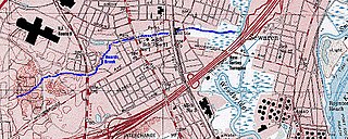
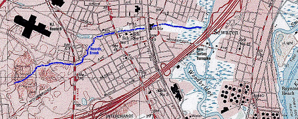
Heards Brook map, Woodbridge, New Jersey; USGS map with superimposed geographical markings
Summary
[edit]
| Description |
English: USGS topo map of a portion of Woodbridge N.J. showing Heards Brook, with superimposed geographical markings |
| Date | Unknown date |
| Source | https://www.topozone.com/map-print/?lat=40.5562815&lon=-74.268077&title=Heards%20Brook%20Topo%20Map%20in%20Middlesex%20County%20New%20Jersey |
| Author | USGS |
Licensing
[edit]
This work is in the public domain in the United States because it is a work prepared by an officer or employee of the United States Government as part of that person’s official duties under the terms of Title 17, Chapter 1, Section 105 of the US Code.
Note: This only applies to original works of the Federal Government and not to the work of any individual U.S. state, territory, commonwealth, county, municipality, or any other subdivision. This template also does not apply to postage stamp designs published by the United States Postal Service since 1978. (See § 313.6(C)(1) of Compendium of U.S. Copyright Office Practices). It also does not apply to certain US coins; see The US Mint Terms of Use.
|
 | |
| This file has been identified as being free of known restrictions under copyright law, including all related and neighboring rights. | ||
File history
Click on a date/time to view the file as it appeared at that time.
| Date/Time | Thumbnail | Dimensions | User | Comment | |
|---|---|---|---|---|---|
| current | 08:56, 14 January 2020 | 1,941 × 775 (2.82 MB) | Mwinog2777 (talk | contribs) | User created page with UploadWizard |
You cannot overwrite this file.
File usage on Commons
The following page uses this file: