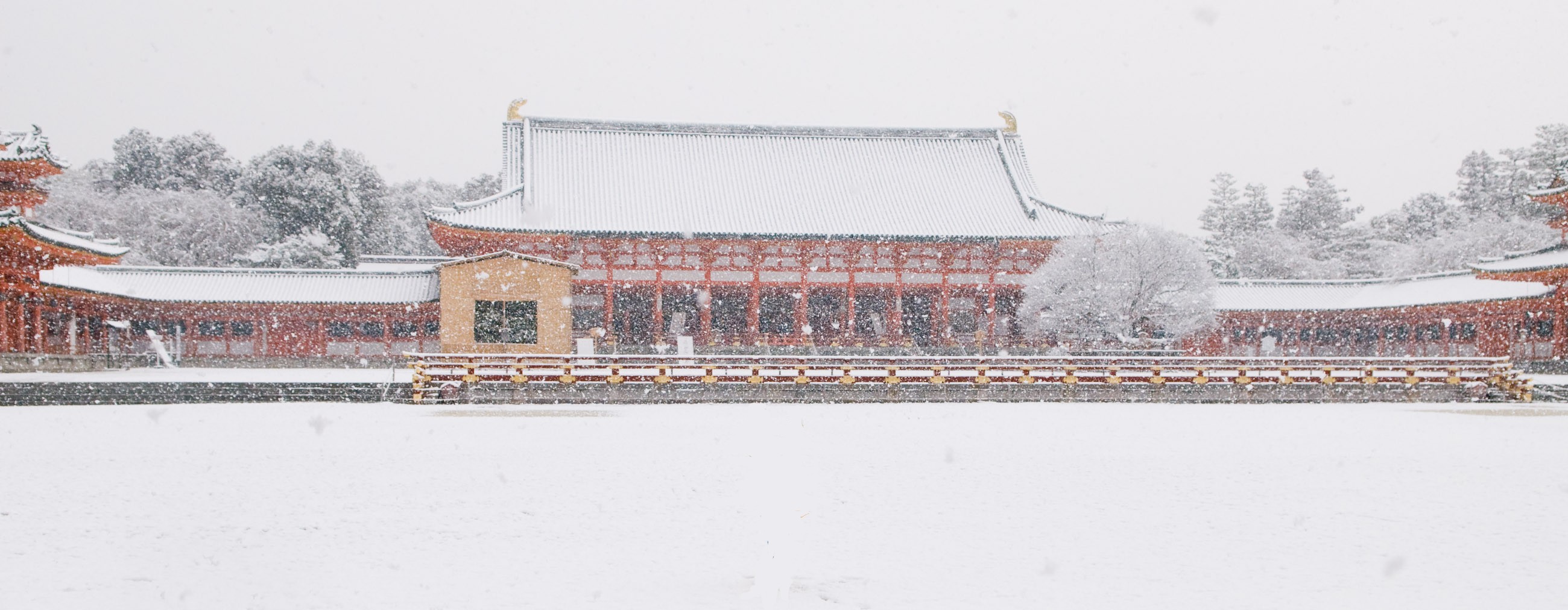
File:Heian Shrine.jpg
From Wikimedia Commons, the free media repository
Jump to navigation
Jump to search
Size of this preview: 800 × 311 pixels. Other resolutions: 320 × 125 pixels | 640 × 249 pixels | 1,024 × 399 pixels | 2,600 × 1,012 pixels.
Original file (2,600 × 1,012 pixels, file size: 455 KB, MIME type: image/jpeg)
File information
Structured data
Captions
Summary
[edit]DescriptionHeian Shrine.jpg |
日本語: 平安神宮 |
Date | Taken on 18 February 2008 |
Source | Own work |
Author | Sayotadashi |
Camera location | 35° 00′ 55.92″ N, 135° 46′ 56.31″ E | View this and other nearby images on: OpenStreetMap | 35.015532; 135.782308 |
---|
Licensing
[edit]Public domainPublic domainfalsefalse |
I, the copyright holder of this work, release this work into the public domain. This applies worldwide. In some countries this may not be legally possible; if so: I grant anyone the right to use this work for any purpose, without any conditions, unless such conditions are required by law. |
File history
Click on a date/time to view the file as it appeared at that time.
Date/Time | Thumbnail | Dimensions | User | Comment | |
---|---|---|---|---|---|
current | 18:57, 16 February 2009 | 2,600 × 1,012 (455 KB) | Sayotadashi (talk | contribs) | {{Information |Description={{ja|1=平安陣具}} |Source=Own work by uploader |Author=Sayotadashi |Date=February 18, 2008 |Permission= |other_versions= }} <!--{{ImageUpload|full}}--> Category:Heian period Category:Japan |
You cannot overwrite this file.
File usage on Commons
The following page uses this file:
File usage on other wikis
The following other wikis use this file:
- Usage on ca.wikipedia.org
- Usage on www.wikidata.org
Metadata
This file contains additional information such as Exif metadata which may have been added by the digital camera, scanner, or software program used to create or digitize it. If the file has been modified from its original state, some details such as the timestamp may not fully reflect those of the original file. The timestamp is only as accurate as the clock in the camera, and it may be completely wrong.
Image title | http://regex.info/blog/2008-02-18/743 |
---|---|
Camera manufacturer | NIKON CORPORATION |
Camera model | NIKON D200 |
Author | Jeffrey Eric Francis Friedl |
Copyright holder | Copyright 2008 Jeffrey Eric Francis Friedl |
Exposure time | 1/500 sec (0.002) |
F-number | f/6.3 |
ISO speed rating | 400 |
Date and time of data generation | 07:51, 18 February 2008 |
Lens focal length | 24 mm |
User comments | COPYRIGHT 2007 JEFFREY FRIEDL |
Latitude | 35° 0′ 55.92″ N |
Longitude | 135° 46′ 56.31″ E |
Altitude | 57 meters above sea level |
JPEG file comment | http://regex.info/blog/2008-02-18/743 |
Horizontal resolution | 300 dpi |
Vertical resolution | 300 dpi |
Software used | Ver.2.00 |
File change date and time | 20:52, 18 February 2008 |
Exposure Program | Aperture priority |
Exif version | 2.21 |
Date and time of digitizing | 07:51, 18 February 2008 |
APEX shutter speed | 8.965784 |
APEX aperture | 5.310704 |
APEX exposure bias | 0 |
Maximum land aperture | 3 APEX (f/2.83) |
Subject distance | 7.5 meters |
Metering mode | Pattern |
Light source | Unknown |
Flash | Flash did not fire |
DateTimeOriginal subseconds | 20 |
DateTimeDigitized subseconds | 20 |
Sensing method | One-chip color area sensor |
File source | Digital still camera |
Scene type | A directly photographed image |
Custom image processing | Normal process |
Exposure mode | Auto exposure |
White balance | Auto white balance |
Digital zoom ratio | 1 |
Focal length in 35 mm film | 36 mm |
Scene capture type | Standard |
Scene control | Low gain up |
Contrast | Hard |
Saturation | Normal |
Sharpness | Normal |
Subject distance range | Unknown |
GPS time (atomic clock) | 22:51 |
Geodetic survey data used | WGS-84 |
GPS date | 17 February 2008 |
GPS tag version | 0.0.2.2 |