File:Herrnhut Gottesacker aerial Pan180.jpg
From Wikimedia Commons, the free media repository
Jump to navigation
Jump to search
Size of this preview: 800 × 217 pixels. Other resolutions: 320 × 87 pixels | 640 × 173 pixels | 1,024 × 277 pixels | 1,280 × 347 pixels | 2,560 × 693 pixels | 17,020 × 4,608 pixels.
Original file (17,020 × 4,608 pixels, file size: 6.67 MB, MIME type: image/jpeg)
File information
Structured data
Captions
Summary
[edit]DescriptionHerrnhut Gottesacker aerial Pan180.jpg |
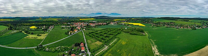
English: Gottesacker Herrnhut (Saxony, Germany) |
Date | |
Source | Own work |
Author | PaulT (Gunther Tschuch) |
Camera location | 51° 01′ 10.84″ N, 14° 45′ 11.51″ E | View this and other nearby images on: OpenStreetMap | 51.019679; 14.753198 |
---|
Licensing
[edit]I, the copyright holder of this work, hereby publish it under the following license:
This file is licensed under the Creative Commons Attribution-Share Alike 4.0 International license.
- You are free:
- to share – to copy, distribute and transmit the work
- to remix – to adapt the work
- Under the following conditions:
- attribution – You must give appropriate credit, provide a link to the license, and indicate if changes were made. You may do so in any reasonable manner, but not in any way that suggests the licensor endorses you or your use.
- share alike – If you remix, transform, or build upon the material, you must distribute your contributions under the same or compatible license as the original.
File history
Click on a date/time to view the file as it appeared at that time.
Date/Time | Thumbnail | Dimensions | User | Comment | |
---|---|---|---|---|---|
current | 15:22, 24 May 2021 | 17,020 × 4,608 (6.67 MB) | PaulT (talk | contribs) | Uploaded own work with UploadWizard |
You cannot overwrite this file.
File usage on Commons
The following page uses this file:
File usage on other wikis
The following other wikis use this file:
- Usage on fi.wikipedia.org
Metadata
This file contains additional information such as Exif metadata which may have been added by the digital camera, scanner, or software program used to create or digitize it. If the file has been modified from its original state, some details such as the timestamp may not fully reflect those of the original file. The timestamp is only as accurate as the clock in the camera, and it may be completely wrong.
Image title |
|
---|---|
Camera manufacturer | Hasselblad |
Camera model | L1D-20c |
Copyright holder |
|
Exposure time | 1/500 sec (0.002) |
F-number | f/6.3 |
ISO speed rating | 100 |
Date and time of data generation | 11:16, 24 May 2021 |
Lens focal length | 10.26 mm |
Latitude | 51° 1′ 10.85″ N |
Longitude | 14° 45′ 11.51″ E |
Altitude | 455 meters above sea level |
Width | 5,472 px |
Height | 3,648 px |
Bits per component |
|
Pixel composition | RGB |
Orientation | Normal |
Number of components | 3 |
Horizontal resolution | 72 dpi |
Vertical resolution | 72 dpi |
Software used | Adobe Photoshop Elements 15.0 (Windows) |
File change date and time | 11:16, 24 May 2021 |
Y and C positioning | Centered |
Exposure Program | Normal program |
Exif version | 2.3 |
Date and time of digitizing | 11:16, 24 May 2021 |
Meaning of each component |
|
APEX shutter speed | 8.965784 |
APEX aperture | 5.310704 |
APEX exposure bias | −0.3 |
Maximum land aperture | 2.971 APEX (f/2.8) |
Metering mode | Average |
Light source | Daylight |
Flash | Flash did not fire |
Supported Flashpix version | 1 |
Color space | sRGB |
File source | Digital still camera |
Scene type | A directly photographed image |
Exposure mode | Auto exposure |
White balance | Auto white balance |
Digital zoom ratio | 1 |
Focal length in 35 mm film | 28 mm |
Scene capture type | Standard |
Scene control | None |
Contrast | Normal |
Saturation | Normal |
Sharpness | Normal |
GPS time (atomic clock) | 11:16 |
Reference for direction of image | True direction |
Direction of image | 270 |
GPS date | 24 May 2021 |
GPS tag version | 0.0.3.2 |
Lens used | 28.0 mm f/2.8 |
Serial number of camera | 0K8TFB10024203 |
Geodetic survey data used | WGS-84 |
Date metadata was last modified | 19:10, 24 May 2021 |
Unique ID of original document | 1C8E357FF837048E223A5CBF9E7AE99D |