File:HexaTrek Track OSM.png
Jump to navigation
Jump to search
Size of this preview: 663 × 600 pixels. Other resolutions: 265 × 240 pixels | 531 × 480 pixels | 683 × 618 pixels.
Original file (683 × 618 pixels, file size: 708 KB, MIME type: image/png)
Captions
Captions
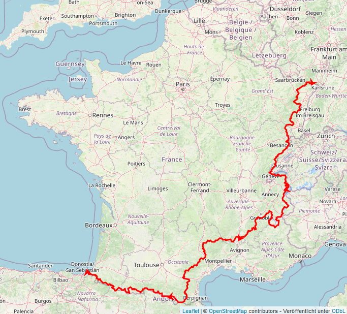
Overview map of the HexaTrek hiking trail
Summary[edit]
| Description |
English: The HexaTrek is a 3000+ km hiking trail through France. This file is a screenshot of an OpenStreetMap visualization of the track. |
| Date | |
| Source | https://www.openstreetmap.org/ |
| Author |
|
Licensing[edit]
This file is licensed under the Creative Commons Attribution-Share Alike 2.0 Generic license.
- You are free:
- to share – to copy, distribute and transmit the work
- to remix – to adapt the work
- Under the following conditions:
- attribution – You must give appropriate credit, provide a link to the license, and indicate if changes were made. You may do so in any reasonable manner, but not in any way that suggests the licensor endorses you or your use.
- share alike – If you remix, transform, or build upon the material, you must distribute your contributions under the same or compatible license as the original.
File history
Click on a date/time to view the file as it appeared at that time.
| Date/Time | Thumbnail | Dimensions | User | Comment | |
|---|---|---|---|---|---|
| current | 16:16, 2 May 2024 | | 683 × 618 (708 KB) | BitPoet (talk | contribs) | Uploaded a work by * Overlay of GPX track by BitPoet * Map image (c) [https://www.openstreetmap.org/copyright OpenStreetMap] contributors from https://www.openstreetmap.org/ with UploadWizard |
You cannot overwrite this file.
File usage on Commons
The following 2 pages use this file:
File usage on other wikis
The following other wikis use this file:
- Usage on en.wikipedia.org