File:Hillside at the Gartner Site.jpg
Jump to navigation
Jump to search

Size of this preview: 800 × 600 pixels. Other resolutions: 320 × 240 pixels | 640 × 480 pixels | 1,024 × 768 pixels | 1,280 × 960 pixels | 2,560 × 1,920 pixels | 2,816 × 2,112 pixels.
Original file (2,816 × 2,112 pixels, file size: 2.38 MB, MIME type: image/jpeg)
Captions
Captions
Add a one-line explanation of what this file represents
|
This is an image of a place or building that is listed on the National Register of Historic Places in the United States of America. Its reference number is 5000752. |
| Camera location | | View this and other nearby images on: OpenStreetMap |
|---|
| Description |
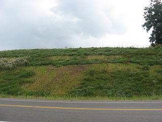
English: A hillside on the northern edge of the Gartner Site, an archaeological site of the Fort Ancient culture on the bluffs above the Scioto River north of Chillicothe in Green Township, Ross County, Ohio, United States. The village site and an associated mound are listed on the National Register of Historic Places. |
||
| Date | Taken on 9 July 2010 | ||
| Source | Own work | ||
| Author | Nyttend | ||
| Permission (Reusing this file) |
|
File history
Click on a date/time to view the file as it appeared at that time.
| Date/Time | Thumbnail | Dimensions | User | Comment | |
|---|---|---|---|---|---|
| current | 21:31, 12 July 2010 | | 2,816 × 2,112 (2.38 MB) | Nyttend (talk | contribs) | {{Location|39|24|51.6|N|82|58|55.2|W}} {{Information |Description={{en|A hillside on the northern edge of the {{w|Gartner Site}}, an {{w|archaeological site}} of the {{w|Fort Ancient culture|Fort Ancient}} on the bluffs above the {{w|Scioto River}} north |
You cannot overwrite this file.
File usage on Commons
There are no pages that use this file.
File usage on other wikis
The following other wikis use this file:
- Usage on en.wikipedia.org