File:Holborn-viaduct-map.svg
Jump to navigation
Jump to search

Size of this PNG preview of this SVG file: 654 × 599 pixels. Other resolutions: 262 × 240 pixels | 524 × 480 pixels | 838 × 768 pixels | 1,117 × 1,024 pixels | 2,235 × 2,048 pixels | 671 × 615 pixels.
Original file (SVG file, nominally 671 × 615 pixels, file size: 269 KB)
Captions
Captions
Add a one-line explanation of what this file represents
| Camera location | | View this and other nearby images on: OpenStreetMap |
|---|
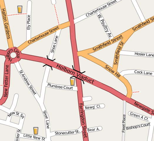
| Description | Map of the area around Holborn Viaduct (in central London) |
| Date | |
| Source | openstreetmap.org |
| Author | Collaboratively created by the OpenStreetMap community using only free map sources and manual GPS surveying to build the map from scratch. Harry Wood exported this area to SVG format and did some cleanup work. |
| Permission (Reusing this file) |
This file is licensed under the Creative Commons Attribution 2.0 Generic license.
|
| Other versions | The 'live' version of this map is available at http://www.openstreetmap.org/?lat=51.51699&lon=-0.10535&zoom=17&layers=B0FT Use the 'export' tab to get a fresh export in a variety of formats. This includes SVG (as used here) and '.osm', the underlying geolocated data. Use the 'edit' tab there to edit the map! |
File history
Click on a date/time to view the file as it appeared at that time.
| Date/Time | Thumbnail | Dimensions | User | Comment | |
|---|---|---|---|---|---|
| current | 09:51, 31 December 2013 | | 671 × 615 (269 KB) | Ysangkok (talk | contribs) | scour |
| 14:52, 22 April 2008 |  | 671 × 615 (1.09 MB) | Harry Wood (talk | contribs) | this SVG renderer didn't like the oneway arrows. Remove them | |
| 14:42, 22 April 2008 |  | 671 × 615 (1.11 MB) | Harry Wood (talk | contribs) | try to fix 'page' boundary | |
| 14:39, 22 April 2008 |  | 671 × 615 (1.08 MB) | Harry Wood (talk | contribs) | {{Information |Description=Map of the area around Holborn Viaduct |Source=OpenStreetMap.org |Date= |Author= |Permission={{OpenStreetMap}} |other_versions= }} |
You cannot overwrite this file.
File usage on Commons
There are no pages that use this file.
File usage on other wikis
The following other wikis use this file:
- Usage on de.wikipedia.org
- Usage on en.wikipedia.org
- Usage on fr.wikipedia.org
- Usage on tg.wikipedia.org