File:Homestead National Monument - 50188599016.jpg

Original file (3,000 × 2,247 pixels, file size: 4.99 MB, MIME type: image/jpeg)
Captions
Captions
Summary
[edit]
| Description |
English: In January, 2021, at the behest of the Republican led legislature of Nebraska, the Republican led US Congress demoted the 85 year old Homestead National Monument to Homestead National Historical Park. The law decreeing this is written to give it the 1984 treatment, mandating that all references be changed. As a result, the National Park Service history page now says that it was designated as a national historical park 85 years ago, rather than noting that it was re-designated in 2021. They have gone so far down this false narrative that a government representative has contacted me to rename my photos here on Flickr. I have refused.
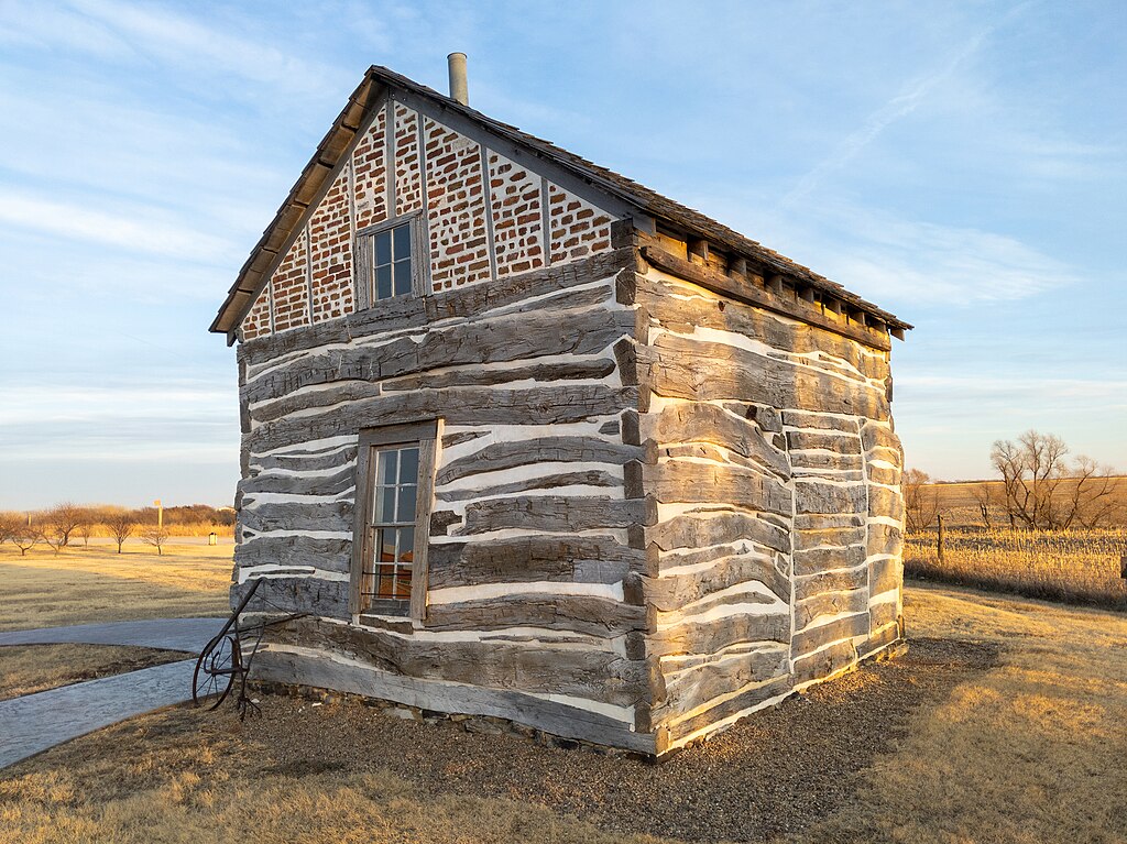
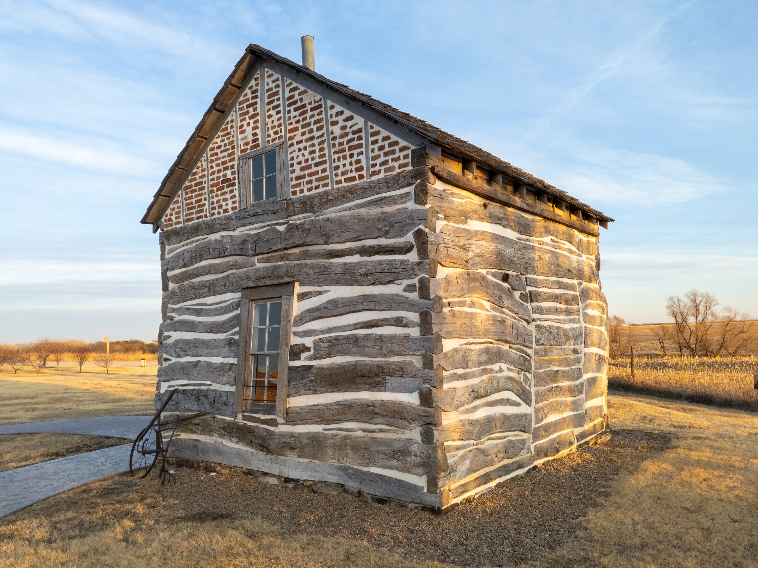
Homestead National Monument of America, a unit of the National Park System, commemorates passage of the Homestead Act of 1862, which allowed any qualified person to claim up to 160 acres (0.65 km2) of federally owned land in exchange for five years of residence and the cultivation and improvement of the property. The Act eventually transferred 270,000,000 acres (1,100,000 km2) from public to private ownership. The national monument is five miles west of Beatrice, Gage County, Nebraska on a site that includes some of the first acres successfully claimed under the Homestead Act. The national monument was first included in the National Register of Historic Places on October 15, 1966 (ID 66000115). The Homestead Heritage Center, dedicated in 2007, contains exhibits that treat the effect of the Homestead Act on immigration, agriculture, native tribes, the tallgrass prairie ecosystem, and federal land policy. The roof line of the center resembles a "single bottom plow moving through the sod," and the parking lot measures exactly 1-acre (4,000 m2). A separate Education Center features science and social science presentations that can be shared with classrooms anywhere in the United States through distance-learning. Source: Wikipedia en.wikipedia.org/wiki/Homestead_National_Monument_of_America |
| Date | |
| Source | https://www.flickr.com/photos/21874566@N07/50188599016/ |
| Author | RuggyBearLA |
| Camera location | | View this and other nearby images on: OpenStreetMap |
|---|
Licensing
[edit]
- You are free:
- to share – to copy, distribute and transmit the work
- to remix – to adapt the work
- Under the following conditions:
- attribution – You must give appropriate credit, provide a link to the license, and indicate if changes were made. You may do so in any reasonable manner, but not in any way that suggests the licensor endorses you or your use.
| This image was originally posted to Flickr by RuggyBearLA at https://flickr.com/photos/21874566@N07/50188599016. It was reviewed on 18 April 2022 by FlickreviewR 2 and was confirmed to be licensed under the terms of the cc-by-2.0. |
File history
Click on a date/time to view the file as it appeared at that time.
| Date/Time | Thumbnail | Dimensions | User | Comment | |
|---|---|---|---|---|---|
| current | 20:13, 18 April 2022 | | 3,000 × 2,247 (4.99 MB) | Ser Amantio di Nicolao (talk | contribs) | Uploaded a work by RuggyBearLA from https://www.flickr.com/photos/21874566@N07/50188599016/ with UploadWizard |
You cannot overwrite this file.
File usage on Commons
The following page uses this file:
- File:Homestead National Monument (50188599016).jpg (file redirect)
.jpg&redirect=no)