File:Honduras rel 1985.jpg
Salta a la navegació
Salta a la cerca

Mida d'aquesta previsualització: 743 × 600 píxels. Altres resolucions: 297 × 240 píxels | 595 × 480 píxels | 952 × 768 píxels | 1.188 × 959 píxels.
Fitxer original (1.188 × 959 píxels, mida del fitxer: 240 Ko, tipus MIME: image/jpeg)
Llegendes
Llegendes
Afegeix una explicació d'una línia del que representa aquest fitxer
Resum[modifica]
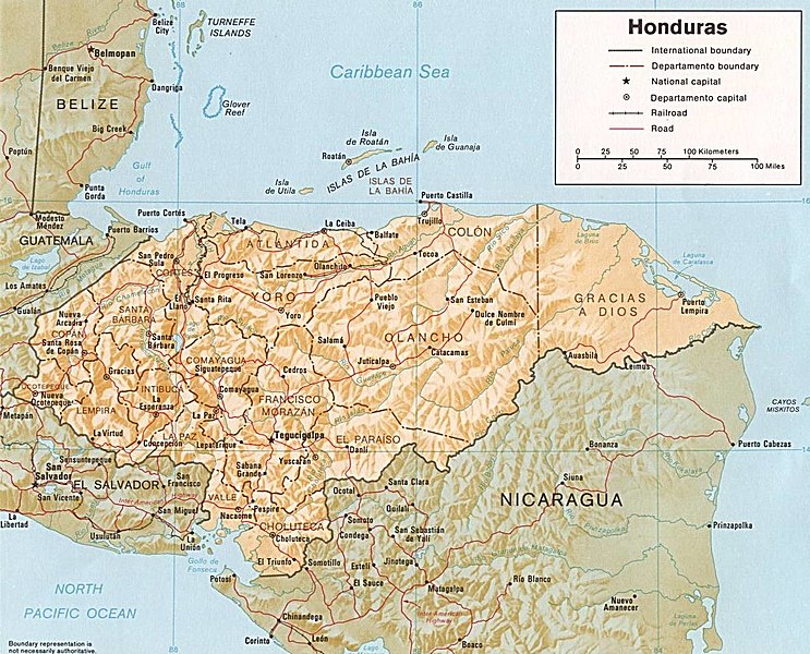
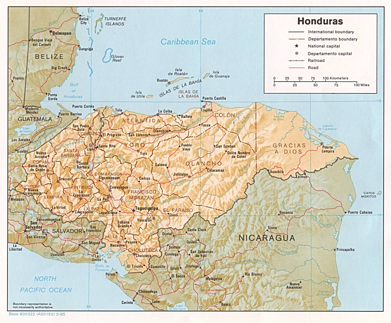
| Descripció | Shaded relief map of Honduras, in year 1985, showing more than 45 Honduras towns, plus 40 bordering towns, in original JPEG format, 1249 x 1033 pixel, 246kb (labeled for large resizing > 600px width). |
| Data | Uploaded 28-October-2005 |
| Font | Image source URL: http://www.lib.utexas.edu/maps/americas/honduras.jpg; there was no copyright restriction on the containing webpage of the UT Library: UT Perry-Castañeda Library Map Collection - Honduras Maps. |
| Autor | US CIA (archived by UT Library) |
| Altres versions | (none yet) |
Llicència[modifica]
| This image is a work of a Central Intelligence Agency employee, taken or made as part of that person's official duties. As a Work of the United States Government, this image or media is in the public domain in the United States.
|

|
-
Historial del fitxer
Cliqueu una data/hora per veure el fitxer tal com era aleshores.
| Data/hora | Miniatura | Dimensions | Usuari/a | Comentari | |
|---|---|---|---|---|---|
| actual | 07:08, 3 oct 2017 | | 1.188 × 959 (240 Ko) | ديفيد عادل وهبة خليل 2 (discussió | contribucions) | Removed border by cropping 5 % horizontally and 7 % vertically using CropTool with precise mode. |
| 00:52, 28 oct 2005 |  | 1.249 × 1.033 (246 Ko) | Brian0918 (discussió | contribucions) | Shaded relief map of Honduras, 1985. http://www.lib.utexas.edu/maps/honduras.html {{PD-USGov-CIA}} Category:Maps of Honduras |
No podeu sobreescriure aquest fitxer.
Ús del fitxer
La pàgina següent utilitza aquest fitxer:
Ús global del fitxer
Utilització d'aquest fitxer en altres wikis:
- Utilització a arz.wikipedia.org
- Utilització a ast.wikipedia.org
- Utilització a ba.wikipedia.org
- Utilització a ca.wikipedia.org
- Utilització a el.wikipedia.org
- Utilització a en.wikipedia.org
- Utilització a es.wikipedia.org
- Utilització a fa.wikipedia.org
- Utilització a fr.wikipedia.org
- Utilització a gd.wikipedia.org
- Utilització a gu.wikipedia.org
- Utilització a hu.wikipedia.org
- Utilització a hy.wikipedia.org
- Utilització a id.wikipedia.org
- Utilització a ilo.wikipedia.org
- Utilització a io.wikipedia.org
- Utilització a is.wikipedia.org
- Utilització a it.wikipedia.org
- Utilització a ja.wikipedia.org
- Utilització a kk.wikipedia.org
- Utilització a la.wikipedia.org
- Utilització a lv.wikipedia.org
- Utilització a mk.wikipedia.org
- Utilització a mt.wikipedia.org
- Utilització a os.wikipedia.org
- Utilització a pa.wikipedia.org
- Utilització a pnb.wikipedia.org
- Utilització a pt.wikipedia.org
- Utilització a ru.wikipedia.org
- Utilització a sh.wikipedia.org
- Utilització a sl.wikipedia.org
- Utilització a sq.wikipedia.org
- Utilització a sr.wikipedia.org
- Utilització a ta.wikipedia.org
- Utilització a te.wikipedia.org
- Utilització a th.wikipedia.org
- Utilització a tr.wikipedia.org
- Utilització a uk.wikipedia.org
Vegeu més usos globals d'aquest fitxer.