File:Horsetail Falls Tahoe.jpg
Jump to navigation
Jump to search
No higher resolution available.
Horsetail_Falls_Tahoe.jpg (646 × 599 pixels, file size: 119 KB, MIME type: image/jpeg)
Captions
Captions
Add a one-line explanation of what this file represents
Summary
[edit]
| Description |
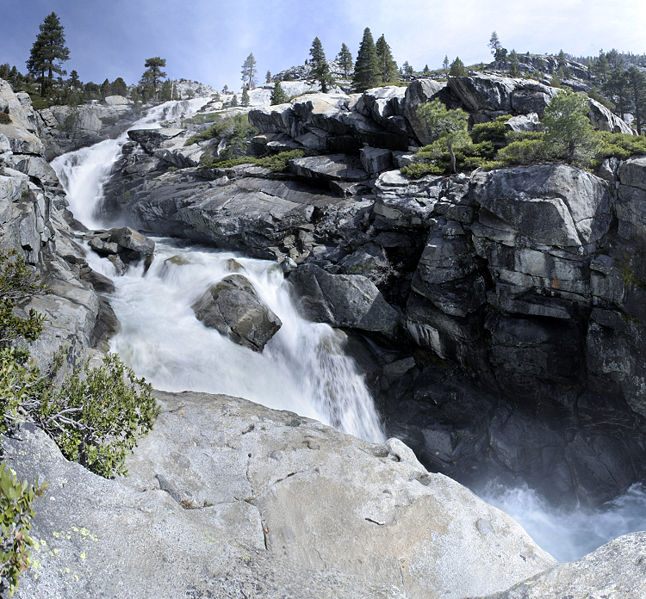
English: en:Horsetail Falls (California) is located in en:El Dorado County, California within the en:Desolation Wilderness
GPS Coords; 38°49'40.28"N; 120° 7'23.87"W |
| Date | 30 July 2006 (original upload date) |
| Source | Transferred from en.wikipedia to Commons by Utopies. |
| Author | Phreakdigital at English Wikipedia |
Licensing
[edit]
Phreakdigital at the English-language Wikipedia, the copyright holder of this work, hereby publishes it under the following license:

|
Permission is granted to copy, distribute and/or modify this document under the terms of the GNU Free Documentation License, Version 1.2 or any later version published by the Free Software Foundation; with no Invariant Sections, no Front-Cover Texts, and no Back-Cover Texts. A copy of the license is included in the section entitled GNU Free Documentation License. Subject to disclaimers. |
Original upload log
[edit]
The original description page was here. All following user names refer to en.wikipedia.
- 2006-07-30 20:59 Phreakdigital 1500×1392× (651089 bytes) [[Horsetail Falls (California)]] is located in [[El Dorado County, California]] within the [[Desolation Wilderness]] GPS Coords; 38°49'40.28"N; 120° 7'23.87"W
File history
Click on a date/time to view the file as it appeared at that time.
| Date/Time | Thumbnail | Dimensions | User | Comment | |
|---|---|---|---|---|---|
| current | 14:06, 10 October 2008 | | 646 × 599 (119 KB) | Utopies (talk | contribs) | {{Information |Description={{en|en:Horsetail Falls (California) is located in en:El Dorado County, California within the en:Desolation Wilderness GPS Coords; 38°49'40.28"N; 120° 7'23.87"W}} |Source=Transferred from [http://en.wikipedia.o |
You cannot overwrite this file.
File usage on Commons
The following 2 pages use this file:
File usage on other wikis
The following other wikis use this file:
- Usage on arz.wikipedia.org
- Usage on en.wikipedia.org
- Usage on fr.wikipedia.org
- Usage on www.wikidata.org