File:How-Bogota-Streets-are-Numbered-and-Named.svg
Jump to navigation
Jump to search

Size of this PNG preview of this SVG file: 424 × 600 pixels. Other resolutions: 170 × 240 pixels | 339 × 480 pixels | 543 × 768 pixels | 724 × 1,024 pixels | 1,448 × 2,048 pixels | 512 × 724 pixels.
Original file (SVG file, nominally 512 × 724 pixels, file size: 21 KB)
Captions
Captions
Add a one-line explanation of what this file represents
Summary[edit]
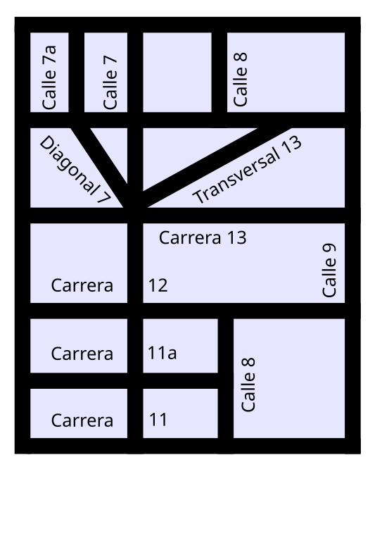
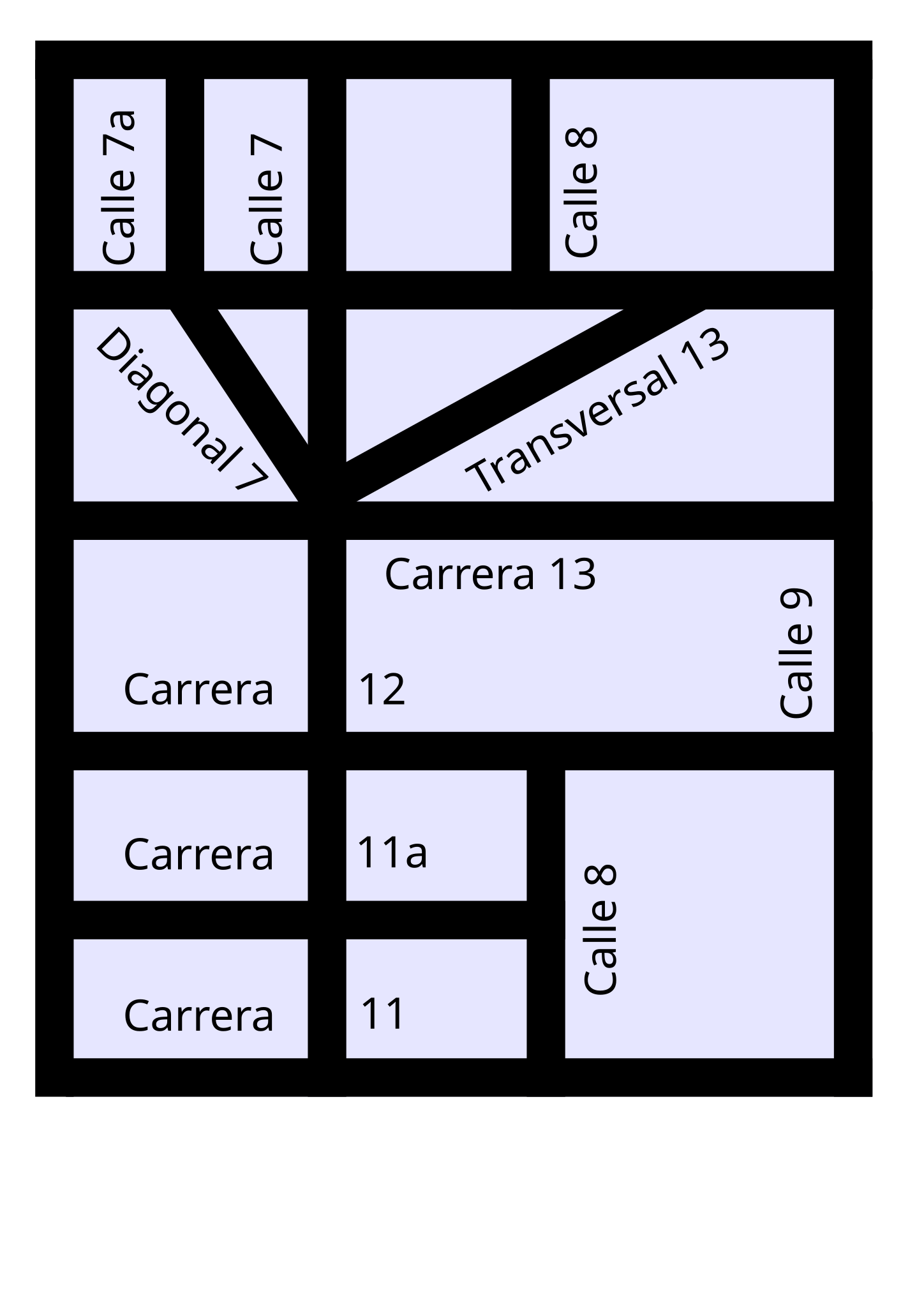
A diagram showing how Streets are named and numbered in the city of Bogotá.
Author: Elkin Fricke
Source: Selfdrawn
Date: 03.29.2006
Licensing[edit]
This file is licensed under the Creative Commons Attribution-Share Alike 2.5 Generic license.
- You are free:
- to share – to copy, distribute and transmit the work
- to remix – to adapt the work
- Under the following conditions:
- attribution – You must give appropriate credit, provide a link to the license, and indicate if changes were made. You may do so in any reasonable manner, but not in any way that suggests the licensor endorses you or your use.
- share alike – If you remix, transform, or build upon the material, you must distribute your contributions under the same or compatible license as the original.
File history
Click on a date/time to view the file as it appeared at that time.
| Date/Time | Thumbnail | Dimensions | User | Comment | |
|---|---|---|---|---|---|
| current | 09:53, 29 March 2006 | | 512 × 724 (21 KB) | Managementboy (talk | contribs) | A diagram showing how Streets are named and numbered in the city of Bogotá. Author: Elkin Fricke Source: Selfdrawn Date: 03.29.2006 |
You cannot overwrite this file.
File usage on Commons
The following page uses this file: