File:ISTHA-roads-map.png
Jump to navigation
Jump to search

Size of this preview: 800 × 474 pixels. Other resolutions: 320 × 190 pixels | 640 × 379 pixels | 960 × 569 pixels.
Original file (960 × 569 pixels, file size: 276 KB, MIME type: image/png)
Captions
Captions
Add a one-line explanation of what this file represents
Summary
[edit]| Description |
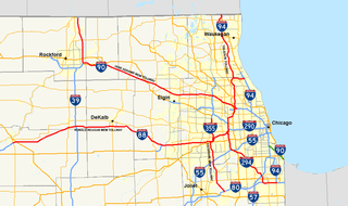
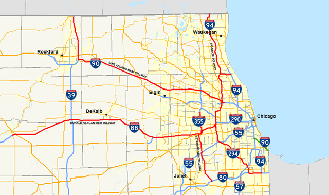
English: map of Illinois State Toll Highway Authority maintained toll roads. |
| Date | |
| Source | Own work - using Quantum GIS 0.10.0 based on data collected from the Census Bureau (borders, water, urban areas) and the Federal Highway Administration (the roads). |
| Author | User: Master son |
Licensing
[edit]
|


File history
Click on a date/time to view the file as it appeared at that time.
| Date/Time | Thumbnail | Dimensions | User | Comment | |
|---|---|---|---|---|---|
| current | 21:26, 1 February 2009 | | 960 × 569 (276 KB) | Master son (talk | contribs) | == Summary == {{Information |Description={{en|1=map of w:Illinois State Toll Highway Authority maintained toll roads.}} |Source=Own work - using Quantum GIS 0.10.0 based on data collected from [http://www.census.gov/geo/www/cob/co2000.html the Cen |
You cannot overwrite this file.
File usage on Commons
There are no pages that use this file.
File usage on other wikis
The following other wikis use this file:
- Usage on en.wikipedia.org