File:ITV network microregions in Scotland map 2015.svg
Jump to navigation
Jump to search

Size of this PNG preview of this SVG file: 368 × 599 pixels. Other resolutions: 147 × 240 pixels | 295 × 480 pixels | 472 × 768 pixels | 629 × 1,024 pixels | 1,258 × 2,048 pixels | 486 × 791 pixels.
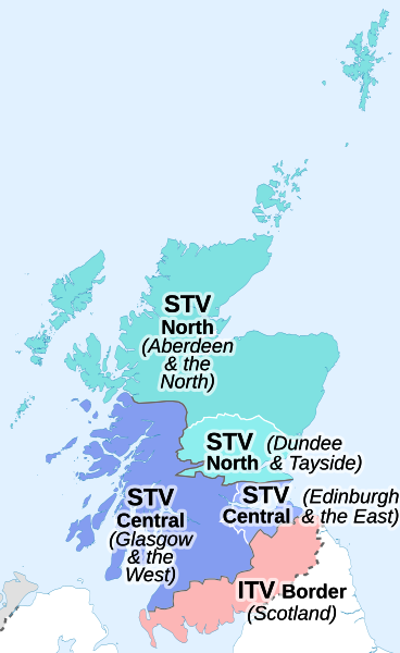
Original file (SVG file, nominally 486 × 791 pixels, file size: 255 KB)
Captions
Captions
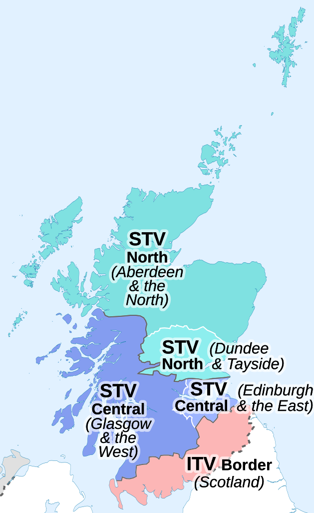
Map of the ITV network microregions in Scotland in 2015
Summary[edit]
| Description | |
| Date | |
| Source |
This file was derived from: ITV microregions map 2015.svg:  |
| Author |
|
References[edit]
- News & Current Affairs. STV Player. Retrieved on 2 March 2022. (names of STV sub-regions)
Licensing[edit]
This file is licensed under the Creative Commons Attribution-Share Alike 4.0 International license.
Attribution: Dr Greg and NordNordWest
- You are free:
- to share – to copy, distribute and transmit the work
- to remix – to adapt the work
- Under the following conditions:
- attribution – You must give appropriate credit, provide a link to the license, and indicate if changes were made. You may do so in any reasonable manner, but not in any way that suggests the licensor endorses you or your use.
- share alike – If you remix, transform, or build upon the material, you must distribute your contributions under the same or compatible license as the original.
File history
Click on a date/time to view the file as it appeared at that time.
| Date/Time | Thumbnail | Dimensions | User | Comment | |
|---|---|---|---|---|---|
| current | 19:04, 5 March 2022 | | 486 × 791 (255 KB) | Dr Greg (talk | contribs) | Uploaded a work by *ITV microregions map 2015.svg: Dr Greg and NordNordWest, created using using United States National Imagery and Mapping Agency data *derivative work: Dr Greg from {{Derived from|ITV microregions map 2015.svg|display=50}} with UploadWizard |
You cannot overwrite this file.
File usage on Commons
The following page uses this file:
File usage on other wikis
The following other wikis use this file:
- Usage on en.wikipedia.org