File:Ifpo 21449 Syrie, gouvernorat de Hama, l'Oronte et la ville fortifiée de Shaizar, vue aérienne oblique.jpg
Jump to navigation
Jump to search

Size of this preview: 793 × 600 pixels. Other resolutions: 317 × 240 pixels | 635 × 480 pixels | 1,015 × 768 pixels | 1,280 × 968 pixels | 2,120 × 1,604 pixels.
Original file (2,120 × 1,604 pixels, file size: 485 KB, MIME type: image/jpeg)
Captions
Captions
Add a one-line explanation of what this file represents
| Photographer |
|
|||||||||||
| Description |
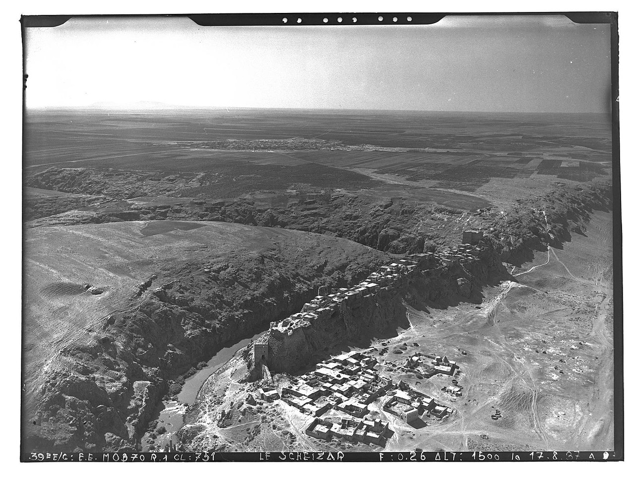
Français : Syrie, gouvernorat de Hama, l'Oronte et la ville fortifiée de Shaizar, vue aérienne oblique |
|||||||||||
| Depicted place | Shaizar | |||||||||||
| Date |
Taken on 17 August 1937 22 January 2020, 10:55:32 (upload date) |
|||||||||||
| Medium | dry plate | |||||||||||
| Dimensions | height: 18 cm (7 in); width: 24 cm (9.4 in) | |||||||||||
| Collection |
|
|||||||||||
| Accession number |
hal-02448260 Ifpo-21449 |
|||||||||||
| Object history | French army | |||||||||||
| Credit line |
Français : Institut français du Proche-Orient (Ifpo) ; ALIPH – Alliance internationale pour la protection du patrimoine dans les zones en conflit |
|||||||||||
| Source |
https://hal.archives-ouvertes.fr/hal-02448260 https://hal.archives-ouvertes.fr/hal-02448260/document |
|||||||||||
| Permission (Reusing this file) |
|
|||||||||||
| Mots-clés | Français : Fleuve,Chayzar,Šayzar,Photographie aérienne oblique,Shayzar,Shaizar,Vue aérienne,Archéologie,Oronte,Photographie aérienne,Gouvernorat de Hama,Syrie |
|||||||||||
| Camera location | | View this and other nearby images on: OpenStreetMap |
|---|
File history
Click on a date/time to view the file as it appeared at that time.
| Date/Time | Thumbnail | Dimensions | User | Comment | |
|---|---|---|---|---|---|
| current | 19:24, 18 April 2021 | | 2,120 × 1,604 (485 KB) | Don-vip (talk | contribs) | pattypan 20.04 |
You cannot overwrite this file.
File usage on Commons
The following page uses this file: