File:Ifpo 23560 Syrie du Nord, Sandjak d'Alexandrette, région de Kirikhan, Forteresse de Trapezac, face sud, vue aérienne oblique.jpg
Jump to navigation
Jump to search

Size of this preview: 800 × 564 pixels. Other resolutions: 320 × 226 pixels | 640 × 452 pixels | 1,024 × 723 pixels | 1,280 × 903 pixels | 2,048 × 1,445 pixels.
Original file (2,048 × 1,445 pixels, file size: 253 KB, MIME type: image/jpeg)
Captions
Captions
Add a one-line explanation of what this file represents
| Photographer |
|
|||||||||||
| Description |
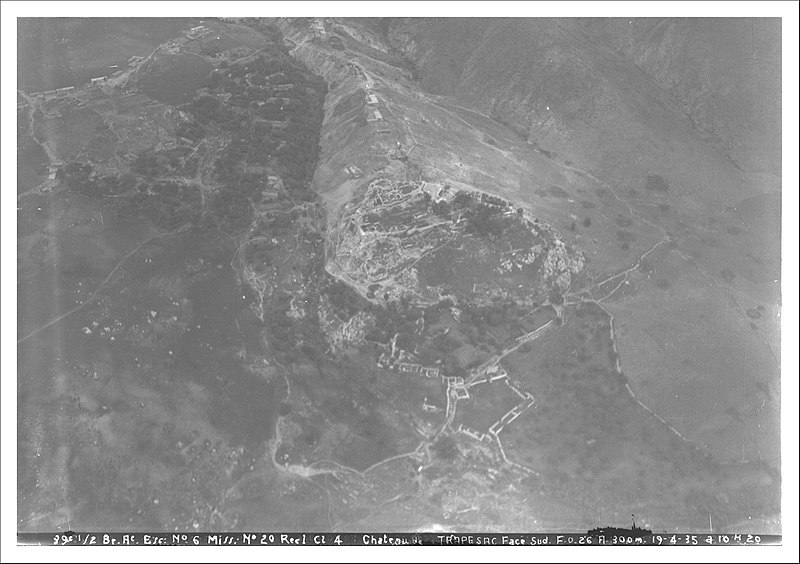
Français : Syrie du Nord, Sandjak d'Alexandrette, région de Kirikhan, Forteresse de Trapezac, face sud, vue aérienne oblique |
|||||||||||
| Depicted place | Trapessac | |||||||||||
| Date |
Taken on 19 April 1935 7 February 2020, 11:59:57 (upload date) |
|||||||||||
| Medium | dry plate | |||||||||||
| Dimensions | height: 18 cm (7 in); width: 24 cm (9.4 in) | |||||||||||
| Collection |
|
|||||||||||
| Accession number |
hal-02470456 Ifpo-23560 |
|||||||||||
| Object history | French army | |||||||||||
| Credit line |
Français : Institut français du Proche-Orient (Ifpo) ; ALIPH – Alliance internationale pour la protection du patrimoine dans les zones en conflit |
|||||||||||
| Notes |
Français : A l'époque de la prise de vue, le Sandjak d'Alexandrette se trouvait en Syrie. |
|||||||||||
| Source |
https://hal.archives-ouvertes.fr/hal-02470456 https://hal.archives-ouvertes.fr/hal-02470456/document |
|||||||||||
| Permission (Reusing this file) |
|
|||||||||||
| Mots-clés | Français : Forteresse de croisés,Archéologie,Photographie aérienne oblique,Chateau de Beyli Alaci Trapesac,Forteresse de Trapezac,Château de Terbezek,Château de Darbsak,Monts Amanus,Syrie,Sandjak d'Alexandrette,Photographie aérienne,Vue aérienne |
|||||||||||
| Camera location | | View this and other nearby images on: OpenStreetMap |
|---|
File history
Click on a date/time to view the file as it appeared at that time.
| Date/Time | Thumbnail | Dimensions | User | Comment | |
|---|---|---|---|---|---|
| current | 23:04, 18 April 2021 | | 2,048 × 1,445 (253 KB) | Don-vip (talk | contribs) | pattypan 20.04 |
You cannot overwrite this file.
File usage on Commons
The following page uses this file: