File:InSight Prelaunch (NHQ201805050009).jpg
跳至導覽
跳至搜尋

預覽大小:487 × 599 像素。 其他解析度:195 × 240 像素 | 390 × 480 像素 | 624 × 768 像素 | 833 × 1,024 像素 | 1,665 × 2,048 像素 | 3,560 × 4,378 像素。
原始檔案 (3,560 × 4,378 像素,檔案大小:2.76 MB,MIME 類型:image/jpeg)
說明
說明
添加單行說明來描述出檔案所代表的內容
摘要
[編輯]| 描述 |
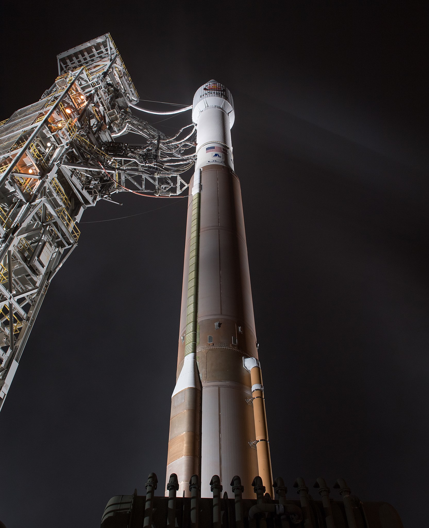
English: The United Launch Alliance (ULA) Atlas-V rocket with the NASA InSight spacecraft onboard is seen shortly after the mobile service tower was rolled back, Friday, May 4, 2018, at Vandenberg Air Force Base in California. InSight, short for Interior Exploration using Seismic Investigations, Geodesy and Heat Transport, is a Mars lander designed to study the "inner space" of Mars: its crust, mantle, and core. |
|||||||||||
| 日期 | 攝於2018年5月5日 | |||||||||||
| 來源 | https://www.flickr.com/photos/nasahqphoto/27033503387/ | |||||||||||
| 作者 |
NASA/Bill Ingalls
|
|||||||||||
.jpg)
.jpg&action=edit§ion=1)
本圖像或影音收錄於美國國家航空暨太空總署 (NASA)NASA總部,其照片編號為: NHQ201805050009 此標籤不表示文件的著作權狀態。任何文件在附有此標籤的同時還需要一個有效的著作權標籤。請參閱許可協議說明頁面以了解更多資訊。 其他語言:
|
授權條款
[編輯].jpg&action=edit§ion=2)
| This image, originally posted to Flickr, is currently not available on Flickr under the license specified on this page. However, please see {{PD-NASA}} for permission to use it under this license. |
| 本作品由NASA創作,屬於公有領域。根據NASA的版權政策:“NASA的創作除非另有聲明否則不受版權保護。”(參見:Template:PD-USGov/zh,NASA版權政策或JPL圖像使用政策) | ||
 |
警告:
|
檔案歷史
點選日期/時間以檢視該時間的檔案版本。
| 日期/時間 | 縮圖 | 尺寸 | 使用者 | 備註 | |
|---|---|---|---|---|---|
| 目前 | 2018年5月5日 (六) 13:04 | | 3,560 × 4,378(2.76 MB) | Ras67(留言 | 貢獻) | {{Information | description = {{en|1=The United Launch Alliance (ULA) Atlas-V rocket with the NASA InSight spacecraft onboard is seen shortly after the mobile service tower was rolled back, Friday, May 4, 2018, at Vandenberg Air Force Base in California. InSight, short for Interior Exploration using Seismic Investigations, Geodesy and Heat Transport, is a Mars lander designed to study the "inner space" of Mars: its crust, mantle, and core.}} | date = {{taken on|2018-05-05}} | sou... |
無法覆蓋此檔案。
檔案用途
全域檔案使用狀況
以下其他 wiki 使用了這個檔案:
- ca.wikipedia.org 的使用狀況
- en.wikipedia.org 的使用狀況
- ja.wikipedia.org 的使用狀況
- ko.wikipedia.org 的使用狀況
- pt.wikipedia.org 的使用狀況
- ro.wikipedia.org 的使用狀況
- ru.wikinews.org 的使用狀況
- vi.wikipedia.org 的使用狀況
- zh.wikipedia.org 的使用狀況
.jpg&oldid=911620131)