File:InSight rises above the fog (VAFB-20180505-PH CSH01 0001).jpg
Jump to navigation
Jump to search
Size of this preview: 800 × 450 pixels. Other resolutions: 320 × 180 pixels | 640 × 360 pixels | 1,024 × 576 pixels | 1,280 × 720 pixels | 2,560 × 1,440 pixels | 3,840 × 2,160 pixels.
Original file (3,840 × 2,160 pixels, file size: 2.41 MB, MIME type: image/jpeg)
Captions
Captions
Add a one-line explanation of what this file represents
Summary
[edit].jpg&action=edit§ion=1)
| Description |
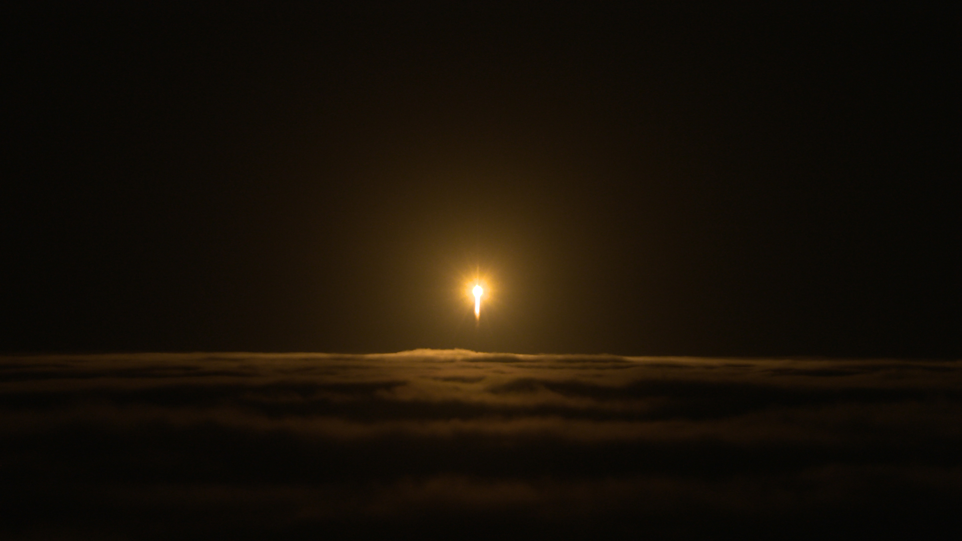
English: A United Launch Alliance Atlas V rocket lifts off from Space Launch Complex 3 at Vandenberg Air Force Base, California, carrying NASA's Interior Exploration using Seismic Investigations, Geodesy and Heat Transport, or InSight, Mars lander. Liftoff was at 4:05 a.m. PDT (7:05 a.m. EDT). The spacecraft will be the first mission to look deep beneath the Martian surface. It will study the planet's interior by measuring its heat output and listen for marsquakes. InSight will use the seismic waves generated by marsquakes to develop a map of the planet’s deep interior. The resulting insight into Mars’ formation will provide a better understanding of how other rocky planets, including Earth, were created.
Español: El cohete Atlas V despega desde la Base Vandenberg de la Fuerza Aérea de los Estados Unidos llevando a la sonda InSight hacia Marte. |
||||||||||
| Date | |||||||||||
| Source | https://www.flickr.com/photos/nasakennedy/27037119217/in/photostream/ | ||||||||||
| Author |
NASA/Cory Huston
|
||||||||||
Licensing
[edit].jpg&action=edit§ion=2)
| This file is in the public domain in the United States because it was solely created by NASA. NASA copyright policy states that "NASA material is not protected by copyright unless noted". (See Template:PD-USGov, NASA copyright policy page or JPL Image Use Policy.) | ||
 |
Warnings:
|
File history
Click on a date/time to view the file as it appeared at that time.
| Date/Time | Thumbnail | Dimensions | User | Comment | |
|---|---|---|---|---|---|
| current | 18:45, 5 May 2018 | | 3,840 × 2,160 (2.41 MB) | BugWarp (talk | contribs) | User created page with UploadWizard |
You cannot overwrite this file.
File usage on Commons
The following page uses this file:
File usage on other wikis
The following other wikis use this file:
.jpg&oldid=910713634)