File:India Karnataka COVID-19 map.svg
Jump to navigation
Jump to search

Size of this PNG preview of this SVG file: 415 × 600 pixels. Other resolutions: 166 × 240 pixels | 332 × 480 pixels | 531 × 768 pixels | 708 × 1,024 pixels | 1,417 × 2,048 pixels | 1,630 × 2,356 pixels.
Original file (SVG file, nominally 1,630 × 2,356 pixels, file size: 260 KB)
Captions
Captions
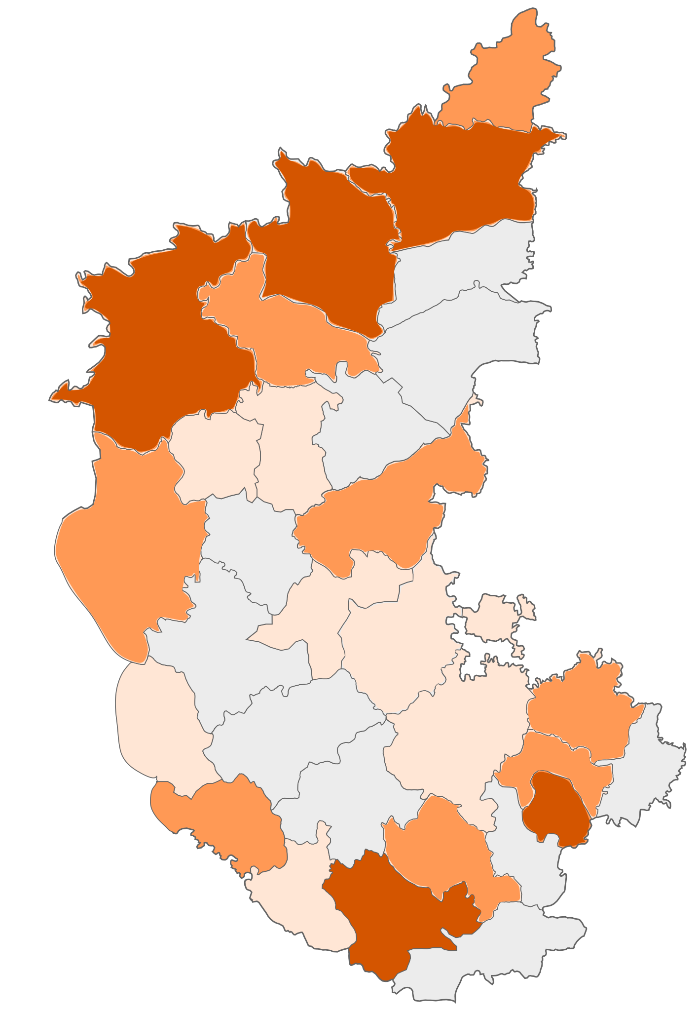
COVID 19 affected districts in Karnataka
Summary[edit]
| Description | COVID-19 affected districts in Karnataka state of India as of 7 April 2020. |
| Date | (UTC) |
| Source |
This file was derived from: |
| Author | Firos ak |


| This is a retouched picture, which means that it has been digitally altered from its original version. Modifications: marking COVID 19 district map. The original can be viewed here: India Karnataka COVID-19 map.png:
|
Licensing[edit]
This file is licensed under the Creative Commons Attribution-Share Alike 3.0 Unported license.
- You are free:
- to share – to copy, distribute and transmit the work
- to remix – to adapt the work
- Under the following conditions:
- attribution – You must give appropriate credit, provide a link to the license, and indicate if changes were made. You may do so in any reasonable manner, but not in any way that suggests the licensor endorses you or your use.
- share alike – If you remix, transform, or build upon the material, you must distribute your contributions under the same or compatible license as the original.
Original upload log[edit]
This image is a derivative work of the following images:
- File:India Karnataka location map.svg licensed with Cc-by-sa-3.0
- 2010-11-15T15:50:48Z Nayvik 1630x2356 (211689 Bytes) Changed background color
- 2010-11-15T15:34:13Z Nayvik 1630x2356 (211293 Bytes) {{Information |Description=Location map of [[:en:Karnataka|Karnataka]] Geographic limits of the map: * 18.5°N * 11.0°N * 73.6°E * 78.7°E |Source=*[[:File:Karnataka_locator_map.svg|]], [http://www.censusindia.gov.in/2011-I
- File:Karnataka locator map.svg licensed with Cc-by-sa-3.0
- 2010-11-20T10:48:54Z Nayvik 1630x2356 (240130 Bytes) Created 3 new districts [[:en:Chikballapur district|Chikballapur district]], [[:en:Ramanagara district|Ramanagara district]] and [[:en:Yadgir district|Yadgir district]]
- 2007-05-08T10:07:08Z Planemad 1630x2356 (231256 Bytes) chg color of chamarajanagar
- 2007-05-06T13:55:02Z Planemad 1630x2356 (231773 Bytes) {{WikiProject_India_Maps |Title=Karnataka locator Map |Description=Map of [[w:Karnataka]] with road and rail lines |Source= [http://aquarium.lipetsk.ru/discovery/India2004/karnataka-map.jpg Karnataka Map], [http://www.indianr
- File:India Karnataka COVID-19 map.png licensed with Cc-by-sa-3.0
- 2020-03-21T10:18:11Z Firos ak 1630x2356 (400039 Bytes) Removed Bangalore rural and added Chikballapur Dist.
- 2020-03-21T09:56:47Z Firos ak 1630x2356 (399619 Bytes) Added Bangalore rural
- 2020-03-21T08:17:25Z Firos ak 1630x2356 (397871 Bytes) Added Kodagu district
- 2020-03-17T09:22:44Z Shanze1 2608x3768 (686680 Bytes) fix
- 2020-03-17T09:17:26Z Shanze1 2379x3711 (702913 Bytes) transparency
- 2020-03-17T09:13:51Z Shanze1 1631x2357 (387099 Bytes) == {{int:filedesc}} == {{Information |Description=COVID-19 affected districts in Karnataka state of India as of 17 March 2020. |Source={{Derived from|India Karnataka location map.svg|display=50}} |Date=2020-03-17 09:10 (UTC)
Uploaded with derivativeFX
File history
Click on a date/time to view the file as it appeared at that time.
| Date/Time | Thumbnail | Dimensions | User | Comment | |
|---|---|---|---|---|---|
| current | 14:27, 23 April 2020 | | 1,630 × 2,356 (260 KB) | Prasannatb (talk | contribs) | Kalaburagi - 30+ Vijayapura - 30+ |
| 09:48, 17 April 2020 |  | 1,630 × 2,356 (255 KB) | Prasannatb (talk | contribs) | Mandya - 10+, Ballari - 10+ | |
| 13:53, 16 April 2020 |  | 1,630 × 2,356 (249 KB) | Prasannatb (talk | contribs) | Belagavi -30+ and Vijayapura - 10+ | |
| 17:11, 14 April 2020 |  | 1,630 × 2,356 (238 KB) | Prasannatb (talk | contribs) | Chitradurga - 1+ | |
| 17:03, 14 April 2020 |  | 1,630 × 2,356 (235 KB) | Prasannatb (talk | contribs) | Chikkaballapura, Bengaluru Rural, Uttara Kannada - 10+ | |
| 09:36, 14 April 2020 |  | 1,630 × 2,356 (228 KB) | Prasannatb (talk | contribs) | Bagalkote - 10+ | |
| 08:31, 12 April 2020 |  | 1,630 × 2,356 (225 KB) | Prasannatb (talk | contribs) | Vijayapura - +1 | |
| 08:47, 10 April 2020 |  | 1,630 × 2,356 (222 KB) | Prasannatb (talk | contribs) | Kalaburagi - 10+ | |
| 14:24, 9 April 2020 |  | 1,630 × 2,356 (218 KB) | Prasannatb (talk | contribs) | Belagavi - 10+ | |
| 15:28, 7 April 2020 |  | 1,630 × 2,356 (212 KB) | Firos ak (talk | contribs) | 7 apr |
You cannot overwrite this file.
File usage on Commons
The following page uses this file:
File usage on other wikis
The following other wikis use this file:
- Usage on en.wikipedia.org
- Usage on kn.wikipedia.org
- Usage on tcy.wikipedia.org
- Usage on te.wikipedia.org
- Usage on tr.wikipedia.org
- Usage on ur.wikipedia.org
- Usage on www.wikidata.org