File:Indian Railways DFC.png
Jump to navigation
Jump to search
Size of this preview: 527 × 600 pixels. Other resolutions: 211 × 240 pixels | 422 × 480 pixels | 1,000 × 1,138 pixels.
Original file (1,000 × 1,138 pixels, file size: 89 KB, MIME type: image/png)
Captions
Captions
Add a one-line explanation of what this file represents

|
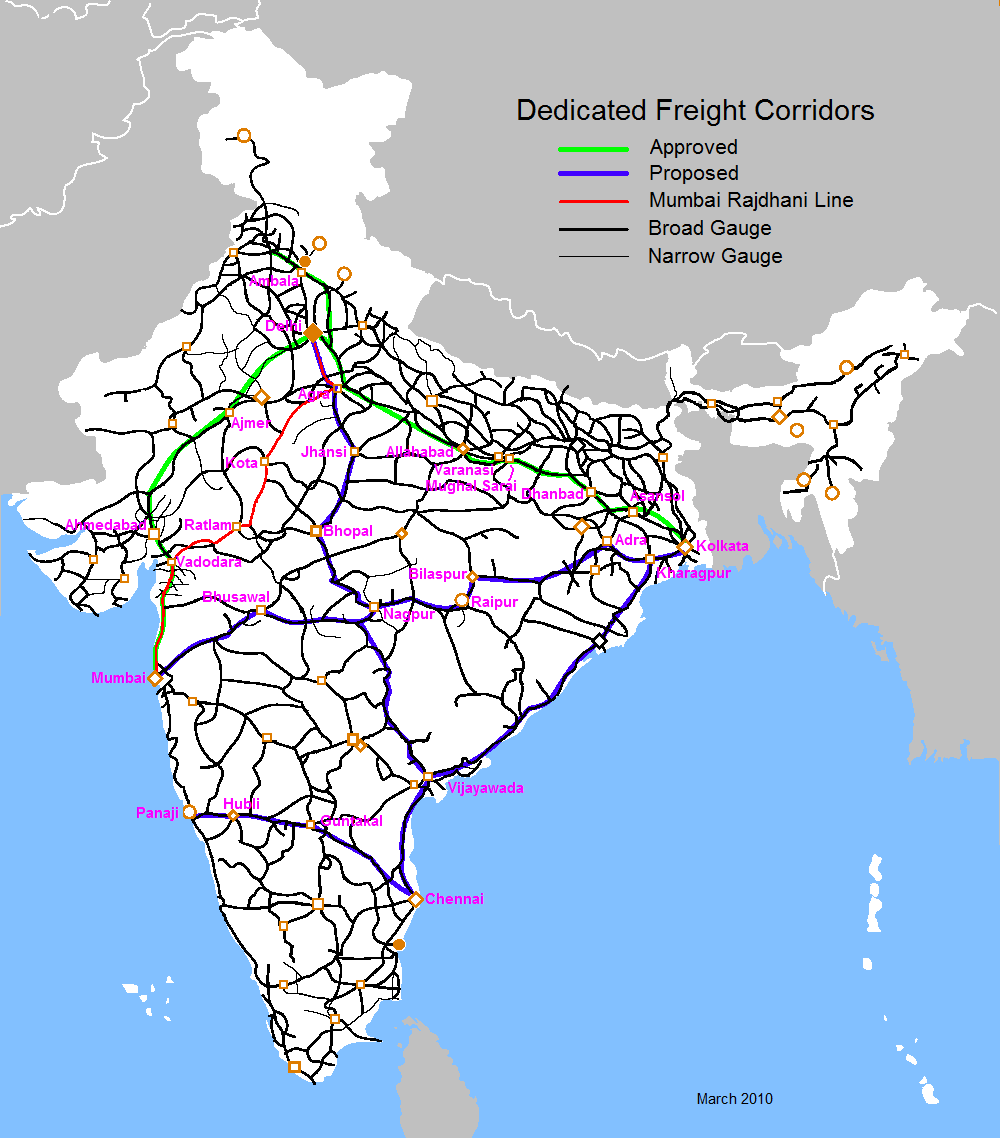
This file requires updating because: the map is outdated. There is ongoing conversion of all narrow-gauge and metre-gauge tracks to broad-gauge tracks in India, with completion expected in 2022. The map should be updated every year. In doing so, you could add a timestamp to the file.
|
| Description | Dedicated Freight Corridors |
| Date | (UTC) |
| Source | |
| Author |
|
I, the copyright holder of this work, hereby publish it under the following license:
This file is licensed under the Creative Commons Attribution-Share Alike 2.5 Generic license.
- You are free:
- to share – to copy, distribute and transmit the work
- to remix – to adapt the work
- Under the following conditions:
- attribution – You must give appropriate credit, provide a link to the license, and indicate if changes were made. You may do so in any reasonable manner, but not in any way that suggests the licensor endorses you or your use.
- share alike – If you remix, transform, or build upon the material, you must distribute your contributions under the same or compatible license as the original.
Original upload log[edit]
This image is a derivative work of the following images:
- File:Railway_network_map.png licensed with Cc-by-sa-2.5
- 2006-02-05T12:46:18Z PlaneMad 1000x1138 (132826 Bytes)
- 2006-01-15T07:02:38Z PlaneMad 1000x1138 (123346 Bytes) Railway network map of India ==Author== [[w:user:planemad]] ==Comments and Suggestions== Please leave your suggestions or errors noted in the map here. [[Category:Maps of India]] [[Category:Wikiproject Indian Maps]]
Uploaded with derivativeFX
File history
Click on a date/time to view the file as it appeared at that time.
| Date/Time | Thumbnail | Dimensions | User | Comment | |
|---|---|---|---|---|---|
| current | 01:08, 11 March 2010 | | 1,000 × 1,138 (89 KB) | Harvardton (talk | contribs) | {{Information |Description=Dedicated Freight Corridors |Source=*File:Railway_network_map.png |Date=2010-03-11 01:05 (UTC) |Author=*File:Railway_network_map.png:PlaneMad *derivative work: ~~~ |Permission=see below |other_versions= }} {{self|Cc |
| 04:52, 10 March 2010 |  | 1,000 × 1,138 (89 KB) | Harvardton (talk | contribs) | {{Information |Description=Indian Railways Dedicated Freight Corridors |Source=*File:Railway_network_map.png |Date=2010-03-10 04:45 (UTC) |Author=*User:PlaneMad *derivative work Hardvardton |Permission=see below |other_versions= }} {{self | |
| 03:13, 8 March 2010 |  | 1,002 × 1,138 (3.26 MB) | Harvardton (talk | contribs) | {{Information |Description=Dedicated Freight Corridors |Source=*File:Railway_network_map.png |Date=2010-03-08 03:05 (UTC) |Author=*User:PlaneMad *derivative work: Harvardton |Permission=see below |other_versions= }} {{self|Cc-by-sa-2.5}} == O |
You cannot overwrite this file.
File usage on Commons
There are no pages that use this file.