File:Indonesia Papua 2022 location map.svg
跳去導覽
跳去搵嘢

呢個「SVG」檔案嘅呢個「PNG」預覽嘅大細:800 × 511 像素。 第啲解像度:320 × 204 像素 | 640 × 409 像素 | 1,024 × 654 像素 | 1,280 × 817 像素 | 2,560 × 1,634 像素 | 2,832 × 1,808 像素。
原本檔案 (SVG檔案,表面大細: 2,832 × 1,808 像素,檔案大細:144 KB)
Captions
Captions
Add a one-line explanation of what this file represents
摘要
[編輯]
| 描述 |
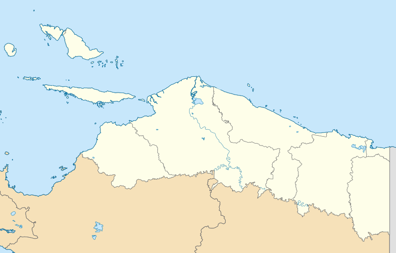
English: Location map of Papua, Indonesia
WGS84, UTM
|
| 日期 | |
| 來源 | 自己作品 |
| 作者 | Envapid |
協議
[編輯]
我,呢份作品嘅作者,決定用以下許可發佈呢件作品:
This file is licensed under the Creative Commons Attribution-Share Alike 4.0 International license.
- 你可以:
- 去分享 – 複製、發佈同傳播呢個作品
- 再改 – 創作演繹作品
- 要遵照下面嘅條件:
- 署名 – 你一定要畀合適嘅表彰、畀返指向呢個授權條款嘅連結,同埋寫明有無改過嚟。你可以用任何合理方式去做,但唔可以用任何方式暗示授權人認可咗你或者你嘅使用方式。
- 相同方式分享 – 如果你用任何方式改過呢個作品,你必須要用返原本或者相似嘅條款發佈。
檔案歷史
撳個日期/時間去睇響嗰個時間出現過嘅檔案。
| 日期/時間 | 縮圖 | 尺寸 | 用戶 | 註解 | |
|---|---|---|---|---|---|
| 現時 | 2024年1月9號 (二) 15:47 | | 2,832 × 1,808(144 KB) | Envapid(傾偈 | 貢獻) | fix2 |
| 2024年1月9號 (二) 13:51 |  | 2,832 × 1,808(144 KB) | Envapid(傾偈 | 貢獻) | Uploaded own work with UploadWizard |
你無得衾咗個檔案。
檔案用途
以下嘅5版用到呢個檔:
全域檔案使用情況
下面嘅維基都用緊呢個檔案:
- ban.wikipedia.org嘅使用情況
- en.wikipedia.org嘅使用情況
- Biak
- Yapen
- Dortheys Hiyo Eluay International Airport
- Supiori Island
- Module:Location map/data/Indonesia Papua/doc
- Numfor
- Kornasoren Airport
- Wakde Airfield
- Owi Airfield
- Tariku River
- Taritatu River
- 2010 Papua earthquake
- 1996 Biak earthquake
- Sobger River
- Waruta River
- Songgato River
- Arso Airport
- Dabra Airport
- Lake Sentani
- Module:Location map/data/Indonesia Papua
- User:Ty654/List of earthquakes exceeding magnitude 8+
- User:Ty654/List of earthquakes from 1900-1949 exceeding magnitude 7+
- User:Ty654/List of earthquakes from 1950-1999 exceeding magnitude 7+
- User:Ty654/List of earthquakes from 2000-present exceeding magnitude 7+
- User:Ty654/List of earthquakes from 1910-1919 exceeding magnitude 6+
- User:Ty654/List of earthquakes from 1920-1929 exceeding magnitude 6+
- User:Ty654/List of earthquakes from 1930-1939 exceeding magnitude 6+
- User:Ty654/List of earthquakes from 1940-1949 exceeding magnitude 6+
- User:Ty654/List of earthquakes from 1950-1954 exceeding magnitude 6+
- User:Ty654/List of earthquakes from 1955-1959 exceeding magnitude 6+
- User:Ty654/List of earthquakes from 1960-1964 exceeding magnitude 6+
- User:Ty654/List of earthquakes from 1965-1969 exceeding magnitude 6+
- User:Ty654/List of earthquakes from 1970-1974 exceeding magnitude 6+
- User:Ty654/List of earthquakes from 1975-1979 exceeding magnitude 6+
- User:Ty654/List of earthquakes from 1980-1984 exceeding magnitude 6+
- User:Ty654/List of earthquakes from 1985-1989 exceeding magnitude 6+
- User:Ty654/List of earthquakes from 1990-1994 exceeding magnitude 6+
- User:Ty654/List of earthquakes from 1995-1999 exceeding magnitude 6+
- User:Ty654/List of earthquakes from 2000-2004 exceeding magnitude 6+
- User:Ty654/List of earthquakes from 2005-2009 exceeding magnitude 6+
- User:Ty654/List of earthquakes from 2010-2014 exceeding magnitude 6+
- User:Ty654/List of earthquakes from 2015-2019 exceeding magnitude 6+
- 2019 Jayapura flood and landslide
- Sentani Kota, Sentani, Jayapura
- Pauwasi River
睇呢個檔案嘅更多全域使用情況。