File:Inspektorat Graniczny nr 2 Przasnysz.png
Jump to navigation
Jump to search
Size of this preview: 800 × 448 pixels. Other resolutions: 320 × 179 pixels | 640 × 358 pixels | 915 × 512 pixels.
Original file (915 × 512 pixels, file size: 1.13 MB, MIME type: image/png)
Captions
Captions
Add a one-line explanation of what this file represents
Summary[edit]
| Description |
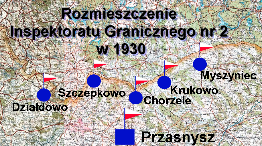
Polski: Rozmieszczenie inspektoratu Granicznego nr 2 Przasnysz w 1930 roku |
|||||
| Date | ||||||
| Source |
Baza mapy: Wojskowy Instytut Geograficzny, arkusz 45 - rok wydania 1932 i arkusz 44 - rok wydania 1933, skala 1:300 000,
|
|||||
| Author | Baza mapy: WIG, arkusz 45 - rok wydania 1932 i arkusz 44 - rok wydania 1933, Mapa ze znakami taktycznymi -Kerim44 |
File history
Click on a date/time to view the file as it appeared at that time.
| Date/Time | Thumbnail | Dimensions | User | Comment | |
|---|---|---|---|---|---|
| current | 16:45, 21 December 2017 | | 915 × 512 (1.13 MB) | Kerim44 (talk | contribs) | {{Information |Description ={{pl|1=IG nr 2 Przasnysz}} |Source ={{own}} |Author =Kerim44 |Date = |Permission = |other_versions = }} |
You cannot overwrite this file.
File usage on Commons
There are no pages that use this file.
File usage on other wikis
The following other wikis use this file:
- Usage on pl.wikipedia.org
- Inspektorat Graniczny nr 2
- Komisariat Straży Granicznej „Myszyniec”
- Komisariat Straży Granicznej „Chorzele”
- Komisariat Straży Granicznej „Szczepkowo Borowe”
- Komisariat Straży Granicznej „Działdowo”
- Komisariat Straży Granicznej „Zaręby”
- Dyslokacja Straży Granicznej 1 lutego 1930 roku
- Garnizon Przasnysz