File:Interstate 4 contraflow crossover at Interstate 75.jpg
Jump to navigation
Jump to search
Size of this preview: 800 × 549 pixels. Other resolutions: 320 × 220 pixels | 640 × 440 pixels | 1,024 × 703 pixels | 1,296 × 890 pixels.
Original file (1,296 × 890 pixels, file size: 214 KB, MIME type: image/jpeg)
Captions
Captions
Add a one-line explanation of what this file represents
Summary[edit]
| Description |
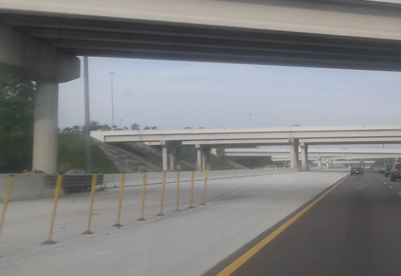
English: The western crossover location for the contraflow plan for Interstate 4, viewed from eastbound I-4. The metal crash attenuator beneath the left bridge pier is the end of the permanent, concrete traffic barrier which separates eastbound and westbound I-4 traffic. Although difficult to discern, the concrete wall between the metal attenuator and the next bridge (southbound Interstate 75) is composed of modular Jersey barriers. When the contraflow plan is enacted, the Jersey barriers are quickly removed to allow some eastbound traffic to transfer to the westbound lanes. Contraflow can be enacted in the event of the need to evacuate the Tampa Bay Area if a significant hurricane threatens the region. |
| Date | |
| Source | Own work |
| Author | AHeneen |
| Camera location | | View this and other nearby images on: OpenStreetMap |
|---|
Licensing[edit]
I, the copyright holder of this work, hereby publish it under the following license:
This file is licensed under the Creative Commons Attribution 4.0 International license.
- You are free:
- to share – to copy, distribute and transmit the work
- to remix – to adapt the work
- Under the following conditions:
- attribution – You must give appropriate credit, provide a link to the license, and indicate if changes were made. You may do so in any reasonable manner, but not in any way that suggests the licensor endorses you or your use.
File history
Click on a date/time to view the file as it appeared at that time.
| Date/Time | Thumbnail | Dimensions | User | Comment | |
|---|---|---|---|---|---|
| current | 08:43, 19 April 2015 | | 1,296 × 890 (214 KB) | AHeneen (talk | contribs) | User created page with UploadWizard |
You cannot overwrite this file.
File usage on Commons
The following page uses this file: