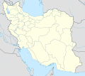
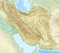
File:Iran location map.svg
出自Wikimedia Commons
跳至導覽
跳至搜尋

此 SVG 檔案的 PNG 預覽的大小:672 × 600 像素。 其他解析度:269 × 240 像素 | 538 × 480 像素 | 861 × 768 像素 | 1,147 × 1,024 像素 | 2,295 × 2,048 像素 | 1,200 × 1,071 像素。
原始檔案 (SVG 檔案,表面大小:1,200 × 1,071 像素,檔案大小:299 KB)
檔案資訊
結構化資料
說明
說明
添加單行說明來描述出檔案所代表的內容
Iran location map
نقشە تقسیمات استانی ایران که دارای ۳۱استان است.کرمان،فارس،سیستان و بلوچستان،اصفهان،چهارمحال و بختیاری،کهگیلویه و بویراحمد،خراسان جنوبی شمالی و رضوی،گلستان،مازندران،قم،مرکزی،کردستان،لرستان،آذربایجان غربی و شرقی، و یزد از جمله استان های ایران هستند.
عکس ناغان
İran haritası
이란에 위치 지도
İran xəritəsi
nexşeya Îranê
شہر کا گاؤں
لشت نيشا
گوندی مام سێوەدین
摘要
| 描述Iran location map.svg |
English: Location map of Iran.
Equirectangular projection. Stretched by 118.0%. Geographic limits of the map: * N: 40.0° N * S: 24.5° N * W: 43.5° E * E: 64.0° EMade with Natural Earth. Free vector and raster map data @ naturalearthdata.com. |
| 日期 | |
| 來源 | 自己的作品 |
| 作者 | Uwe Dedering |
| 其他版本 |
此檔案衍生的作品:
|
| SVG開發 InfoField |
授權條款
我,本作品的著作權持有者,決定用以下授權條款發佈本作品:
此檔案採用創用CC 姓名標示-相同方式分享 3.0 未在地化版本授權條款。
- 您可以自由:
- 分享 – 複製、發佈和傳播本作品
- 重新修改 – 創作演繹作品
- 惟需遵照下列條件:
- 姓名標示 – 您必須指名出正確的製作者,和提供授權條款的連結,以及表示是否有對內容上做出變更。您可以用任何合理的方式來行動,但不得以任何方式表明授權條款是對您許可或是由您所使用。
- 相同方式分享 – 如果您利用本素材進行再混合、轉換或創作,您必須基於如同原先的相同或兼容的條款,來分布您的貢獻成品。

|
已授權您依據自由軟體基金會發行的無固定段落、封面文字和封底文字GNU自由文件授權條款1.2版或任意後續版本,對本檔進行複製、傳播和/或修改。該協議的副本列在GNU自由文件授權條款中。http://www.gnu.org/copyleft/fdl.htmlGFDLGNU Free Documentation Licensetruetrue |
您可以選擇您需要的授權條款。
檔案歷史
點選日期/時間以檢視該時間的檔案版本。
| 日期/時間 | 縮圖 | 尺寸 | 使用者 | 備註 | |
|---|---|---|---|---|---|
| 目前 | 2013年10月22日 (二) 07:59 |  | 1,200 × 1,071(299 KB) | NordNordWest(留言 | 貢獻) | Reverted to version as of 17:55, 15 April 2013; no reason for change given |
| 2013年10月21日 (一) 13:44 |  | 1,200 × 1,071(640 KB) | Ekivalan(留言 | 貢獻) | Reverted to version as of 17:38, 12 April 2013 | |
| 2013年10月21日 (一) 13:43 |  | 1,200 × 1,071(640 KB) | Ekivalan(留言 | 貢獻) | Reverted to version as of 17:38, 12 April 2013 | |
| 2013年4月15日 (一) 17:55 |  | 1,200 × 1,071(299 KB) | NordNordWest(留言 | 貢獻) | according to http://images.persianblog.ir/516041_B0b76ypr.jpg + Tabas -> South Khorasan province | |
| 2013年4月12日 (五) 17:40 |  | 1,200 × 1,071(640 KB) | Yamaha5(留言 | 貢獻) | Reverted to version as of 20:08, 11 July 2010 | |
| 2013年4月12日 (五) 17:38 |  | 1,200 × 1,071(640 KB) | Yamaha5(留言 | 貢獻) | Reverted to version as of 20:08, 11 July 2010 in all maps khorasan is like past! | |
| 2013年3月17日 (日) 11:30 |  | 1,200 × 1,071(294 KB) | NordNordWest(留言 | 貢獻) | upd | |
| 2010年7月11日 (日) 20:08 |  | 1,200 × 1,071(640 KB) | Uwe Dedering(留言 | 貢獻) | 31. province Alborz | |
| 2010年2月18日 (四) 17:44 |  | 1,200 × 1,071(705 KB) | Uwe Dedering(留言 | 貢獻) | Bahrain above water, no disputed countries | |
| 2010年2月18日 (四) 13:00 |  | 1,200 × 1,071(709 KB) | Uwe Dedering(留言 | 貢獻) | {{Information |Description={{en|1=Location map of Iran. Equirectangular projection. Strechted by 118.0%. Geographic limits of the map: * N: 40.0° N * S: 24.5° N * W: 43.5° E * E: 64.0° E Made with Natural Earth. Free vector and raster map data @ |
無法覆蓋此檔案。
檔案用途
下列47個頁面有用到此檔案:
- ایران
- User:SpinnerLaserz/Flags/Flags of the United States/Iran
- User:SpinnerLaserzthe2nd/Flags/Flags of Iran/Iran
- File:2024 Iranian Assembly of Experts election seats per province.svg
- File:2024 Iranian legislative election seats per province.svg
- File:Alborz in Iran.svg
- File:Ardabil in Iran.svg
- File:Bushehr in Iran.svg
- File:Chahar Mahaal and Bakhtiari in Iran.svg
- File:Climate maps of Iran (Köppen-Geiger).png
- File:East Azerbaijan in Iran.svg
- File:Elam regio.PNG
- File:Fars in Iran.svg
- File:Gilan in Iran.svg
- File:Golestan in Iran.svg
- File:Hamadan in Iran.svg
- File:Hormozgan in Iran.svg
- File:Ilam in Iran.svg
- File:IranWestAzerbaijan-SVG.svg
- File:Iran antique sites.PNG
- File:Iran location map.svg.png (檔案重新導向)
- File:Iran location map in farsi 1.jpg
- File:Iran relief location light map.jpg
- File:Iran relief location map.jpg
- File:Isfahan in Iran.svg
- File:Kerman in Iran.svg
- File:Kermanshah in Iran.svg
- File:Khurasan division.svg
- File:Khuzestan in Iran.svg
- File:Kohgiluyeh and Boyer-Ahmad in Iran.svg
- File:Kurdistan in Iran.svg
- File:Locator map Iran Alborz Province.png
- File:Lorestan in Iran.svg
- File:Markazi in Iran.svg
- File:Mazandaran in Iran.svg
- File:North Khorasan in Iran.svg
- File:Qazvin in Iran.svg
- File:Qom in Iran.svg
- File:Razavi Khorasan in Iran.svg
- File:Semnan in Iran.svg
- File:Sistan and Baluchistan in Iran.svg
- File:South Khorasan in Iran.svg
- File:Tehran in Iran.svg
- File:West Azerbaijan in Iran.svg
- File:Yazd in Iran.svg
- File:Zanjan in Iran.svg
- Category:Iran
全域檔案使用狀況
以下其他 wiki 使用了這個檔案:
- af.wikipedia.org 的使用狀況
- als.wikipedia.org 的使用狀況
- an.wikipedia.org 的使用狀況
- ar.wikipedia.org 的使用狀況
- محمد بن إسماعيل البخاري
- طهران
- صحيح مسلم
- محافظات إيران
- فخر الدين الرازي
- كأس آسيا 1968
- كأس آسيا 1976
- مسلم بن الحجاج
- قالب:خريطة مواقع إیران
- مشهد
- زلزال بم 2003
- تفجيرات زاهدان 2010
- زلزال طبس 1978
- بطولة آسيا للناشئين تحت 16 عاما 2012
- قائمة المفكرين المسيحيين في العلم
- مرتضى الأنصاري
- زلزال تبريز 2012
- زلزال بوشهر 2013
檢視此檔案的更多全域使用狀況。
詮釋資料
此檔案中包含其他資訊,這些資訊可能是由數位相機或掃描器在建立或數位化過程中所新增的。若檔案自原始狀態已被修改,一些詳細資料可能無法完整反映出已修改的檔案。
| 寬度 | 1200px |
|---|---|
| 高度 | 1070.635px |
