File:Irwin Brush Creek Salem United Church of Christ, Hempfield Township, Westmoreland County, Pennsylvania - 20210227.jpg
Jump to navigation
Jump to search

Size of this preview: 800 × 600 pixels. Other resolutions: 320 × 240 pixels | 640 × 480 pixels | 1,024 × 768 pixels | 1,280 × 960 pixels | 2,560 × 1,920 pixels | 4,032 × 3,024 pixels.
Original file (4,032 × 3,024 pixels, file size: 4.72 MB, MIME type: image/jpeg)
Captions
Captions
Add a one-line explanation of what this file represents
Summary
[edit]
| Description |
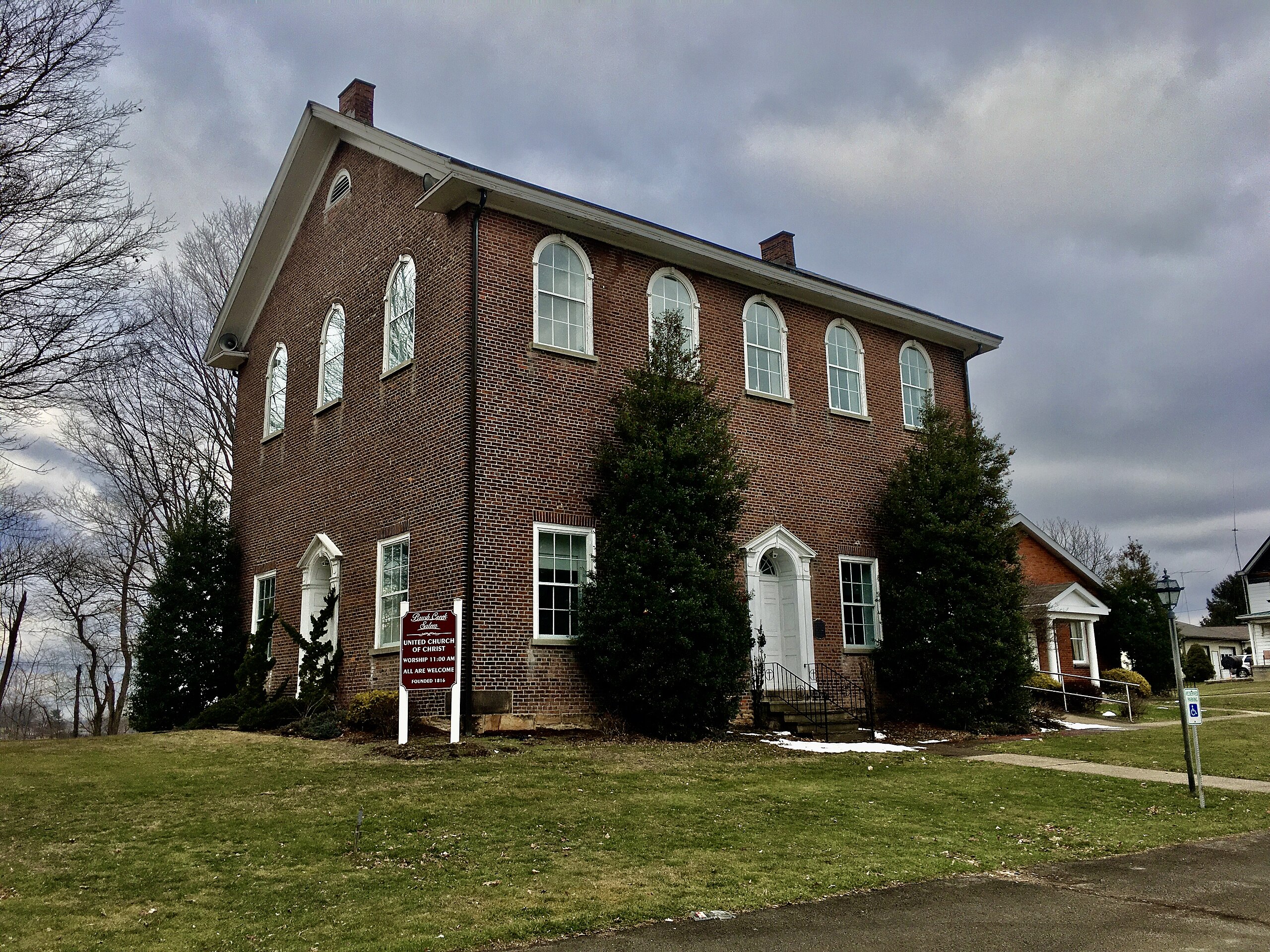
English: Irwin Brush Creek Salem United Church of Christ, 113 Altar Lane, Hempfield Township, Westmoreland County, Pennsylvania, February 2021. Added to the National Register of Historic Places in 1987, this two-story, side-gabled structure was built from 1816 through 1820 and, save for an annex added in 1958 to the north side of the building (seen at right in this photo) retains the integrity of its original design almost perfectly. Its simple architecture, an iteration of the Federal style that draws heavy influence from the design of contemporaneous Anglican church buildings in Virginia, is characterized by a strict bilateral symmetry both of the five-bay main façade and the three-bay south-facing lateral elevation. These are both centered on identical entrances whose Classical characteristics consist of double doors crowned by fanlights and framed in turn by pairs of engaged Doric pilasters, elegant keystone-adorned round arches, and denticulated broken pediments. Said arches are echoed by those the crown the second-floor windows, which in turn present a contrast with the square-headed widows on the ground floor. The interior contains a Victorian Gothic organ in a walnut case dating back to 1870, as well as high-quality original woodwork that's rarely seen in churches of similar vintage in the region. The church was founded about 1773 and originally worshiped in a log church on the same site that was lost to fire; it took the name Salem, a Hebrew word translating to "peace", due to the fact that it was shared by two separate congregations of different denominations, one German Reformed and one Lutheran, the latter of which moved to their own building in 1836 and the former, which now after multiple denominational mergers over the years is affiliated with the United Church of Christ, still occupy the building. |
| Date | Taken on 27 February 2021, 15:02:47 |
| Source | Own work |
| Author | Andre Carrotflower |
| Camera location | | View this and other nearby images on: OpenStreetMap |
|---|
Licensing
[edit]
I, the copyright holder of this work, hereby publish it under the following license:
This file is licensed under the Creative Commons Attribution-Share Alike 4.0 International license.
- You are free:
- to share – to copy, distribute and transmit the work
- to remix – to adapt the work
- Under the following conditions:
- attribution – You must give appropriate credit, provide a link to the license, and indicate if changes were made. You may do so in any reasonable manner, but not in any way that suggests the licensor endorses you or your use.
- share alike – If you remix, transform, or build upon the material, you must distribute your contributions under the same or compatible license as the original.
File history
Click on a date/time to view the file as it appeared at that time.
| Date/Time | Thumbnail | Dimensions | User | Comment | |
|---|---|---|---|---|---|
| current | 05:19, 30 April 2021 | | 4,032 × 3,024 (4.72 MB) | Andre Carrotflower (talk | contribs) | Uploaded own work with UploadWizard |
You cannot overwrite this file.
File usage on Commons
The following page uses this file: