File:Israel location map with stripes.svg
跳至導覽
跳至搜尋

此 SVG 檔案的 PNG 預覽的大小:322 × 598 像素。 其他解析度:129 × 240 像素 | 258 × 480 像素 | 413 × 768 像素 | 551 × 1,024 像素 | 1,102 × 2,048 像素 | 614 × 1,141 像素。
原始檔案 (SVG 檔案,表面大小:614 × 1,141 像素,檔案大小:170 KB)
說明
說明
添加單行說明來描述出檔案所代表的內容
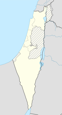
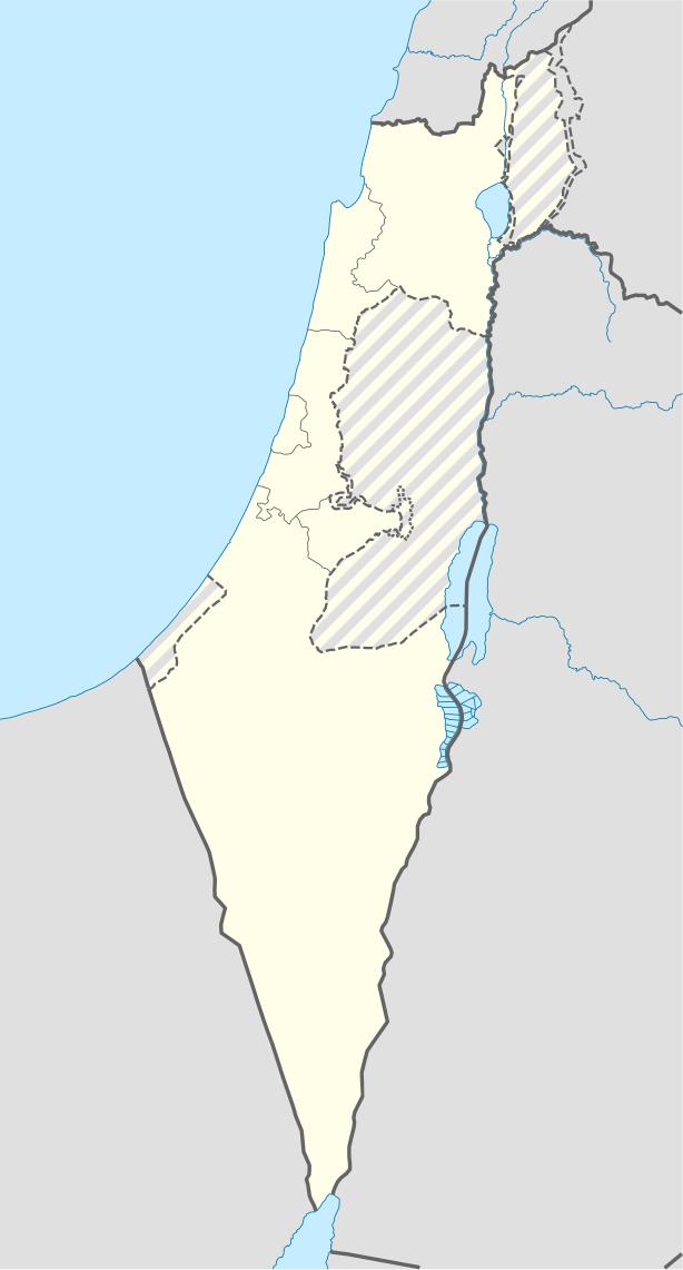
| 描述 | Location map of Israel, with the Israeli-occupied Palestinian territories of the West Bank and the Gaza Strip and the Israeli Golan Heights grey stripes. | ||
| 日期 | |||
| 來源 | 我個人以下列物件為基礎來創作: Israel location map.svg 由 NordNordWest | ||
| 作者 | Jackmcbarn | ||
| 授權許可 (重用此檔案) |
我,本作品的著作權持有者,決定用以下授權條款發佈本作品:
此檔案採用共享創意 姓名標示-相同方式分享 3.0 未在地化版本授權條款。
您可以選擇您需要的授權條款。 |
||
| SVG開發 | 本向量圖形使用Other tools創作。 |

檔案歷史
點選日期/時間以檢視該時間的檔案版本。
| 日期/時間 | 縮圖 | 尺寸 | 用戶 | 備註 | |
|---|---|---|---|---|---|
| 目前 | 2018年6月16日 (六) 14:43 | | 614 × 1,141(170 KB) | Jdx(對話 | 貢獻) | Reverted to version as of 10:35, 16 June 2018 (UTC) |
| 2018年6月16日 (六) 14:04 |  | 504 × 936(170 KB) | Beebbeebe(對話 | 貢獻) | Reverted to version as of 00:40, 16 June 2018 (UTC) don't revert without stating a reason | |
| 2018年6月16日 (六) 10:35 |  | 614 × 1,141(170 KB) | Denniss(對話 | 貢獻) | Reverted to version as of 04:28, 21 May 2018 (UTC) | |
| 2018年6月16日 (六) 00:40 |  | 504 × 936(170 KB) | Beebbeebe(對話 | 貢獻) | Reverted to version as of 19:23, 14 May 2018 (UTC) The current map is simply incorrect. And I don't want to upload a new one, I'll have to edit more than a hundred wiki-articles. | |
| 2018年5月21日 (一) 04:28 |  | 614 × 1,141(170 KB) | Nableezy(對話 | 貢獻) | Reverted to version as of 19:08, 18 September 2016 (UTC) actually go back to standard no green or blue lines | |
| 2018年5月15日 (二) 18:23 |  | 614 × 1,141(174 KB) | Nableezy(對話 | 貢獻) | Reverted to version as of 03:49, 14 May 2018 (UTC) | |
| 2018年5月14日 (一) 19:23 |  | 504 × 936(170 KB) | Eric's son(對話 | 貢獻) | Reverted to version as of 13:42, 24 March 2018 (UTC) | |
| 2018年5月14日 (一) 03:49 |  | 614 × 1,141(174 KB) | Nableezy(對話 | 貢獻) | Reverted to version as of 06:09, 11 March 2018 (UTC) restore golan as occupied territory | |
| 2018年3月24日 (六) 13:42 |  | 504 × 936(170 KB) | Eric's son(對話 | 貢獻) | Correcting color for border with Jordan | |
| 2018年3月24日 (六) 13:26 |  | 504 × 936(170 KB) | Eric's son(對話 | 貢獻) | Fixed correct colors with vector |
無法覆蓋此檔案。
檔案用途
下列17個頁面有用到此檔案:
- User:Geagea/Israel/2016 September 19
- User:Geagea/Israel/2018 January 21
- User:Geagea/Israel/2018 January 28
- User:Geagea/Israel/2018 January 29
- User:Geagea/Israel/2018 June 16
- User:Geagea/Israel/2018 March 10
- User:Geagea/Israel/2018 March 11
- User:Geagea/Israel/2018 March 2
- User:Geagea/Israel/2018 March 24
- User:Geagea/Israel/2018 March 5
- User:Geagea/Israel/2018 May 14
- User:Geagea/Israel/2018 May 15
- User:Geagea/Israel/2018 May 21
- File:Neutral Israel location map.svg (檔案重新導向)
- Category:Belvoir Fortress
- Category:Ein Afek
- Category:Views from Belvoir Fortress
全域檔案使用狀況
以下其他 wiki 使用了這個檔案:
- af.wikipedia.org 的使用狀況
- Rehovot
- Nasaret
- Eilat
- Dimona
- Ramla
- Safed
- Tiberias
- Lod
- Ben Gurion Internasionale Lughawe
- Hadera
- Gedera
- Givatayim
- Be'er Sheva
- Rishon LeZion
- Petah Tikva
- Ashdod
- Netanya
- Binyamina-Giv'at Ada
- Bnei Brak
- Holon
- Ramat Gan
- Ashkelon
- Bat Yam
- Beit Shemesh
- Kfar Saba
- Herzliya
- Modi'in-Maccabim-Re'ut
- Ra'anana
- Ramon-lughawe
- an.wikipedia.org 的使用狀況
- ar.wikipedia.org 的使用狀況
- القوات الجوية الإسرائيلية
- قلعة كوكب الهوا
- قالب:Location map Israel Golan
- قالب:Location map Israel ashkelon
- قالب:Location map Israel binyamin
- قالب:Location map Israel center ta
- قالب:Location map Israel haifa
- قالب:Location map Israel jezreel
- قالب:Location map Israel negev mt
- قالب:Location map Israel north haifa
- قالب:Location map Israel north negev
- قالب:Location map Israel northeast
- قالب:Location map Israel northwest
- قالب:Location map Israel northwest negev
- قالب:Location map Israel shomron
- قالب:Location map Israel south wb
- ثقافة كبارية
- مغارة كبارة
檢視此檔案的更多全域使用狀況。