File:Izilda 25 March 2009 at 0715 UTC.jpg
跳至導覽
跳至搜尋

預覽大小:466 × 599 像素。 其他解析度:187 × 240 像素 | 373 × 480 像素 | 597 × 768 像素 | 796 × 1,024 像素 | 1,593 × 2,048 像素 | 5,600 × 7,200 像素。
原始檔案 (5,600 × 7,200 像素,檔案大小:8.73 MB,MIME 類型:image/jpeg)
說明
說明
添加單行說明來描述出檔案所代表的內容
摘要
[編輯]
| 描述 |
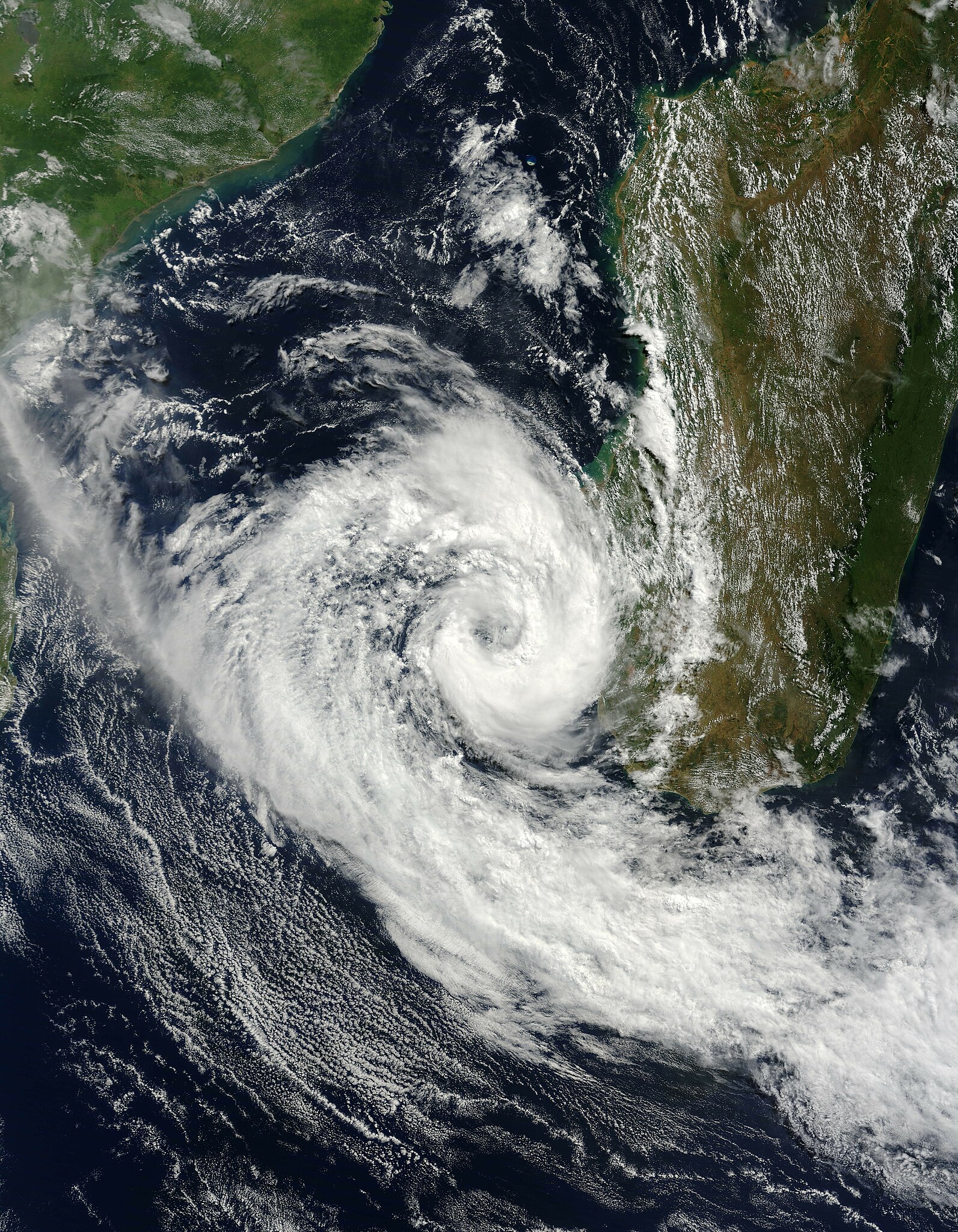
English: Cyclone Izilda was near its peak strength when the Moderate Resolution Imaging Spectroradiometer (MODIS) on NASA’s Terra satellite captured this image on March 25, 2009. As far as cyclones go, the comma-shaped storm was weak, with winds estimated at 65 kilometers per hour (40 miles per hour or 35 knots). The Joint Typhoon Warning Center forecast that the storm would weaken as it moved south through the Mozambique Channel. It was not forecast to go ashore.
Most of the clouds in this photo-like image are concentrated in Cyclone Izilda, leaving a relatively clear view of southern Madagascar. A line of dark green mountains runs up the eastern side of the island. To the east, the land is lush and green. Inland, to the west of the mountains, the land is drier and brown. |
| 日期 | |
| 來源 | http://earthobservatory.nasa.gov/NaturalHazards/view.php?id=37645 |
| 作者 | NASA |
授權條款
[編輯]
| 本作品由NASA創作,屬於公有領域。根據NASA的版權政策:“NASA的創作除非另有聲明否則不受版權保護。”(參見:Template:PD-USGov/zh,NASA版權政策或JPL圖像使用政策) | ||
 |
警告:
|
檔案歷史
點選日期/時間以檢視該時間的檔案版本。
| 日期/時間 | 縮圖 | 尺寸 | 使用者 | 備註 | |
|---|---|---|---|---|---|
| 目前 | 2009年3月26日 (四) 23:42 | | 5,600 × 7,200(8.73 MB) | Potapych(留言 | 貢獻) | That version is off center and clips off the storm |
| 2009年3月26日 (四) 22:08 |  | 3,843 × 4,057(3.97 MB) | HurricaneSpin(留言 | 貢獻) | Cropped | |
| 2009年3月26日 (四) 13:24 |  | 5,600 × 7,200(8.73 MB) | Potapych(留言 | 貢獻) | NASA images never work... | |
| 2009年3月26日 (四) 13:20 |  | 5,600 × 7,200(5.14 MB) | Potapych(留言 | 貢獻) | {{Information |Description={{en|1=Cyclone Izilda was near its peak strength when the Moderate Resolution Imaging Spectroradiometer (MODIS) on NASA’s Terra satellite captured this image on March 25, 2009. As far as cyclones go, the comma-shaped storm was |
無法覆蓋此檔案。
檔案用途
沒有使用此檔案的頁面。
全域檔案使用狀況
以下其他 wiki 使用了這個檔案:
- de.wikipedia.org 的使用狀況
- en.wikipedia.org 的使用狀況
- es.wikipedia.org 的使用狀況
- pt.wikipedia.org 的使用狀況
- zh.wikipedia.org 的使用狀況