File:JMA TD 06 2012 track.png
(Redirected from File:JMA TD5 2012 track.png)

Size of this preview: 800 × 495 pixels. Other resolutions: 320 × 198 pixels | 640 × 396 pixels | 1,024 × 633 pixels | 1,280 × 791 pixels | 2,700 × 1,669 pixels.
Original file (2,700 × 1,669 pixels, file size: 1.91 MB, MIME type: image/png)
Captions
Captions
Add a one-line explanation of what this file represents
Summary
[edit]
Summary
| Description |
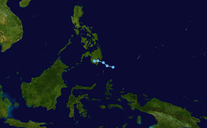
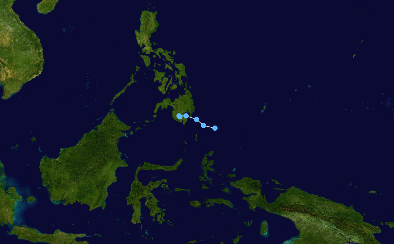
English: Track map of JMA Topical Depression Six of the 2012 Pacific typhoon season. The points show the location of the storm at 6-hour intervals. The colour represents the storm's maximum sustained wind speeds as classified in the (see below), and the shape of the data points represent the nature of the storm, according to the legend below. Tropical depression (≤38 mph, ≤62 km/h)
Tropical storm (39–73 mph, 63–118 km/h)
Category 1 (74–95 mph, 119–153 km/h)
Category 2 (96–110 mph, 154–177 km/h)
Category 3 (111–129 mph, 178–208 km/h)
Category 4 (130–156 mph, 209–251 km/h)
Category 5 (≥157 mph, ≥252 km/h)
Unknown
Storm type |
||
| Date | 2012-04-28–2012-04-30 | ||
| Source | Created by Keith Edkins using Wikipedia:WikiProject Tropical cyclones/Tracks. The background image is from NASA. Tracking data is from the Japan Meteorological Agency[1]. | ||
| Author | Keith Edkins | ||
| Source code | Track map data table, if present below, is in HURDAT2 or ATCF format. See format details in [2] and [3], respectively.
|
Licensing
[edit]| This work has been released into the public domain by its author, Keith Edkins. This applies worldwide. In some countries this may not be legally possible; if so: Keith Edkins grants anyone the right to use this work for any purpose, without any conditions, unless such conditions are required by law. |
File history
Click on a date/time to view the file as it appeared at that time.
| Date/Time | Thumbnail | Dimensions | User | Comment | |
|---|---|---|---|---|---|
| current | 20:33, 8 April 2020 | | 2,700 × 1,669 (1.91 MB) | Supportstorm (talk | contribs) | Finalized JMA Wx chart data |
| 08:58, 1 May 2012 |  | 1,024 × 633 (394 KB) | Keith Edkins (talk | contribs) | Corrected (had been plotted with wrong sense of longitude) | |
| 07:20, 30 April 2012 |  | 1,024 × 633 (11 KB) | Keith Edkins (talk | contribs) | Updated | |
| 08:28, 29 April 2012 |  | 1,024 × 633 (10 KB) | Keith Edkins (talk | contribs) | {{Information |Description={{en|Track map of JMA Tropical Depression 5 of the 2012 Pacific typhoon season. The points show the location of the storm at 6-hour int... |
You cannot overwrite this file.
File usage on Commons
The following 2 pages use this file:
- User:Supportstorm/2012 Storm Data
- File:JMA TD5 2012 track.png (file redirect)
File usage on other wikis
The following other wikis use this file:
- Usage on de.wikipedia.org
- Usage on th.wikipedia.org
- Usage on zh.wikipedia.org