File:Jesusland map with Alberta.svg
跳转到导航
跳转到搜索

此SVG文件的PNG预览的大小:600 × 600像素。 其他分辨率:240 × 240像素 | 480 × 480像素 | 768 × 768像素 | 1,024 × 1,024像素 | 2,048 × 2,048像素 | 1,730 × 1,730像素。
原始文件 (SVG文件,尺寸为1,730 × 1,730像素,文件大小:218 KB)
说明
说明
添加一行文字以描述该文件所表现的内容
摘要
[编辑]
| 描述 |
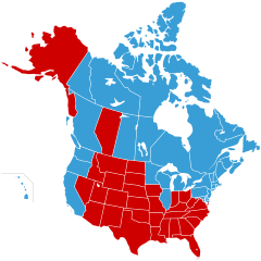
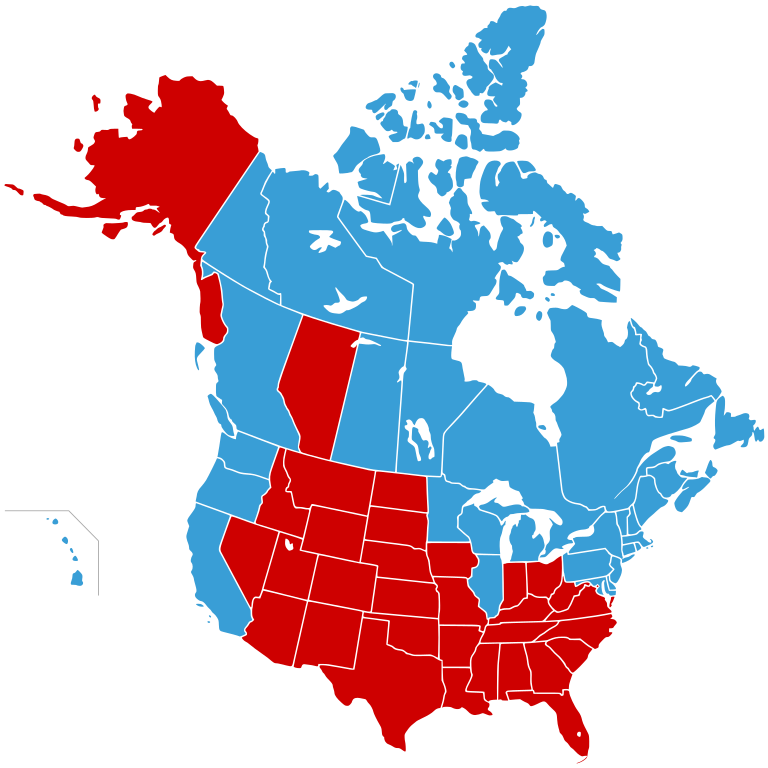
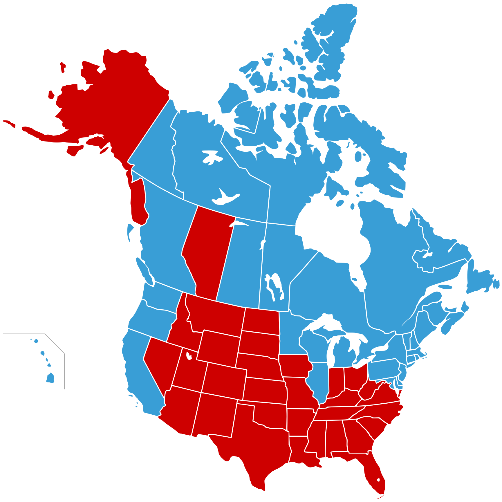
English: Jesusland map
"United States of Canada", Canada plus blue states
"Jesusland", red states |
| 日期 | 08-12-2007 |
| 来源 |
W3C-validity not checked. |
| 作者 | Oren neu dag |
| 授权 (二次使用本文件) |
本文件采用知识共享署名-相同方式共享 2.5 通用许可协议授权。
|
| 其他版本 |
 |

|
This map, as well as other fictitious maps, is fictitious or too incorrect (i.e. due to anachronism) to be used in real-life contexts (contemporary or historic). It may have some visual elements that are similar to official maps such as colors or certain layout features, but they are NOT official and don't have any official recognition. |
[[Category:]]
文件历史
点击某个日期/时间查看对应时刻的文件。
| 日期/时间 | 缩略图 | 大小 | 用户 | 备注 | |
|---|---|---|---|---|---|
| 当前 | 2008年2月23日 (六) 17:03 | | 1,730 × 1,730(218 KB) | Oren neu dag(留言 | 贡献) | {{Information |Description={{en|Jesusland map}} {{legend|#399ed6|"United States of Canada", Canada plus blue states }} {{legend|#ce0000|"Jesusland", red states }} | |
您不可以覆盖此文件。
文件用途
以下6个页面使用本文件:
全域文件用途
以下其他wiki使用此文件:
- en.wikipedia.org上的用途
- fr.wikipedia.org上的用途
- fr.wiktionary.org上的用途
- tr.wikipedia.org上的用途
- zh.wikipedia.org上的用途