File:Jezzine and Jbaa in the Carte du Liban d'apres les reconnaissances de la Brigade Topographique du Corps Expeditionnaire de Syrie en 1860-1861 (cropped).jpg
Jump to navigation
Jump to search

Size of this preview: 529 × 600 pixels. Other resolutions: 212 × 240 pixels | 423 × 480 pixels | 677 × 768 pixels | 1,183 × 1,341 pixels.
Original file (1,183 × 1,341 pixels, file size: 788 KB, MIME type: image/jpeg)
Captions
Captions
Add a one-line explanation of what this file represents
Summary[edit]
| Description |
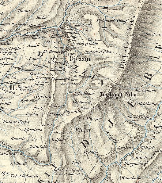
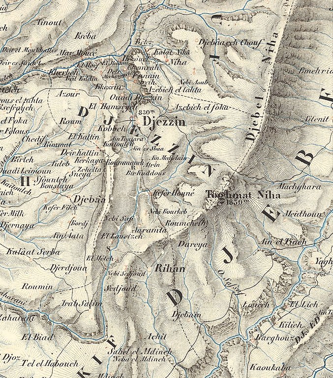
Français : Carte du Liban d'apres les reconnaissances de la Brigade Topographique du Corps Expeditionnaire de Syrie en 1860-1861. Dressee au Depot de la Guerre Etant Directeur Le General Blondel Sous Le Ministere de S. E. Le Marechal Comte Randon 1862. Gravee par Erhard Schieble. Paris. Pub. Lemercier. |
| Date | |
| Source | https://www.davidrumsey.com/luna/servlet/detail/RUMSEY~8~1~304095~90074708:Carte-du-Liban |
| Author | Dépôt De La Guerre (France) |
| Other versions |

.jpg&action=edit§ion=1)
Image No: 11800000
Licensing[edit]
.jpg&action=edit§ion=2)
This file is licensed under the Creative Commons Attribution-Share Alike 3.0 Unported license.
- You are free:
- to share – to copy, distribute and transmit the work
- to remix – to adapt the work
- Under the following conditions:
- attribution – You must give appropriate credit, provide a link to the license, and indicate if changes were made. You may do so in any reasonable manner, but not in any way that suggests the licensor endorses you or your use.
- share alike – If you remix, transform, or build upon the material, you must distribute your contributions under the same or compatible license as the original.
File history
Click on a date/time to view the file as it appeared at that time.
| Date/Time | Thumbnail | Dimensions | User | Comment | |
|---|---|---|---|---|---|
| current | 08:12, 29 August 2021 | | 1,183 × 1,341 (788 KB) | Onceinawhile (talk | contribs) | File:Carte du Liban d'apres les reconnaissances de la Brigade Topographique du Corps Expeditionnaire de Syrie en 1860-1861.jpg cropped 86 % horizontally, 88 % vertically using CropTool with precise mode. |
You cannot overwrite this file.
File usage on Commons
The following page uses this file:
File usage on other wikis
The following other wikis use this file:
- Usage on en.wikipedia.org
.jpg&oldid=818838295)