File:Jugon-les-Lacs-1972.png
Jump to navigation
Jump to search

Size of this preview: 739 × 600 pixels. Other resolutions: 296 × 240 pixels | 592 × 480 pixels | 947 × 768 pixels | 1,262 × 1,024 pixels | 2,525 × 2,048 pixels | 3,057 × 2,480 pixels.
Original file (3,057 × 2,480 pixels, file size: 533 KB, MIME type: image/png)
Captions
Captions
Add a one-line explanation of what this file represents
Summary[edit]
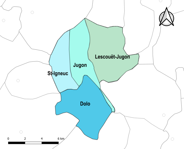
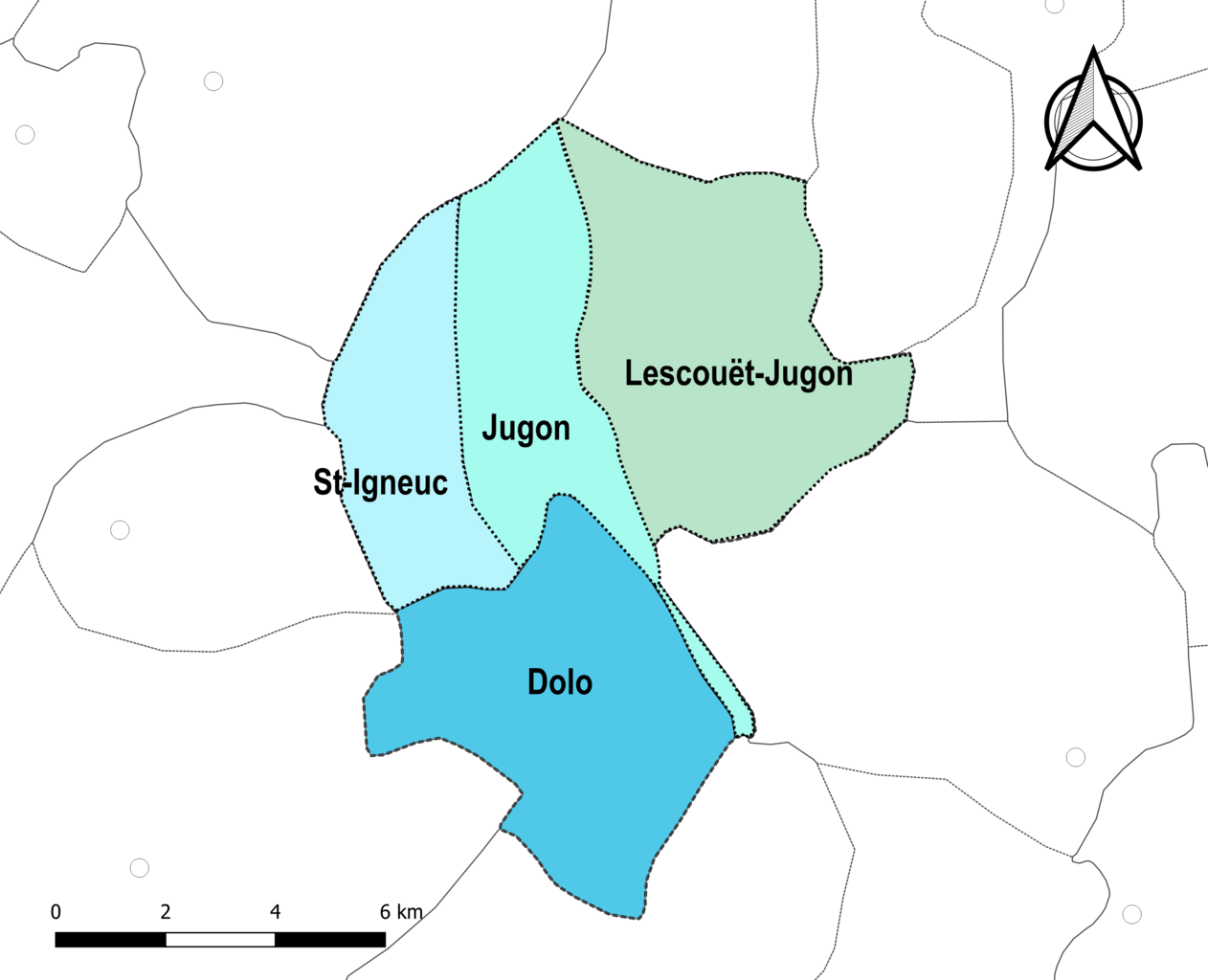
| Description |
Français : Carte du territoire de l'actuelle commune de fr:Jugon-les-Lacs (France) avant le 1er avril 1973. |
| Date | |
| Source |
Own work avec les données : * Découpage administratif communal et départemental : Communes édition 2015 France Métropolitaine publié par l'IGNF Le découpage entre Saint-Igneuc, Jugon et Lescouët-Jugon résulte d'une interprétation d'une carte de 1950 et n'est à ce titre pas exact. Il n'a qu'une vocation informative Assemblé et enrichi dans fr:QGis. |
| Author | Roland45 |
Licensing[edit]
I, the copyright holder of this work, hereby publish it under the following license:
This file is licensed under the Creative Commons Attribution-Share Alike 4.0 International license.
- You are free:
- to share – to copy, distribute and transmit the work
- to remix – to adapt the work
- Under the following conditions:
- attribution – You must give appropriate credit, provide a link to the license, and indicate if changes were made. You may do so in any reasonable manner, but not in any way that suggests the licensor endorses you or your use.
- share alike – If you remix, transform, or build upon the material, you must distribute your contributions under the same or compatible license as the original.
File history
Click on a date/time to view the file as it appeared at that time.
| Date/Time | Thumbnail | Dimensions | User | Comment | |
|---|---|---|---|---|---|
| current | 18:30, 31 December 2023 | | 3,057 × 2,480 (533 KB) | Roland45 (talk | contribs) | == {{int:filedesc}} == {{Information |description = {{fr|1=Carte du territoire de l'actuelle commune de fr:Jugon-les-Lacs (France) avant le 1er avril 1973.}} |date = 2023-12-31 |source = {{own}} avec les données : <br>* Découpage administratif communal et départemental : [https://geoservices.ign.fr/geofla Communes édition 2015 France Métropolitaine] publié par l'IGNF<br>Le découpage entre Saint-Igneuc, Jugon et Lescouët-Jugon résulte d'une interprétation d'une carte de 1950 et n'est à... |
You cannot overwrite this file.
File usage on Commons
There are no pages that use this file.
File usage on other wikis
The following other wikis use this file:
- Usage on fr.wikipedia.org