File:Justingen Flurkarte 1820.jpg
Original file (1,778 × 1,240 pixels, file size: 295 KB, MIME type: image/jpeg)
Captions
Captions
| Description |
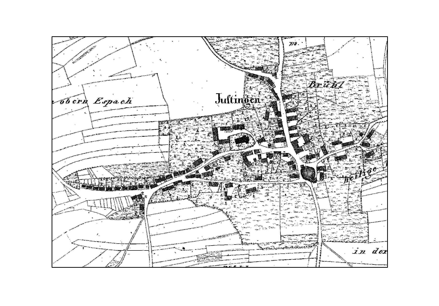
Deutsch: Flurkartenausschnitt mit Ortsplan „Justingen“ um 1820. |
||||
| Date | circa 1820 | ||||
| Source |
Deutsch: Flurkarte Maßstab 1 : 2.500 um 1820, Blatt S.O.XIII.40. |
||||
| Author |
Deutsch: Erste Landesvermessung im Königreich Württemberg |
||||
| Permission (Reusing this file) |
|
||||
Original upload log
[edit]
- 2009-02-13 18:46 Franz Rothenbacher 1778×1240× (301880 bytes) {{Information |Beschreibung = Flurkartenausschnitt mit Ortsplan „Justingen“ um 1820. |Quelle = Flurkarte Maßstab 1 : 2.500 um 1820, Blatt S.O.XIII.40. |Urheber = Erste Landesvermessung im Königreich Württemberg. |Datum = 13.02.2009 |Genehmigung =
File history
Click on a date/time to view the file as it appeared at that time.
| Date/Time | Thumbnail | Dimensions | User | Comment | |
|---|---|---|---|---|---|
| current | 05:44, 13 February 2011 | | 1,778 × 1,240 (295 KB) | File Upload Bot (Magnus Manske) (talk | contribs) | {{BotMoveToCommons|de.wikipedia|year={{subst:CURRENTYEAR}}|month={{subst:CURRENTMONTHNAME}}|day={{subst:CURRENTDAY}}}} {{Information |Description={{de|Flurkartenausschnitt mit Ortsplan „Justingen“ um 1820.}} |Source=Transferred from [http://de.wikipe |
You cannot overwrite this file.
File usage on Commons
There are no pages that use this file.
File usage on other wikis
The following other wikis use this file:
- Usage on de.wikipedia.org