File:Jvuo1942 en.png
Salta a la navegació
Salta a la cerca
Mida d'aquesta previsualització: 641 × 600 píxels. Altres resolucions: 256 × 240 píxels | 513 × 480 píxels | 821 × 768 píxels | 1.076 × 1.007 píxels.
Fitxer original (1.076 × 1.007 píxels, mida del fitxer: 132 Ko, tipus MIME: image/png)
Llegendes
Llegendes
Afegeix una explicació d'una línia del que representa aquest fitxer
Resum
[modifica]
| Descripció |
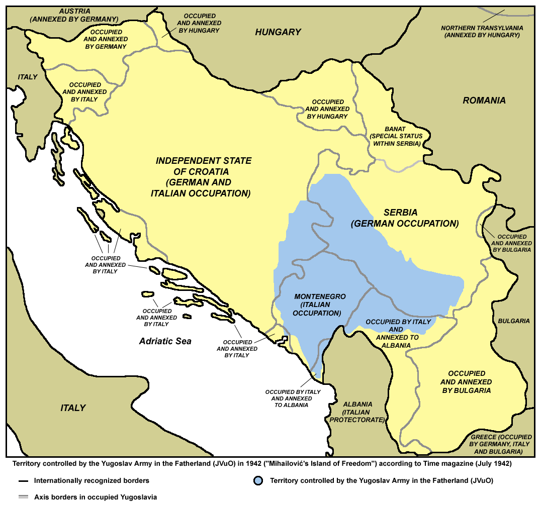
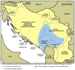
English: Territory controlled by the Yugoslav Army in the Fatherland (JVuO) in 1942 ("Mihailović's Island of Freedom") according to Time magazine (July 1942). Српски / srpski: Teritorija pod kontrolom Jugoslovenske vojske u otadžbini (JVuO) 1942. godine ("Mihailovićevo ostrvo slobode"), prema magazinu Tajm, juli 1942. |
| Data | |
| Font | Treball propi |
| Autor | PANONIAN |
Llicència
[modifica]
Jo, el titular dels drets d'autor d'aquest treball, el public sota la següent llicència:
| L'ús d'aquest fitxer és regulat sota les condicions de Creative Commons de CC0 1.0 lliurament al domini públic universal. | |
| La persona que ha associat un treball amb aquest document ha dedicat l'obra domini públic, renunciant en tot el món a tots els seus drets de d'autor i a tots els drets legals relacionats que tenia en l'obra, en la mesura permesa per la llei. Podeu copiar, modificar, distribuir i modificar l'obra, fins i tot amb fins comercials, tot sense demanar permís.
|
References
[modifica]
- Mr Radovan Kalabić, Ravnogorska istorija, Beograd, 1992.
- http://upload.wikimedia.org/wikipedia/sh/7/77/Četničko_ostrvo_slobode.jpg
- http://t2.gstatic.com/images?q=tbn:ANd9GcR2b-_eiCCmU7sdzRFb3jQoOcETY87wu14NqYy3je2QRAoEJK088w
Historial del fitxer
Cliqueu una data/hora per veure el fitxer tal com era aleshores.
| Data/hora | Miniatura | Dimensions | Usuari/a | Comentari | |
|---|---|---|---|---|---|
| actual | 11:10, 15 maig 2013 | | 1.076 × 1.007 (132 Ko) | PANONIAN (discussió | contribucions) | {{Information |Description ={{en|1=Territory controlled by the Yugoslav Army in the Fatherland (JVuO) in 1942.}} |Source ={{own}} |Author =PANONIAN |Date =2013 |Permission = |other_versions = }} |
No podeu sobreescriure aquest fitxer.
Ús del fitxer
Les 5 pàgines següents utilitzen aquest fitxer:
Ús global del fitxer
Utilització d'aquest fitxer en altres wikis:
- Utilització a ca.wikipedia.org
- Utilització a cs.wikipedia.org
- Utilització a de.wikipedia.org
- Utilització a en.wikipedia.org
- Utilització a fi.wikipedia.org
- Utilització a fr.wikipedia.org
- Utilització a hr.wikipedia.org
- Utilització a it.wikipedia.org
- Utilització a ja.wikipedia.org
- Utilització a sh.wikipedia.org
- Utilització a sl.wikipedia.org
- Utilització a uk.wikipedia.org
Categories:
- Maps of Yugoslavia during World War II
- Maps of Serbia during World War II
- Maps of Montenegro during World War II
- Maps of the Independent State of Croatia
- Maps of the history of Bosnia and Herzegovina in modern times
- Maps of Bosnia and Herzegovina during World War II
- Maps of the history of Kosovo in modern times
- Chetniks during World War II