File:KG-Osh-Kara-Suu.svg
Jump to navigation
Jump to search

Size of this PNG preview of this SVG file: 345 × 599 pixels. Other resolutions: 138 × 240 pixels | 276 × 480 pixels | 442 × 768 pixels | 590 × 1,024 pixels | 1,180 × 2,048 pixels | 400 × 694 pixels.
Original file (SVG file, nominally 400 × 694 pixels, file size: 1.03 MB)
Captions
Captions
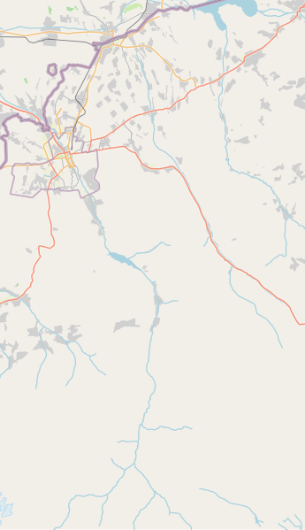
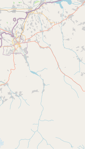
KG-Osh-Kara-Suu
Summary
[edit]
| Description |
English: KG-Osh-Kara-Suu |
| Date | |
| Source | openstreetmap.org |
| Author | OpenStreetMap contributors |
Licensing
[edit]
| Description |
This map was created from OpenStreetMap project data, collected by the community. This map may be incomplete, and may contain errors. Don't rely solely on it for navigation. |
|||
| Date | (see file history) | |||
| Source | openstreetmap.org | |||
| Creator |
OpenStreetMap contributors |
|||
| Permission (Reusing this file) |
OpenStreetMap data is available under the Open Database License (details). Map tiles are licensed under the Creative Commons Attribution-ShareAlike 2.0 license (CC-BY-SA 2.0).
This file is licensed under the Creative Commons Attribution-Share Alike 2.0 Generic license.
|
|||
| Georeferencing | If inappropriate please set warp_status = skip to hide. |
File history
Click on a date/time to view the file as it appeared at that time.
| Date/Time | Thumbnail | Dimensions | User | Comment | |
|---|---|---|---|---|---|
| current | 21:11, 29 November 2021 | | 400 × 694 (1.03 MB) | Kmaksat (talk | contribs) | Uploaded a work by OpenStreetMap contributors from openstreetmap.org with UploadWizard |
You cannot overwrite this file.
File usage on Commons
There are no pages that use this file.
File usage on other wikis
The following other wikis use this file:
- Usage on en.wikipedia.org
- Usage on fr.wikipedia.org
- Usage on ky.wikipedia.org
- Usage on ru.wikipedia.org
- Кара-Сууский район
- Кашгар-Кыштак
- Шаблон:ПозКарта Кыргызстан Ошская область Кара-Сууский район
- Шаблон:Карта Кара-Сууского района
- Шарк (Ошская область)
- Таштак (Кара-Сууский район)
- Имам-Ата
- Маданият (Шаркский айылный аймак)
- Топ-Терек
- Фуркат (село)
- Медресе (село)
- Дыйкан-Кыштак
- Кыргызстан (Кара-Сууский район)
- Озгур (Кара-Сууский район)
- Телейкен (Кара-Сууский район)
- Учар (село)
- Бодур-Таш
- Жапалак (Ошская область)
- Село имени Кирова (Кара-Сууский район)
- Эркин (село)
- Присавай (Сарайский айылный аймак)
- Конурат
- Село имени Тельмана (Ошская область)
- Ак-Оргоо
- Кызыл-Шарк
- Кен-Сай
- Кечкен-Джар
- Курбан-Кара (Савайский айылный аймак)
- Кыдырша (село)
- Октябрь (Савайский айылный аймак)
- Ынтымак (Савайский айылный аймак)
- Савай (село)
- Султан-Абад
- Папан (село)
- Ак-Терек (Папанский айылный аймак)
- Алчалы (Кыргызстан)
- Ата-Мерек
- Берю
- Карагур
- Коджо-Келен
- Кызыл-Туу (Кара-Сууский район)
- Тогуз-Булак (Кара-Сууский район)
View more global usage of this file.