File:Kaart IJssellinie.JPG
Jump to navigation
Jump to search

Size of this preview: 439 × 599 pixels. Other resolutions: 176 × 240 pixels | 352 × 480 pixels | 563 × 768 pixels | 751 × 1,024 pixels | 1,299 × 1,772 pixels.
Original file (1,299 × 1,772 pixels, file size: 502 KB, MIME type: image/jpeg)
Captions
Captions
Add a one-line explanation of what this file represents
Summary
[edit]
| Description |
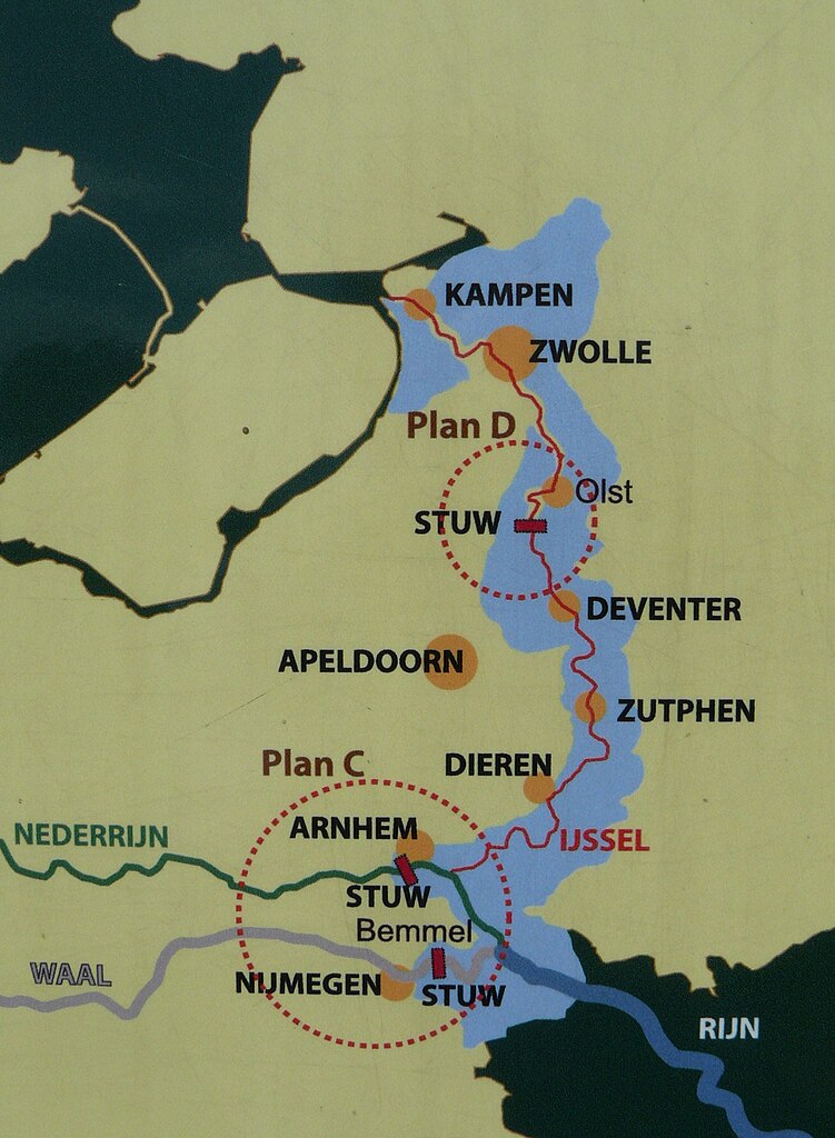
Nederlands: Kaart van de IJssellinie met daarop aangegeven de drie stuwen en in lichtblauw het inundatiegebied. Kaart gezien op informatieborden bij de IJssellinie op het landgoed De Haere in Olst. English: Map of the IJssel Line with the three movable floating dams and in light blue the area that could be inundated. |
| Date | |
| Source | Own work |
| Author | Zandcee |
Licensing
[edit]
I, the copyright holder of this work, hereby publish it under the following license:
This file is licensed under the Creative Commons Attribution-Share Alike 4.0 International license.
- You are free:
- to share – to copy, distribute and transmit the work
- to remix – to adapt the work
- Under the following conditions:
- attribution – You must give appropriate credit, provide a link to the license, and indicate if changes were made. You may do so in any reasonable manner, but not in any way that suggests the licensor endorses you or your use.
- share alike – If you remix, transform, or build upon the material, you must distribute your contributions under the same or compatible license as the original.
File history
Click on a date/time to view the file as it appeared at that time.
| Date/Time | Thumbnail | Dimensions | User | Comment | |
|---|---|---|---|---|---|
| current | 13:02, 8 June 2015 | | 1,299 × 1,772 (502 KB) | Zandcee (talk | contribs) | User created page with UploadWizard |
You cannot overwrite this file.
File usage on Commons
There are no pages that use this file.
File usage on other wikis
The following other wikis use this file:
- Usage on de.wikipedia.org
- Usage on fr.wikipedia.org
- Usage on fy.wikipedia.org
- Usage on nl.wikipedia.org