File:Kalcitova Jeskyne Vokounka Celek.jpg
Jump to navigation
Jump to search

Size of this preview: 450 × 600 pixels. Other resolutions: 180 × 240 pixels | 360 × 480 pixels | 576 × 768 pixels | 768 × 1,024 pixels | 1,536 × 2,048 pixels | 2,880 × 3,840 pixels.
Original file (2,880 × 3,840 pixels, file size: 4.89 MB, MIME type: image/jpeg)
Captions
Captions
Add a one-line explanation of what this file represents
Summary
[edit]
| Description |
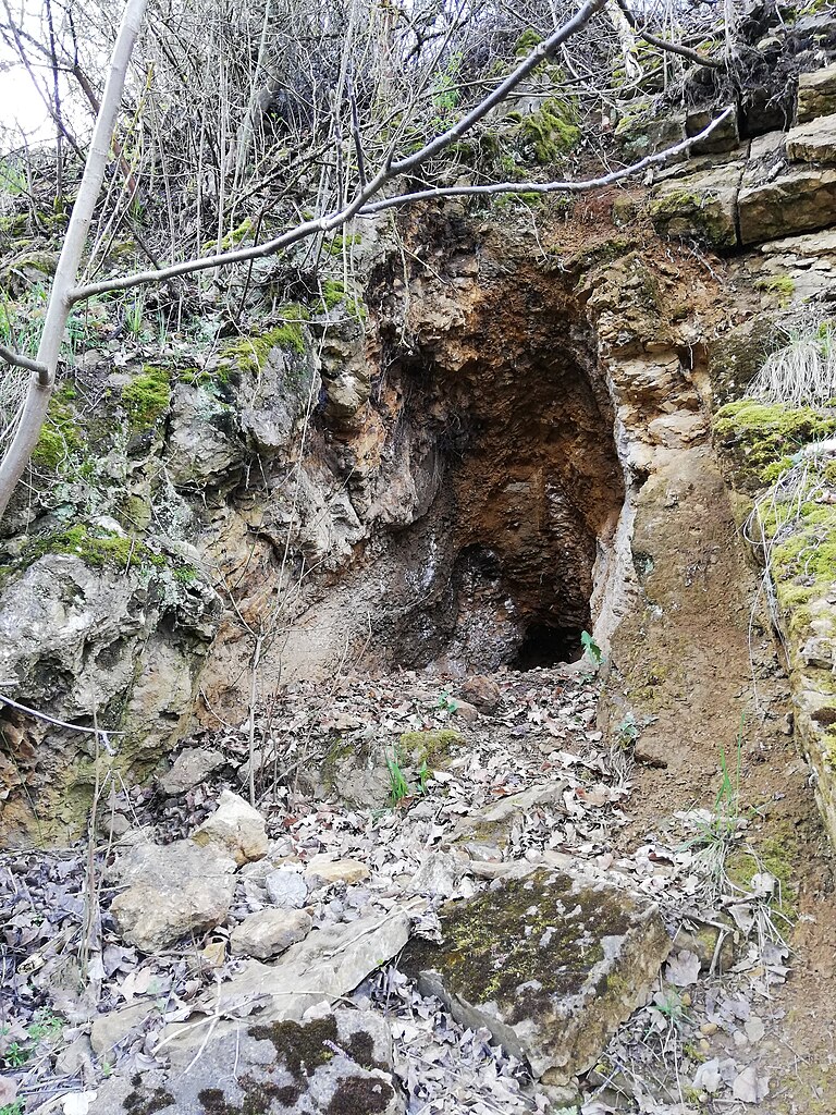
Čeština: Malá kalcitová jeskyně se nachází v severním „vnitřním“ svahu lomu Vokounka. Po vstupu do lomu dopravní štolou se po levé straně nachází do svahu vedoucí kamenitá cestička (nejspíš zbytek svážné) z obou stran zarostlá nálety. Po asi 20 metrech chůze do kopce po této pěšině se na levé straně ve svahu nalézá výrazný strom s balvanem. Kalcitová jeskyně je nad balvanem. Jeskyně není přirozeného původu, je velice mělká (spíše jen jakási vyhloubenina); na stěnách obsahuje bílé a hnědorůžové drůzy kalcitu a v sypké suti na dně (a před vchodem do jeskyně) je možno nalézti (a sesbírati) drobné úlomky kalcitových krystalů.
English: The small calcite cave is located in the northern "inner" slope of the Vokounka quarry. After entering the quarry through the transport tunnel, there is a rocky path leading up the slope on the left (probably a remnant of a sagebrush), overgrown on both sides with infestations. After about 20 metres of walking uphill along this path, a prominent tree with a boulder is found on the left side of the slope. The calcite cave is above the boulder. The cave is not of natural origin, it is very shallow (rather just a kind of excavation); it contains white and brownish-pink calcite crumbs on the walls and small fragments of calcite crystals can be found (and collected) in the loose rubble at the bottom (and in front of the cave entrance). |
| Date | |
| Source | Own work |
| Author | Mojmir Churavy |
| Camera location | | View this and other nearby images on: OpenStreetMap |
|---|
Licensing
[edit]
I, the copyright holder of this work, hereby publish it under the following license:
This file is licensed under the Creative Commons Attribution-Share Alike 4.0 International license.
- You are free:
- to share – to copy, distribute and transmit the work
- to remix – to adapt the work
- Under the following conditions:
- attribution – You must give appropriate credit, provide a link to the license, and indicate if changes were made. You may do so in any reasonable manner, but not in any way that suggests the licensor endorses you or your use.
- share alike – If you remix, transform, or build upon the material, you must distribute your contributions under the same or compatible license as the original.
File history
Click on a date/time to view the file as it appeared at that time.
| Date/Time | Thumbnail | Dimensions | User | Comment | |
|---|---|---|---|---|---|
| current | 19:32, 5 June 2023 | | 2,880 × 3,840 (4.89 MB) | Mojmir Churavy (talk | contribs) | Uploaded own work with UploadWizard |
You cannot overwrite this file.
File usage on Commons
There are no pages that use this file.
File usage on other wikis
The following other wikis use this file:
- Usage on cs.wikipedia.org