File:Kaliningrader Hochstrassen 2.png
Jump to navigation
Jump to search

Size of this preview: 757 × 599 pixels. Other resolutions: 303 × 240 pixels | 606 × 480 pixels | 970 × 768 pixels | 1,280 × 1,013 pixels | 1,819 × 1,440 pixels.
Original file (1,819 × 1,440 pixels, file size: 2.14 MB, MIME type: image/png)
Captions
Captions
Add a one-line explanation of what this file represents
Summary
[edit]
| Description |
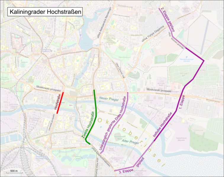
English: General map of elevated highways in en:Kalingrad. Status March 2019
Deutsch: Übersichtskarte der Hochstrassen in Klaingrad. Stand März 2019 |
| Date | |
| Source |
Own work Map was created using: |
| Author | Pechristener |
| Permission (Reusing this file) |
Map data (c) OpenStreetMap (and) contributors, CC-BY-SA. This file is licensed under the Creative Commons Attribution-Share Alike 2.0 Generic license.
|
| Camera location | | View this and other nearby images on: OpenStreetMap |
|---|
File history
Click on a date/time to view the file as it appeared at that time.
| Date/Time | Thumbnail | Dimensions | User | Comment | |
|---|---|---|---|---|---|
| current | 13:12, 31 March 2019 | | 1,819 × 1,440 (2.14 MB) | Pechristener (talk | contribs) | Beschriftung verbessert |
| 13:08, 31 March 2019 |  | 1,819 × 1,440 (2.14 MB) | Pechristener (talk | contribs) | überarbeitet, im Norden war zuviel Strasse bei der Etappe 2 dabei | |
| 08:08, 31 March 2019 |  | 1,974 × 1,492 (2.32 MB) | Pechristener (talk | contribs) | {{Information |Description ={{en|1=General map of elevated highways in en:Kalingrad. Status March 2019}} {{de|1=Übersichtskarte der Hochstrassen in Klaingrad. Stand März 2019}} |Source ={{own}} Map was created using: *[http://www.openstreetmap.org/index.html?mlat=54.707305&mlon=20.507183&zoom=15 Open Street Map] |Author =Pechristener |Date =2012-03-31 |Permission =Map data (c) OpenStreetMap (and) contributors, CC-BY-SA. {{cc-by-... |
You cannot overwrite this file.
File usage on Commons
There are no pages that use this file.
File usage on other wikis
The following other wikis use this file:
- Usage on de.wikipedia.org