File:Kangwon NK.png
Jump to navigation
Jump to search
No higher resolution available.
Kangwon_NK.png (488 × 524 pixels, file size: 10 KB, MIME type: image/png)
Captions
Captions
Add a one-line explanation of what this file represents
Summary
[edit]
| Description |
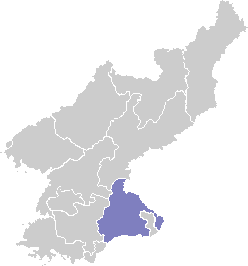
English: Area map of Kangwon-do (North Korea) province |
| Date |
28 March 2008 (original upload date) |
| Source |
Own work (Original text: self-made) |
| Author | ASDFGH at en.wikipedia |
Licensing
[edit]
ASDFGH at en.wikipedia, the copyright holder of this work, hereby publishes it under the following licenses:

|
Permission is granted to copy, distribute and/or modify this document under the terms of the GNU Free Documentation License, Version 1.2 or any later version published by the Free Software Foundation; with no Invariant Sections, no Front-Cover Texts, and no Back-Cover Texts. A copy of the license is included in the section entitled GNU Free Documentation License. |
This file is licensed under the Creative Commons Attribution 3.0 Unported license.
Attribution: ASDFGH at en.wikipedia
- You are free:
- to share – to copy, distribute and transmit the work
- to remix – to adapt the work
- Under the following conditions:
- attribution – You must give appropriate credit, provide a link to the license, and indicate if changes were made. You may do so in any reasonable manner, but not in any way that suggests the licensor endorses you or your use.
You may select the license of your choice.
Original upload log
[edit]
The original description page was here. All following user names refer to en.wikipedia.
- 2008-03-28 05:40 ASDFGH 488×524× (10494 bytes) {{Information |Description=area map of Kangwon |Source=self-made |Date=3.27.2008 |Author= [[User:ASDFGH|ASDFGH]] |Permission= |other_versions= }} == {{int:license-header}} == {{self|GFDL|cc-by-3.0}}
File history
Click on a date/time to view the file as it appeared at that time.
| Date/Time | Thumbnail | Dimensions | User | Comment | |
|---|---|---|---|---|---|
| current | 21:30, 25 April 2009 | | 488 × 524 (10 KB) | ASDFGHJ (talk | contribs) | {{BotMoveToCommons|en.wikipedia|year=2008|month=December |day=23}} {{Information |Description={{en|area map of Kangwon-do (North Korea) province}} |Source=Transferred from [http://en.wikipedia.org en.wikipedia]; transferre |
| 21:37, 23 December 2008 |  | 488 × 524 (10 KB) | File Upload Bot (Magnus Manske) (talk | contribs) | {{BotMoveToCommons|en.wikipedia}} {{Information |Description={{en|area map of Kangwon}} |Source=Transferred from [http://en.wikipedia.org en.wikipedia]; transferred to Commons by User:Hanhil using [http://tools.wikimedia.de/~magnus/commonshelper.php |
You cannot overwrite this file.
File usage on Commons
There are no pages that use this file.
File usage on other wikis
The following other wikis use this file:
- Usage on bn.wikipedia.org
- Usage on en.wikipedia.org
- Kangwon Province, North Korea
- Wonsan
- Mount Kumgang Tourist Region
- Munchon
- Template:Kangwon
- Kosong County
- Anbyon County
- Changdo County
- Chorwon County
- Chonnae County
- Hoeyang County
- Ichon County
- Kosan County
- Kimhwa County
- Poptong County
- Pangyo County
- Kumgang County
- Tongchon County
- Pyonggang County
- Sepo County
- Usage on id.wikipedia.org
- Usage on ko.wikipedia.org
- Usage on ms.wikipedia.org
View more global usage of this file.