File:Karlštejn (vrch), CZ171015-132.jpg
Jump to navigation
Jump to search

Size of this preview: 800 × 450 pixels. Other resolutions: 320 × 180 pixels | 640 × 360 pixels | 1,024 × 576 pixels | 1,280 × 719 pixels | 2,560 × 1,439 pixels | 4,848 × 2,725 pixels.
Original file (4,848 × 2,725 pixels, file size: 6.13 MB, MIME type: image/jpeg)
Captions
Captions
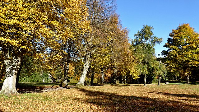
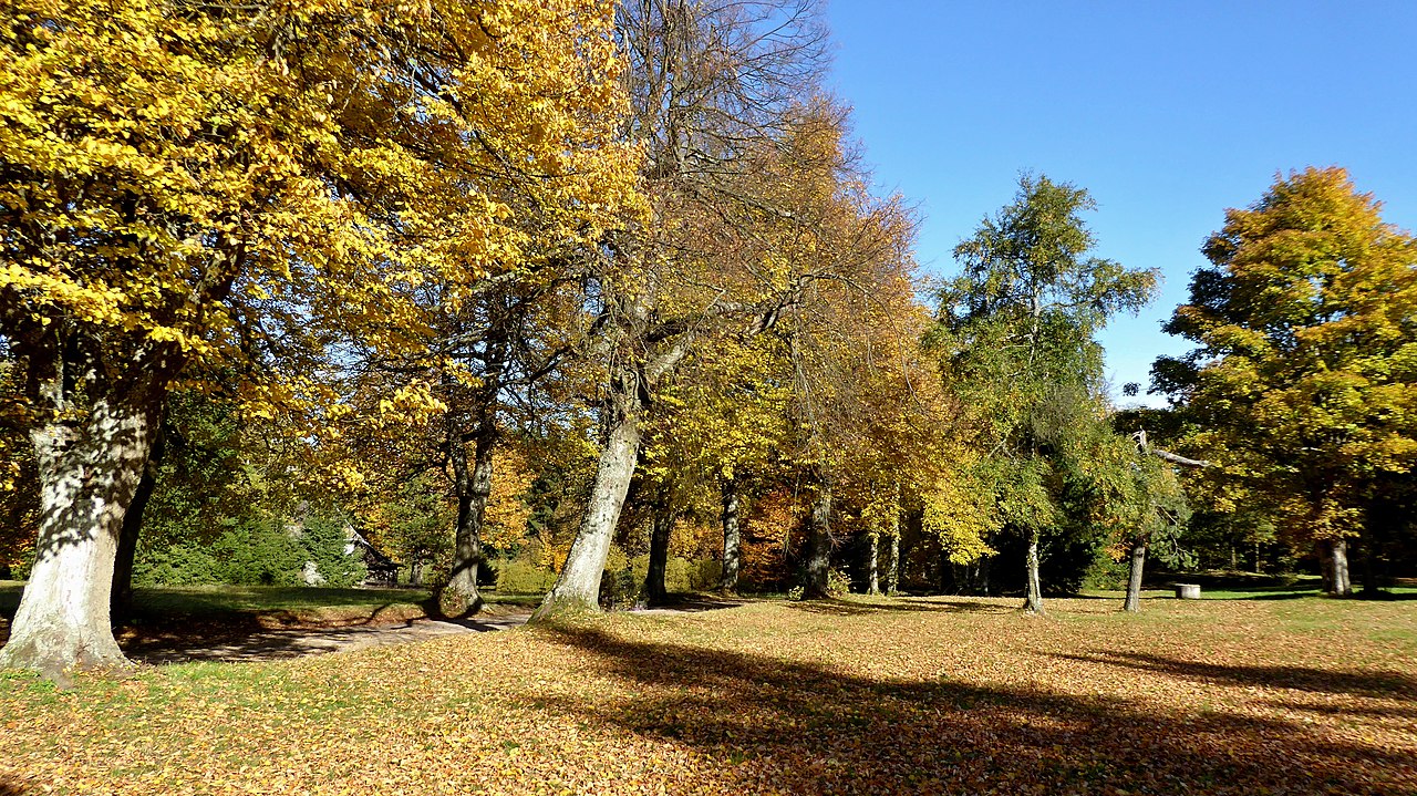
Tree alley on Karlstejn hill.
Summary
[edit],_CZ171015-132.jpg&action=edit§ion=1)
| Description |
English: The tree alley in settlement locality "Karlštejn", in the top part of the hill under the hunting chateau, objects marked with the same name "Karlštejn" on the cadastral territory of Svratouch in the Pardubice Region, Czech Republic. Location in the Protected Landscape Area "Žďárské" hills. The hill with peak in altitude 784 m according to the contour map is the highest in the geomorphological district of "Borovský" forest, a part of "Žďárské" hills in the north-western region of "Hornosvratecká" highlands (geomorphological whole). Photo-location: Czechia, Pardubice Region, the village of "Svratouch", meadows on the peak "Karlštejn", azimuth 0°.
Čeština: Stromová alej v sídelní lokalitě Karlštejn, ve vrcholové části kopce pod loveckým zámkem, objekty označováné shodným názvem Karlštejn na katastrálním území Svratouch v Pardubickém kraji, Česko. Lokalita v Chráněné krajinné oblasti Žďárské vrchy. Kopec s vrcholem v nadmořské výšce 784 m dle vrstevnicové mapy je nejvyšší v geomorfologickém okrsku Borovský les, součást Žďárských vrchů v severozápadní oblasti Hornosvratecké vrchoviny (geomorfologický celek). Foto-lokace: Česko, Pardubický kraj, obec Svratouch, louka na vrcholu Karlštejn, azimut 0°. |
| Date | |
| Source | Own work |
| Author | Josef Kreuz (PEPan) |
| Camera location | | View this and other nearby images on: OpenStreetMap |
|---|
,_CZ171015-132.jpg¶ms=049.714686_N_0016.064475_E_globe:Earth_type:camera_heading:0.00&language=en)
Zdroje informací:
[edit],_CZ171015-132.jpg&action=edit§ion=2)
- AOPK ČR, chráněné krajinné oblasti – CHKO Žďárské vrchy, viz
- AOPK ČR, mapová aplikace – přírodní poměry, viz
- AOPK ČR, chráněná území – přírodní památka Zkamenělý zámek, viz
- ČGS, geologické lokality – rašeliniště Karlštejn, viz
- ČÚZK, základní mapa Česka – obec Svratouch a okolí, viz
- NPÚ ČR, památkový katalog – lovecký zámeček, viz
- Svratouch, obec – webové stránky, viz archive copy at the Wayback Machine
- Mapy.cz, turistická mapa – kompozice Svratouch / Karlštejn, viz https://mapy.cz/s/2CHqc
Licensing
[edit],_CZ171015-132.jpg&action=edit§ion=3)
I, the copyright holder of this work, hereby publish it under the following license:
This file is licensed under the Creative Commons Attribution-Share Alike 4.0 International license.
- You are free:
- to share – to copy, distribute and transmit the work
- to remix – to adapt the work
- Under the following conditions:
- attribution – You must give appropriate credit, provide a link to the license, and indicate if changes were made. You may do so in any reasonable manner, but not in any way that suggests the licensor endorses you or your use.
- share alike – If you remix, transform, or build upon the material, you must distribute your contributions under the same or compatible license as the original.
File history
Click on a date/time to view the file as it appeared at that time.
| Date/Time | Thumbnail | Dimensions | User | Comment | |
|---|---|---|---|---|---|
| current | 10:10, 8 May 2018 | | 4,848 × 2,725 (6.13 MB) | PEPan (talk | contribs) | User created page with UploadWizard |
You cannot overwrite this file.
File usage on Commons
There are no pages that use this file.
File usage on other wikis
The following other wikis use this file:
- Usage on cs.wikipedia.org
,_CZ171015-132.jpg&oldid=832778679)