File:Karlštejn (zámek), CZ140506-192.jpg

Original file (2,949 × 3,953 pixels, file size: 3.78 MB, MIME type: image/jpeg)
Captions
Captions
Summary[edit]
,_CZ140506-192.jpg&action=edit§ion=1)
| Description |
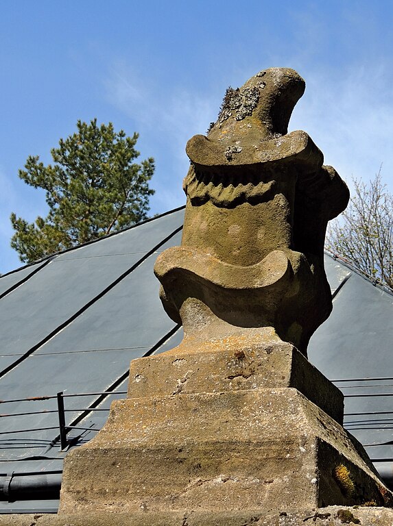
English: Stone sculpture (maybe it's a horse) on a prismatic pillar near the main gate to the hunting castle Karlštejn. Karlštejn on the cadastral territory of Svratouch is originally a hunting castle built between 1770 and 1775 in the style of Central European Baroque, the architecture of the castle is sometimes presented as a rococo style. Since 1958 is the castle a cultural monument and has been included in the catalog of the National Monument Institute. The castle complex is situated in the settlement location of Karlštejn, part of the village Svratouch, from an administrative point of view in the district of Chrudim belonging to the Pardubice Region in the territory of the Czech Republic. Photo-location: Czechia, Pardubice Region, the village of "Svratouch", the hill with named "Karlštejn", azimuth 205°.
Čeština: CZ: Kamenná skulptura (snad stylizace vzepjatého koně) na hranolovém pilíři u hlavní brány do areálu loveckého zámku Karlštejn. Karlštejn na katastrálním území Svratouch je původně lovecký zámek postavený v letech 1770 až 1775 ve stylu středoevropského pozdního baroka, architektura zámku je někdy prezentována jako rokokový styl. Od roku 1958 je zámek kulturní památkou a byl zařazen do katalogu Národního památkového ústavu. Zámecký areál se nachází v sídelní lokalitě Karlštejn, části obce Svratouch, v rámci administrativně správním v okrese Chrudim náležejícím do Pardubického kraje na území České republiky. Foto-lokace: Česko, Pardubický kraj, obec Svratouch, vrch Karlštejn, azimut 205°. |
| Date | |
| Source | Own work |
| Author | Josef Kreuz (PEPan) |
| Camera location | | View this and other nearby images on: OpenStreetMap |
|---|
,_CZ140506-192.jpg¶ms=049.714795_N_0016.064227_E_globe:Earth_type:camera_heading:205.00&language=en)
Faktografie:[edit]
,_CZ140506-192.jpg&action=edit§ion=2)
Zámecký areál je po stranách (jihovýchod a severozápad) a také na severovýchodě uzavřen v prolukách mezi budovami vždy třemi plotovými poli s kovanou mříží, prostřední pole po stranách areálu s jednokřídlou brankou, na vjezdu do nádvoří od severovýchodu s dvoukřídlou bránou. Plotová pole, včetně vjzdové brány, jsou osazená mezi zděné hranolové pilíře, na nich po straně zámeckého areálu kamenné vázy, u vjezdu pískovcové skulptury, pravděpodobně ve stylizovaném postavení koně (na fotografii).
Zdroje informací:[edit]
,_CZ140506-192.jpg&action=edit§ion=3)
- NPÚ ČR, památkový katalog – lovecký zámeček Karlštejn, viz
- Svratouch, obec – webové stránky, viz archive copy at the Wayback Machine
- Mapy.cz, turistická mapa (letecký pohled) – lovecký zámek Karlštejn, viz
Licensing[edit]
,_CZ140506-192.jpg&action=edit§ion=4)
- You are free:
- to share – to copy, distribute and transmit the work
- to remix – to adapt the work
- Under the following conditions:
- attribution – You must give appropriate credit, provide a link to the license, and indicate if changes were made. You may do so in any reasonable manner, but not in any way that suggests the licensor endorses you or your use.
- share alike – If you remix, transform, or build upon the material, you must distribute your contributions under the same or compatible license as the original.
File history
Click on a date/time to view the file as it appeared at that time.
| Date/Time | Thumbnail | Dimensions | User | Comment | |
|---|---|---|---|---|---|
| current | 12:39, 19 May 2018 | | 2,949 × 3,953 (3.78 MB) | PEPan (talk | contribs) | User created page with UploadWizard |
You cannot overwrite this file.
File usage on Commons
There are no pages that use this file.
File usage on other wikis
The following other wikis use this file:
- Usage on cs.wikipedia.org
,_CZ140506-192.jpg&oldid=832778706)