File:Kart over Finmarkens Amt, 1870.jpg
Jump to navigation
Jump to search

Size of this preview: 367 × 600 pixels. Other resolutions: 147 × 240 pixels | 294 × 480 pixels | 470 × 768 pixels | 626 × 1,024 pixels | 1,253 × 2,048 pixels | 6,237 × 10,193 pixels.
Original file (6,237 × 10,193 pixels, file size: 9.56 MB, MIME type: image/jpeg)
Captions
Captions
Add a one-line explanation of what this file represents
Summary
[edit]
| Title |
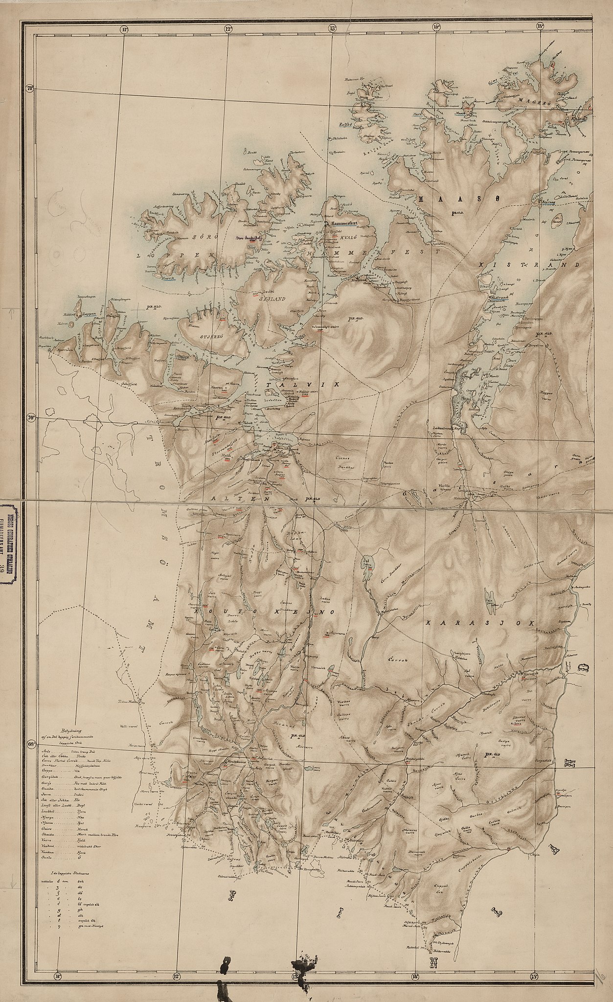
Norsk bokmål: Kart over Finmarkens Amt, 1870 |
||||||||||||||||||||||||||
| Description |
Norsk bokmål: Kart over Finnmarkens Amt. Udarbeidet med Bidrag af Gechworner T. Dahll. Lit. 1870. |
||||||||||||||||||||||||||
| Date | |||||||||||||||||||||||||||
| Source |
|
||||||||||||||||||||||||||
| Creator |
W. Haffner |
||||||||||||||||||||||||||
| Permission (Reusing this file) |
This file is licensed under the Creative Commons Attribution 4.0 International license.
|
||||||||||||||||||||||||||
| Geotemporal data | |||||||||||||||||||||||||||
| Date depicted | |||||||||||||||||||||||||||
| Map location | Finnmark (Finnmark) | ||||||||||||||||||||||||||
| Scale | 1:400,000 | ||||||||||||||||||||||||||
| Georeferencing | If inappropriate please set warp_status = skip to hide. | ||||||||||||||||||||||||||
| Bibliographic data | |||||||||||||||||||||||||||
| Part of the series | Category:Norwegian county map collection | ||||||||||||||||||||||||||
| Map sheet | 39-vest | ||||||||||||||||||||||||||
| Language | Norwegian | ||||||||||||||||||||||||||
| Archival data | |||||||||||||||||||||||||||
| Collection |
|
||||||||||||||||||||||||||
| Accession number | |||||||||||||||||||||||||||
| Dimensions | ca. height: 86 cm (33.8 in); width: 53 cm (20.8 in) | ||||||||||||||||||||||||||
| Medium | lithograph lithography | ||||||||||||||||||||||||||
File history
Click on a date/time to view the file as it appeared at that time.
| Date/Time | Thumbnail | Dimensions | User | Comment | |
|---|---|---|---|---|---|
| current | 12:21, 27 October 2015 | | 6,237 × 10,193 (9.56 MB) | Artturimatias (talk | contribs) | GWToolset: Creating mediafile for Artturimatias. |
You cannot overwrite this file.
File usage on Commons
The following page uses this file: